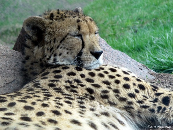
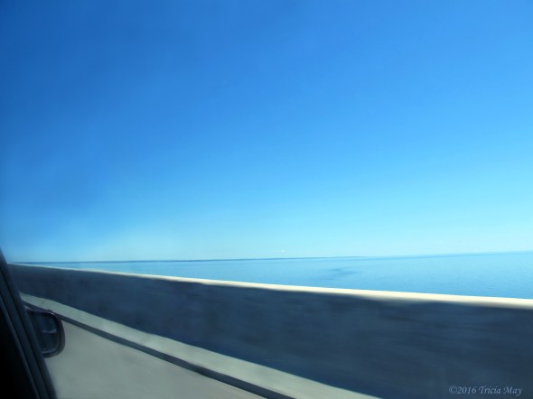
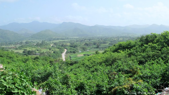
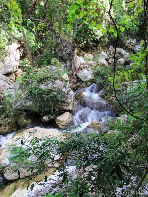
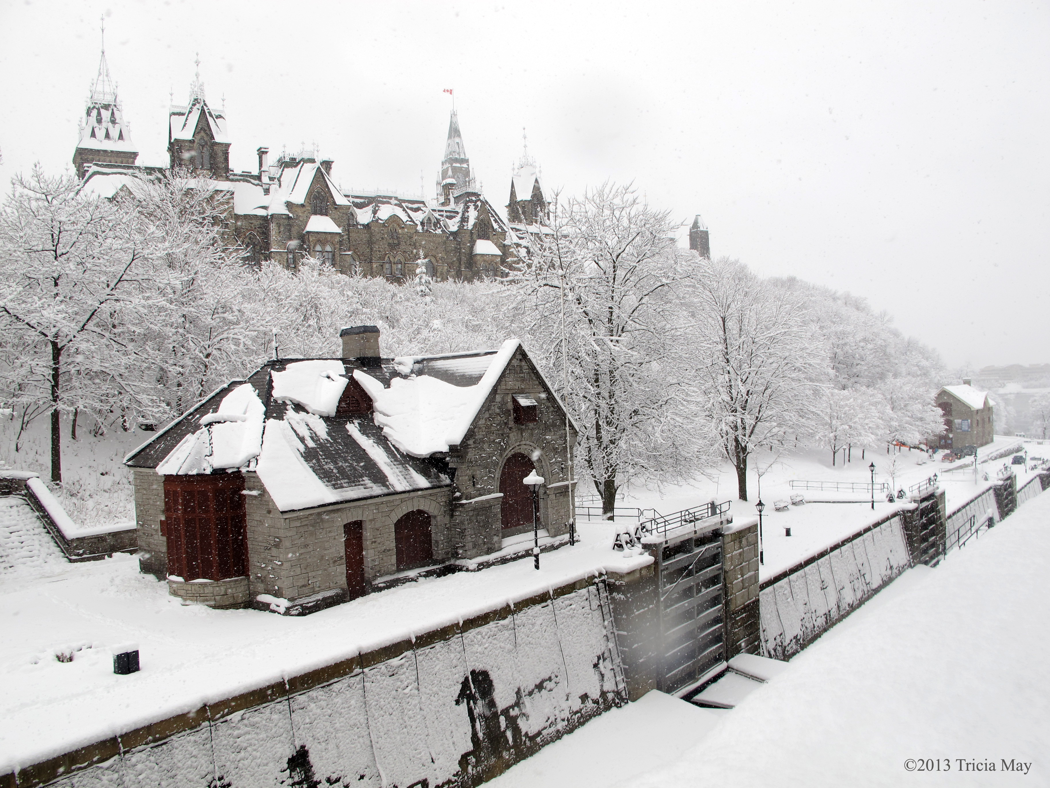
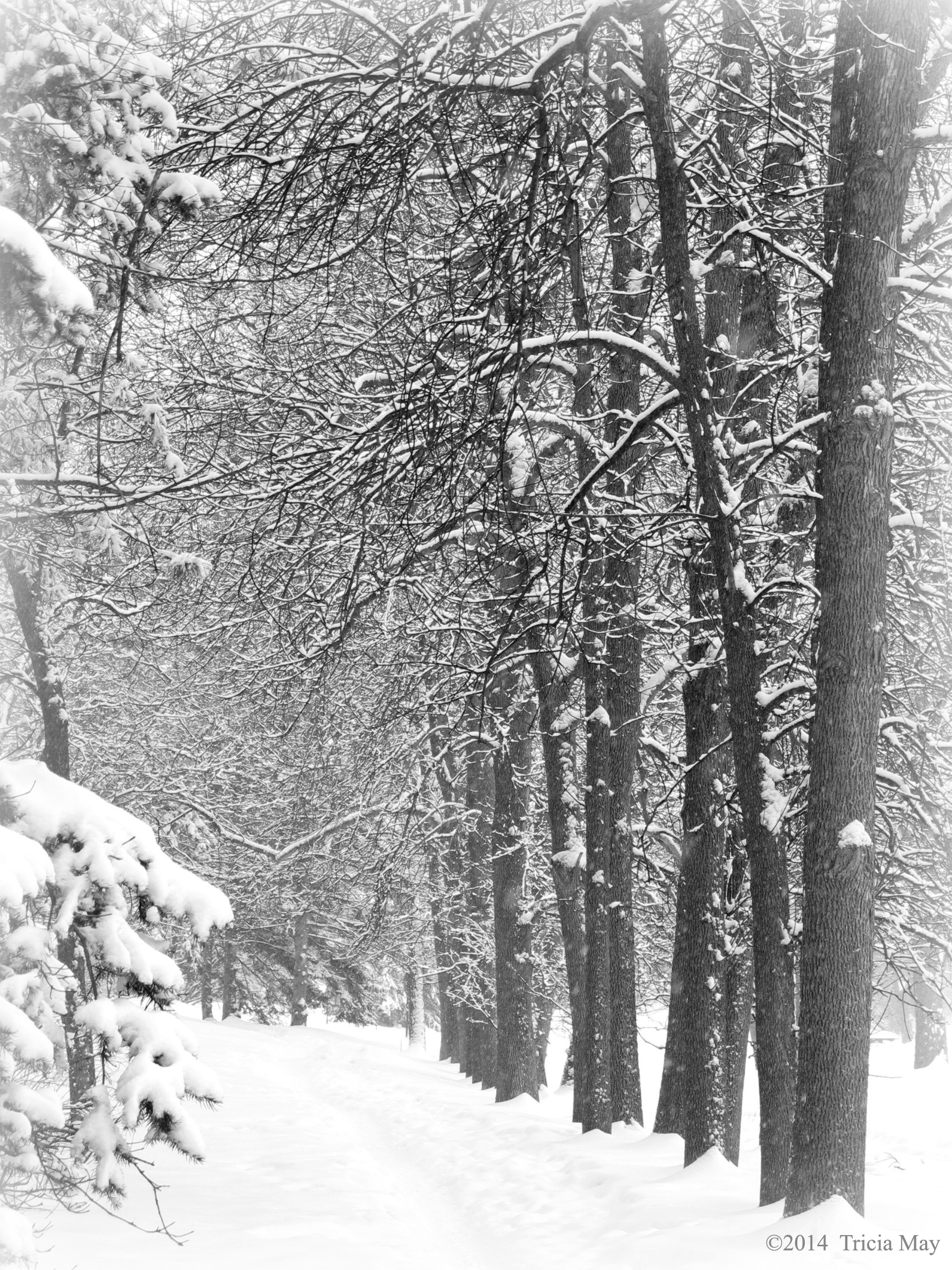
For years I’d been reading about the beauty of Utah and how wonderful the hiking was. This year I decided to find out for myself by travelling to Zion National Park and Bryce Canyon. My friend and I flew to Las Vegas and drove from there, encountering some fantastic scenery along the way.

Beautiful Arizona scenery on our way to Utah
We got to the park a little late in the day, but decided after setting up camp, to get in one quick hike. We decided on the close by Watchman Trail. My Lonely Planet guide (Zion and Bryce Canyon National Parks – which I will using for all of my stats) listed the trail as 2.7 miles on easy-moderate terrain with a 400 foot elevation gain. For my fellow Canadians, that’s about 4.4 km with 122 meters height change.
It was a nice easy walk from our campsite and my first views of the park did not disappoint.

Approaching our first trail – the Watchman
The Watchman was a good introduction – not hard, but hard enough after a long day of being on the road with barely any sleep. And for a sea level gal, it was also a good intro to the higher elevations. I must say, it felt good to have my hiking boots on again.
There was some loose rock, but it’s a pretty well worn, hard packed trail, easy to navigate.
Rocky path up the Watchman Trail
For me, this was so different looking from home…so gorgeous. Just the geology of the area was fascinating with the multi coloured layers. The light blue of the newly exposed rock to the deep red/brown that comes with long exposure. Beautiful. The fact that there were some funky ‘Tim Burton’ trees didn’t hurt either.
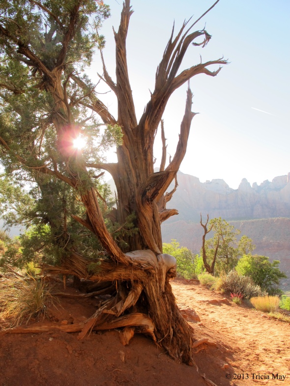
A “Tim Burton” tree on the Watchman Trail
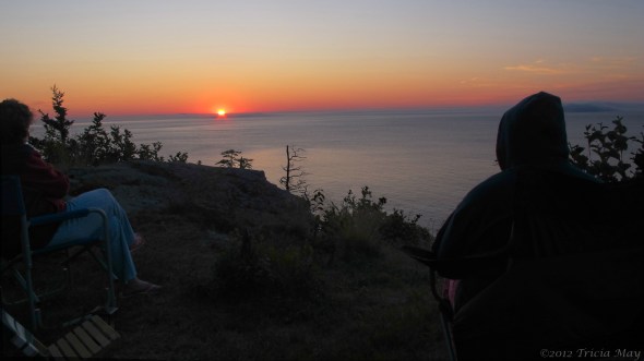
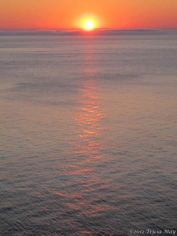
It didn’t take us as long to summit as the guide book suggested, but that was good because the sun was scheduled to set not that long after we got up, and this is the rumoured go-to viewpoint for sunsets in the park. You’ll want to remember a headlamp or flashlight for the return trip, and maybe bring an extra layer because the temperature dropped quite a bit once the sun dipped below the rock formations.

On the Watchman trail as the sun sets

View from the Watchman trail as the sun begins to set
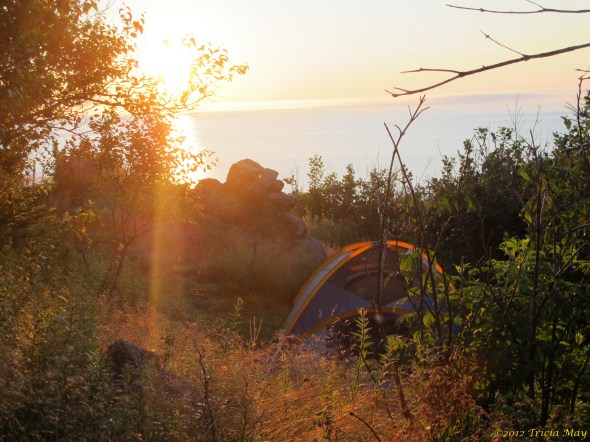
We walked back to our campsite, put on an extra layer, and made dinner in the dark. And it was dark. Very dark. The stars were so brilliant in the sky, and there were oh so many of them. I love being able to look up at the night sky and see the Milky Way. Light pollution sucks. It was a great end to the beginning of a great trip.
DAY 2
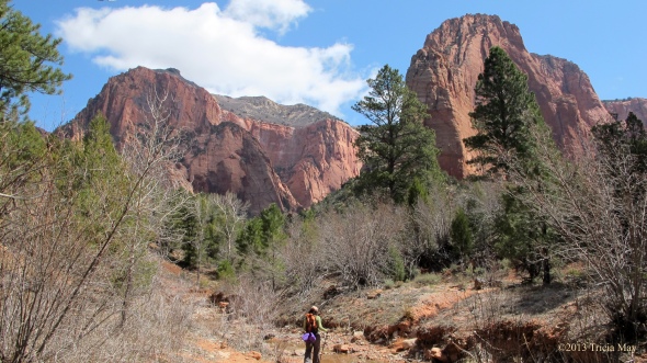
Lots to see and do on this day. We decided over breakfast to drive to the far end of the park and hike the Taylor Creek Middle Fork trail, a moderate 5 miles with 450 feet of elevation (8 km, 137 meters). We drove about a half an hour to Kolob Canyon where we stopped to talk to the ranger at the visitor centre. It was soooo windy and cold that I wasn’t sure what to wear, but we still had to drive to the trailhead, and I could decide after I got there. So after filling our water bladders we got back in the car and drove further up the road . Thankfully it was much more sheltered, so the wind was minimal and the temperature noticeably warmer. I grabbed my hiking poles and we were on our way.
This area was more heavily forested with towering pines and assorted deciduous trees (which kind, I have no idea since it was spring and there were no leaves). It was so striking that my friend and I kept stopping to look around and exclaim just how beautiful it was and how we were lucky to be there.
Crossing a stream on the Taylor Creek Trail
There are quite a few stream crossings so you could potentially get a little wet and muddy, but it was pretty dry when I was there. In a few spots areas had been washed out and the trail was marked with piles of stones, so keep an eye out in case the trail hasn’t been repaired.
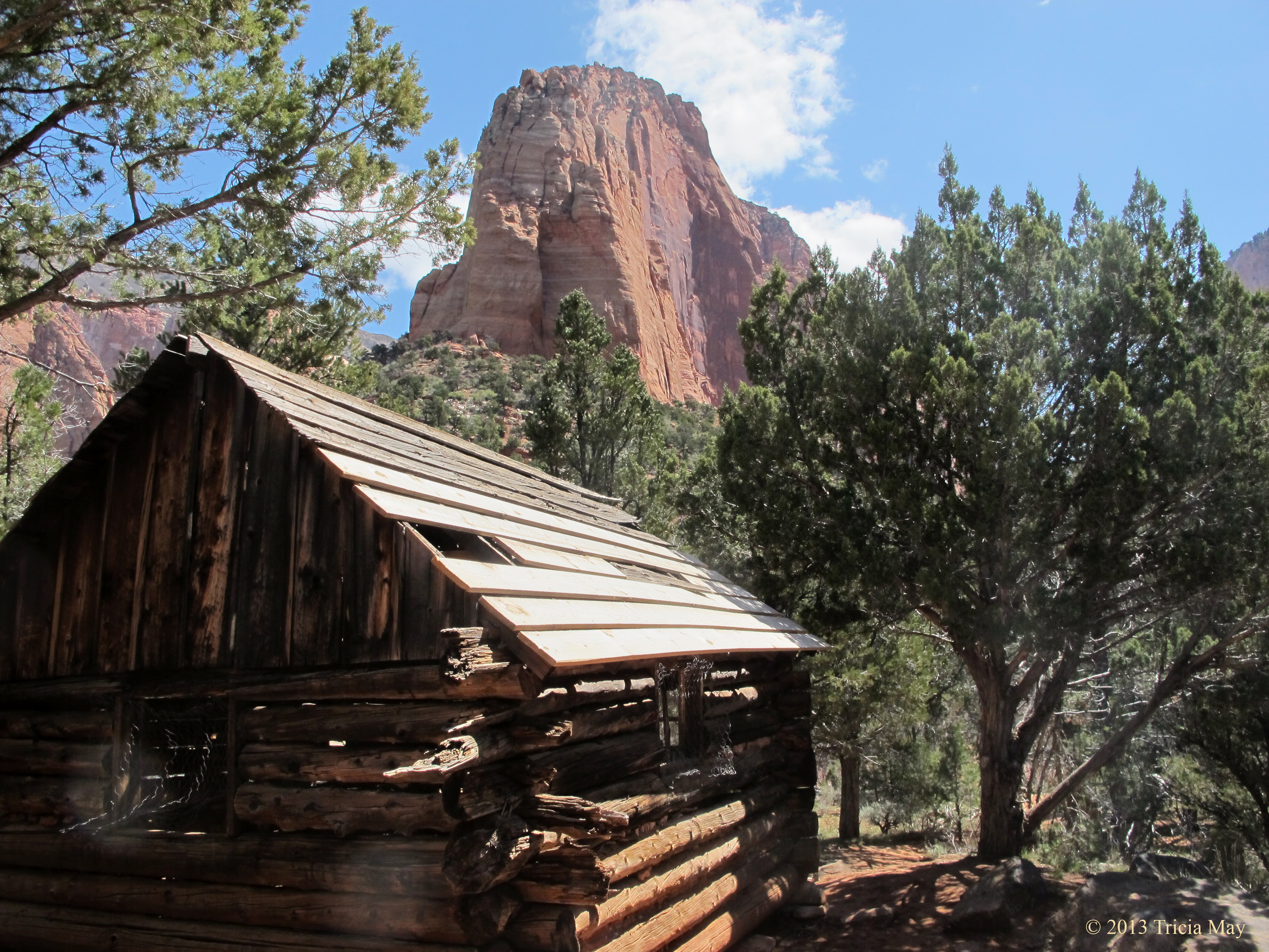
Amongst the beauty of the towering rocks and accompanying trees are two historic homesteading cabins dating from 1930. The Fife and Larson cabins are now considered archeological sites and no entry was allowed. Just imagine living in these surroundings….breathtaking.

The Larson Cabin on the Taylor Creek Middle Fork trail
The high point of this trail for me was what was waiting at the end of it…the double arch alcove. Wow. I needed to stitch together eight photos to capture the majority of it. The temperature dropped – a lot – and the wind was whipping around, but lordy…the beauty of it. Again, beyond description, but it was like the rock was molded clay with a wash of earthtone watercolours covering it. Water dripping down gave splashes of brown down the center, only to lead to the bright green of living things, of algae clinging to red rock and soil. Tall pine trees were dwarfed by the rock, so you can only imagine how we felt beneath the pines, necks craned as far back as they would go, looking up. It was too cool to stay for long, but I’ve got that snapshot clear as day in my head, and I really hope it stays a while, because moments like that put things in perspective.

The Double Arch Alcove and the end of the Taylor Creek Middle Fork trail
We were alone for most of our time on this trail, so if you want some solitude, this might be the place for you. We saw two people as we entered and a few others on our return, so no more than eight of us in the time period we were there.
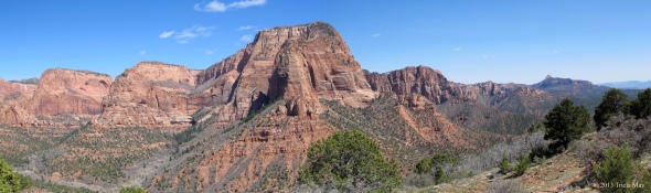
Back at the car we decided to drive to the end of Kolob Canyon Rd and take in the vistas from the Timber Creek Overlook. There is a short trail of the same name, one mile of easy-moderate hiking with only 100 ft of elevation gain (1.6 km and 30.5 meters). Gorgeous scenery at the overlook where you can take in the jagged fingers of the Kolob Canyons to the east and the Lower Kolob Plateau to the south. There are plenty of places to sit and take it all in, but it can get fairly windy out in the open. And apparently the altitude (6300 ft – 1920 m) was still kicking my butt – I got winded on the inclines.
View of the Kolob Canyons from the Timber Creek Lookout trail
We’d read a bit about a ghost town that was within the parks boundaries, so we decided to check it out on our way back. Grafton was initially settled by followers of Brigham Young in 1859, but the town was destroyed by a flood in 1862, forcing it to resettle on higher ground a mile upstream. This is where the current townsite now sits. Even in their new location, flooding was always an issue, but the real problem for the townsfolk were the Navajo who were being squeezed between settlements. Some Mormon settlers were killed by raiders, so Brigham Young ordered villages to coalesce into towns of more than 150 men, making Grafton into a ghost town for the first time. The farmers would return daily to tend their fields, and two years later, with the troubles over, the town was resettled. It thrived until 1906 when a newly built canal delivered the Virgin River water to nearby Hurricane. Most families up and left to move to Hurricane for an easier life, and so by 1945 it was uninhabited.

The church in the ghost town of Grafton

A couple of the headstones in the Grafton cemetary
It felt good to get back to our campsite and just chill for the rest of the night by a nice toasty fire. The sky was clear, and the moon was bright so we took out the night vision goggles we had with us to see what we could see…
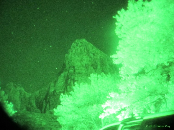
View from our campsite with night vision goggles
DAY 3
Trails for today – Hidden Canyon, Weeping Rock, Emerald Pools and Kayenta. Hidden Canyon is a 2.4 mile moderate-difficult hike with an elevation change of 850 ft (3.9 km, 259 m). Take the shuttle to the Weeping Rock stop to get there. Everything we read said to do this hike early in the morning so that the approach was done while still in the shade. I am sooooo glad we listened. Even in the shade I was sweating and stripping down and I could only imagine how hot it would be in full afternoon sun. Especially in the summer.

Switchback up the Hidden Canyon Trail (lower right)
I think the ‘difficult’ part of this trail is only applicable if you have issues with heights. This is a chain assisted trail with some narrow sliprock ledges, so you may want to grab hold since it’s almost a thousand feet straight down. Makes for some beautiful views!

Chain assist up the Hidden Canyon Trail
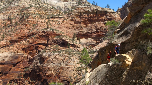
Chain assist on the Hidden Canyon trail
Once past the ledges, it wasn’t far to the mouth of the Hidden Canyon. The trail was a combination of sand and rock and about a quarter of a mile in on the right hand side there was a standing arch. After the arch the trail got rougher with some pretty substantial rock falls, so scrambling up and over rocks, some covered by slippery sand, would be in your future.

An arch along the Hidden Canyon trail
Our return down the ledges was temporarily delayed when we encountered a group of thirteen people coming up. Seeing as the ledge was too narrow for people to pass each other, my friend and I found a wider spot to sit down and wait. Some of the people coming up were moving pretty slow since they were terrified of heights and hugging the wall with a death grip on the chain. Also, huffing and puffing and breathing breaks were required. We didn’t mind the wait…the view was fantastic!

Lynda patiently waiting for a large group of people to go by in a wider spot on the Hidden Canyon trail
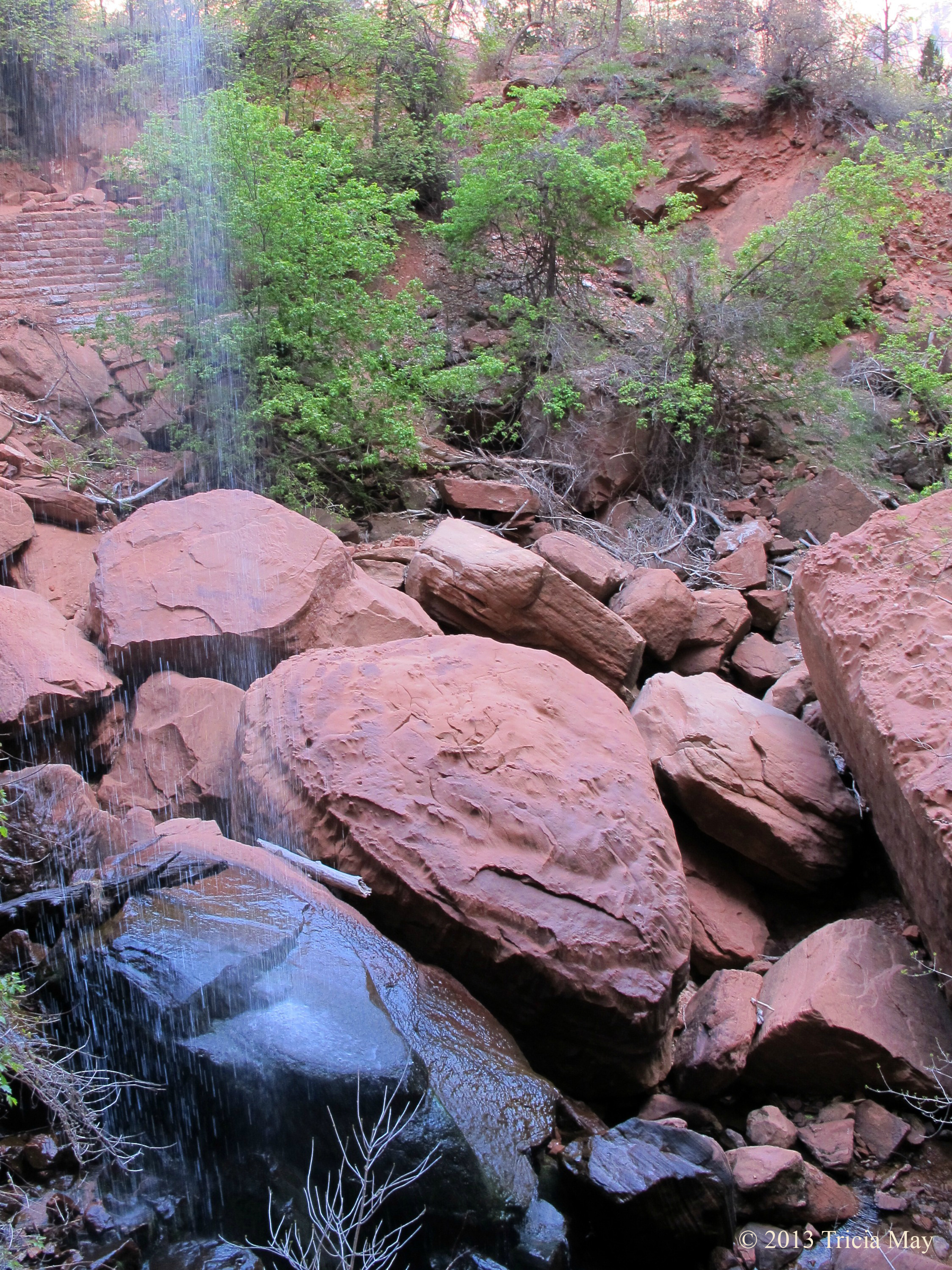
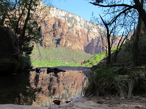
Once we reached the bottom of the trail we figured we would do the short off shoot trail to the Weeping Rock – 0.5 miles, easy-moderate with only a 100 ft elevation gain (0.8 km, 30.5 meters). Very short, but it would be nice to do on a hot day since the parks largest hanging garden is located by the giant alcove at the trails end. Water was constantly dripping down, creating a nice cooling spray. Perfect while you take in the view of the White Throne and Zion Canyon.

View from Weeping Rock
We walked back to the shuttle stop and waited for it to take us up to Zion Lodge where we had a picnic lunch and refilled our water bottles. Then it was on to the Emerald Pools and Kayenta trails – the trailhead is across the street. These are linked trails, and combined it is a 3 mile moderate hike with an elevation gain of 400 ft (4.9 km, 122 meters). I must say, the starting view was very pretty.
Approaching the Emerald Pools Trail
It was fairly dry while we were at the park, so the pools weren’t that spectacular. The first one was had a very small water fall which basically wet one rock, but the second had a very nice reflection of the surrounding hills.

Small falls dropping into the first pool of the Emerald Pools trail
Reflections in the second of the Emerald Pools
The third pool was in a beautiful location with towering sheer rock walls, but again, the water levels were so low that there was a lot more mud than there would be at other times of the year.
Instead of turning around and going back the same way, we took the Kayenta trail down. A nice, gentle decline and beautiful views that take you to the Grotto. We chose to walk back to the Zion Lodge on the Grotto trail instead of waiting for the shuttle and we treated ourselves to a well deserved ice cream cone once we got there. So refreshing! Our hikes for the day done, we took the shuttle back to the visitors centre and walked back to camp. It felt good to get the boots off and the sandals on.
DAY 4
Hikes for today: The Riverside Walk and as much of the Narrows we can do…without the proper gear. We really should have researched this part more. Everything we had read said that the Narrows shouldn’t be done in the spring due to the temperature of the water and the level from snow melt. Well, we were led astray. More on that later.
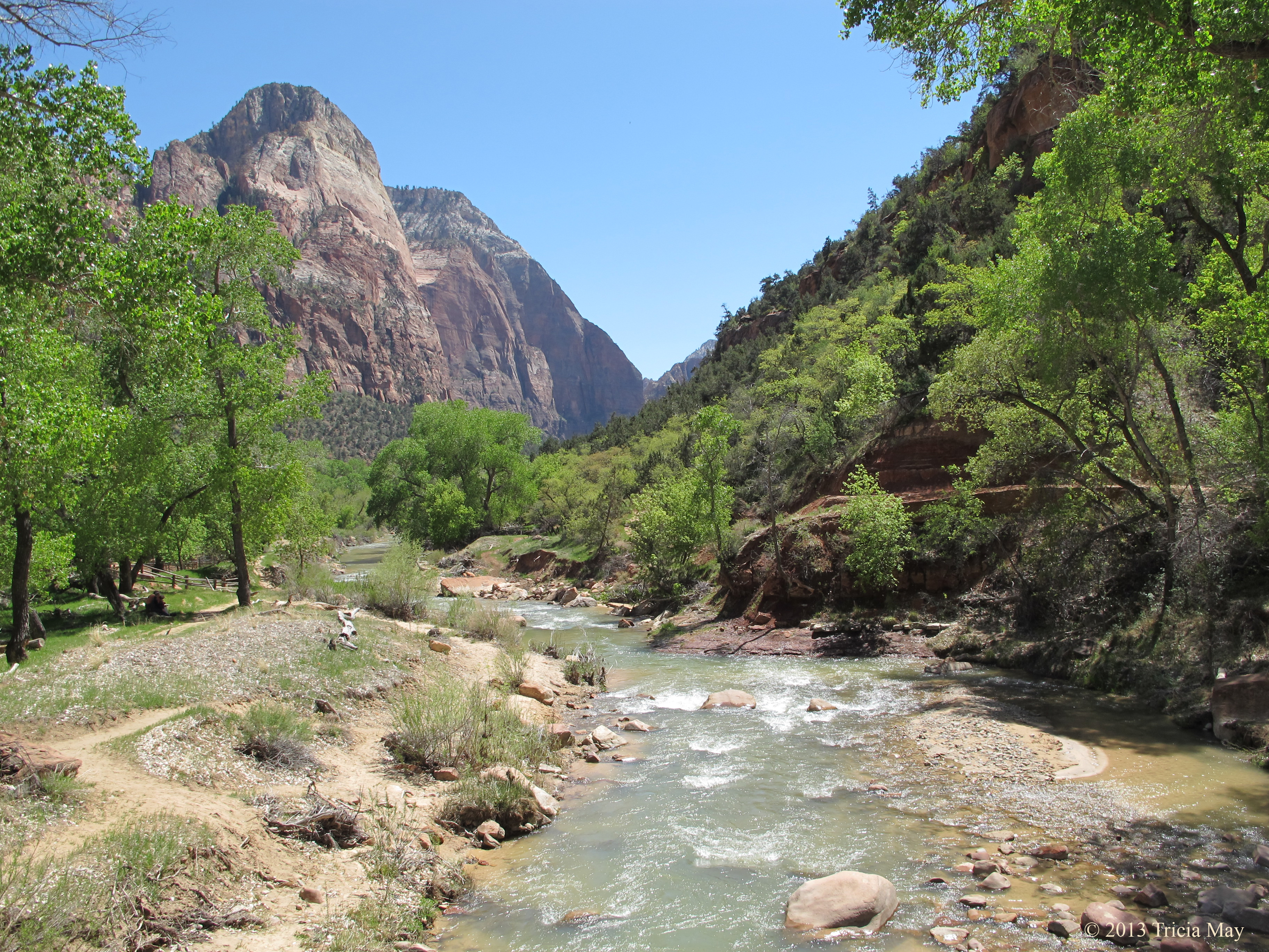
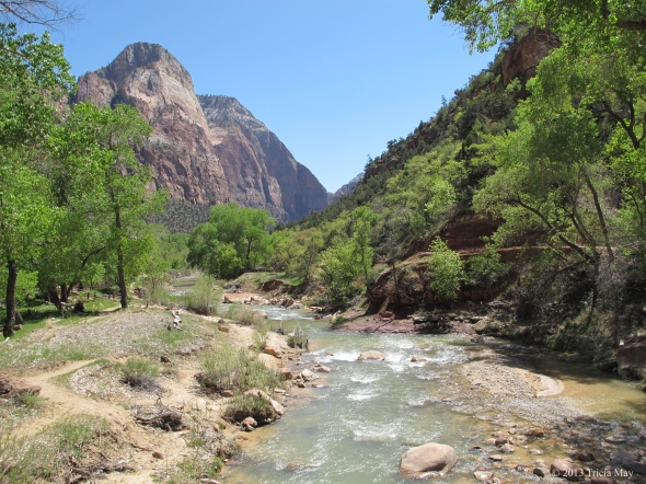
The Riverside walk. An easy hike that starts at the Temple of Sinawava, it is 2 miles (3.2 km) long and only has an elevation change of 100 ft (30.5 meters). The path is paved, and while some literature says that it is wheelchair accessible with assistance, it would take a lot of assistance. There are a lot of roots and some washed out areas that I think would be really difficult to get a wheelchair over. Strollers would be okay though.
The path runs parallel to the Virgin River, giving you some awesome views of towering rock overhead.

Looking up along the Virgin River on the Riverside Walk
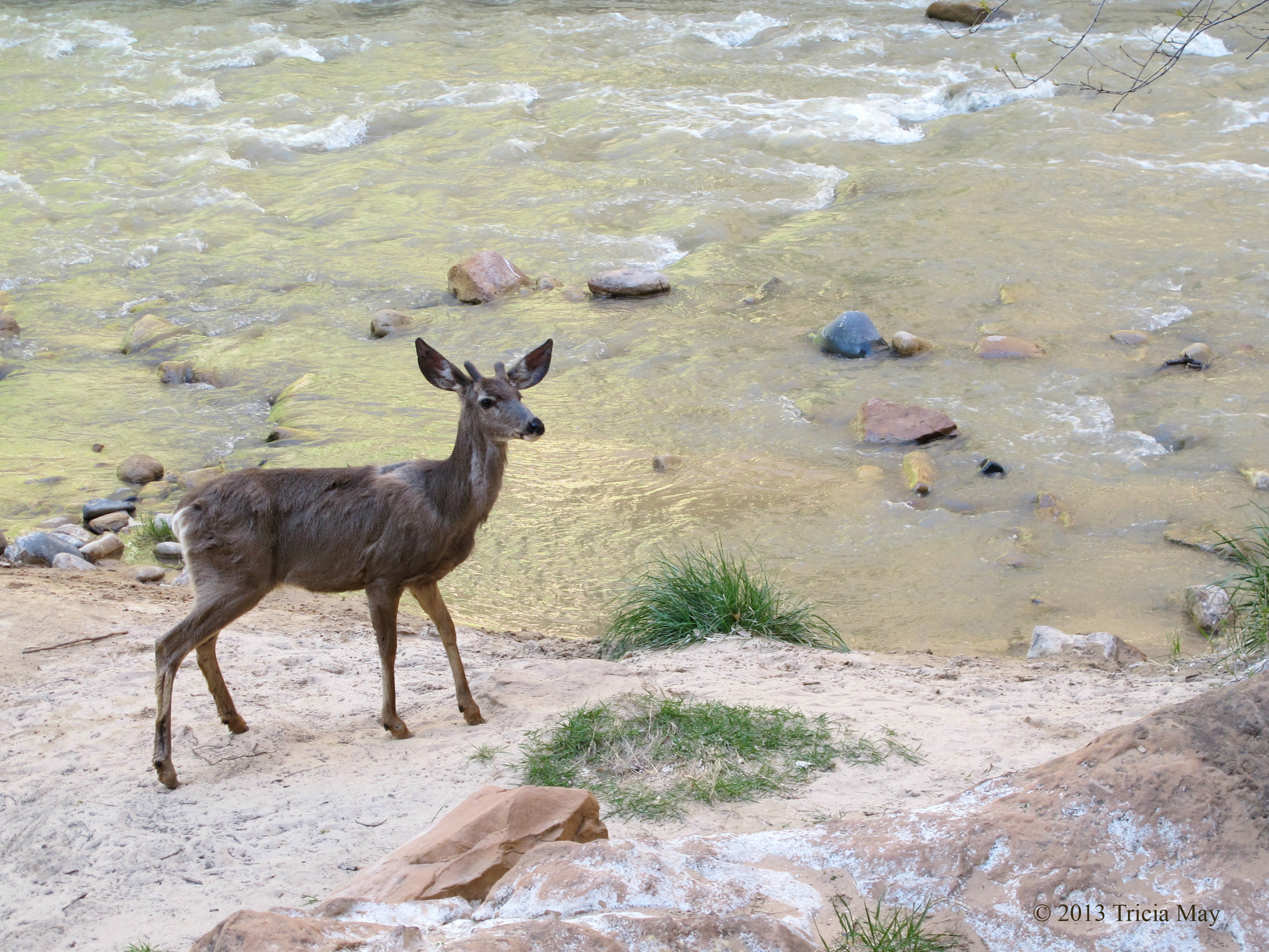
There were also a lot of mule deer to be seen along the trail.

Mule deer along the Virgin River
The end of the Riverside walk is the entrance way to the Narrows – where the Virgin River is the trail. This is listed as moderate to difficult and anyone venturing in must be prepared to be chest deep in water. The return trip is about 10 miles (16 km), but you can turn around at any time.
It is here, at the mouth of the Narrows, that you’ll find all sorts of people sitting on the rocks, watching others head off into the slot canyons.
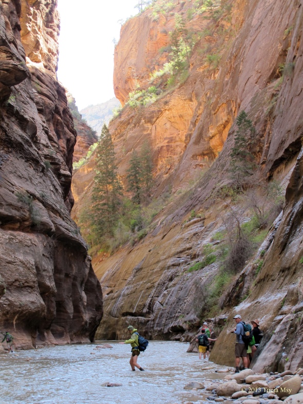
People heading into the Narrows
We wanted to be amongst those getting into the water, but we neglected to do the intelligent thing and consult with the Ranger about the water level and how fast it was running. If we had, we would have found out that it was safe to enter and go forth. We could have gone to one of the many outfitters in nearby Springdale and rented wet suits. But no…we didn’t do any of that. So when we reached the mouth of the narrows, we just decided to do what we could with what we had.

In the Narrows
Unfortunately, we didn’t get as far as we would have liked. It wasn’t that the water was too cold, but it was getting a bit deep, and without poles of some sort to help us along, we didn’t feel safe. The surface of the water may look pretty smooth, but it actually pulls at your legs pretty fierce. So, my advice if you want to do the Narrows, especially in the spring…is check with the ranger! Rent yourself a wet suit and a sturdy walking staff, and if you want to do the whole day trek, give yourself a full eight hours for the the return journey.
After getting out of the water and letting our boots drain for a bit, we got back on the Riverside trail and hopped on the shuttle, only to get off at the Big Bend stop. We wanted to check out Menu Falls – about a half mile (0.8 km) back. It was a nice little waterfall just off the road with a nice place to sit and just relax. On a hot day this would be a great place to chill out.

Menu Falls
After a few minutes here we got back on the shuttle and went back to camp for lunch. We needed to get some supplies so we walked into Springdale, picked up what we needed, and chilled at our site for the rest of the day.
DAY 5
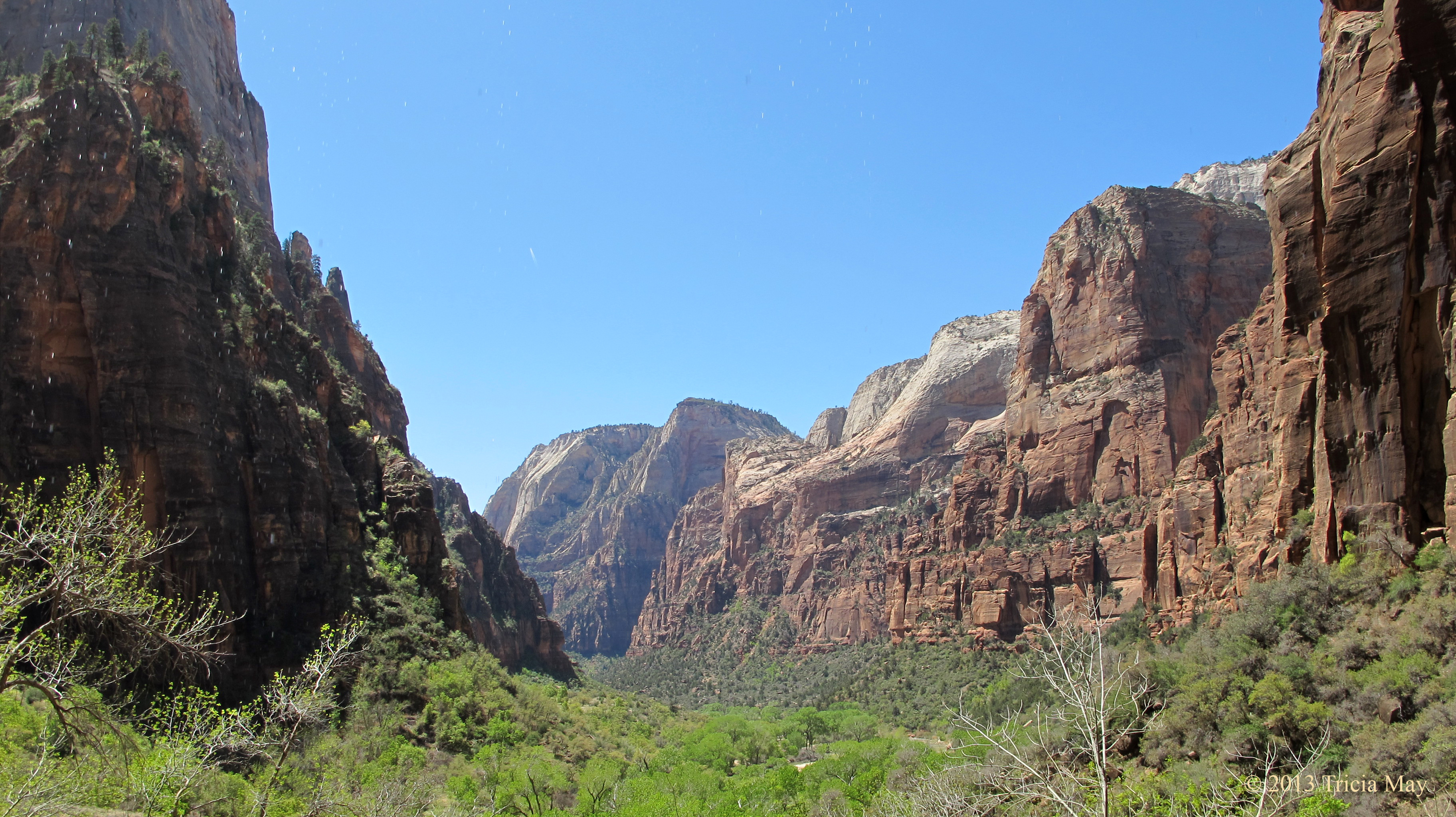
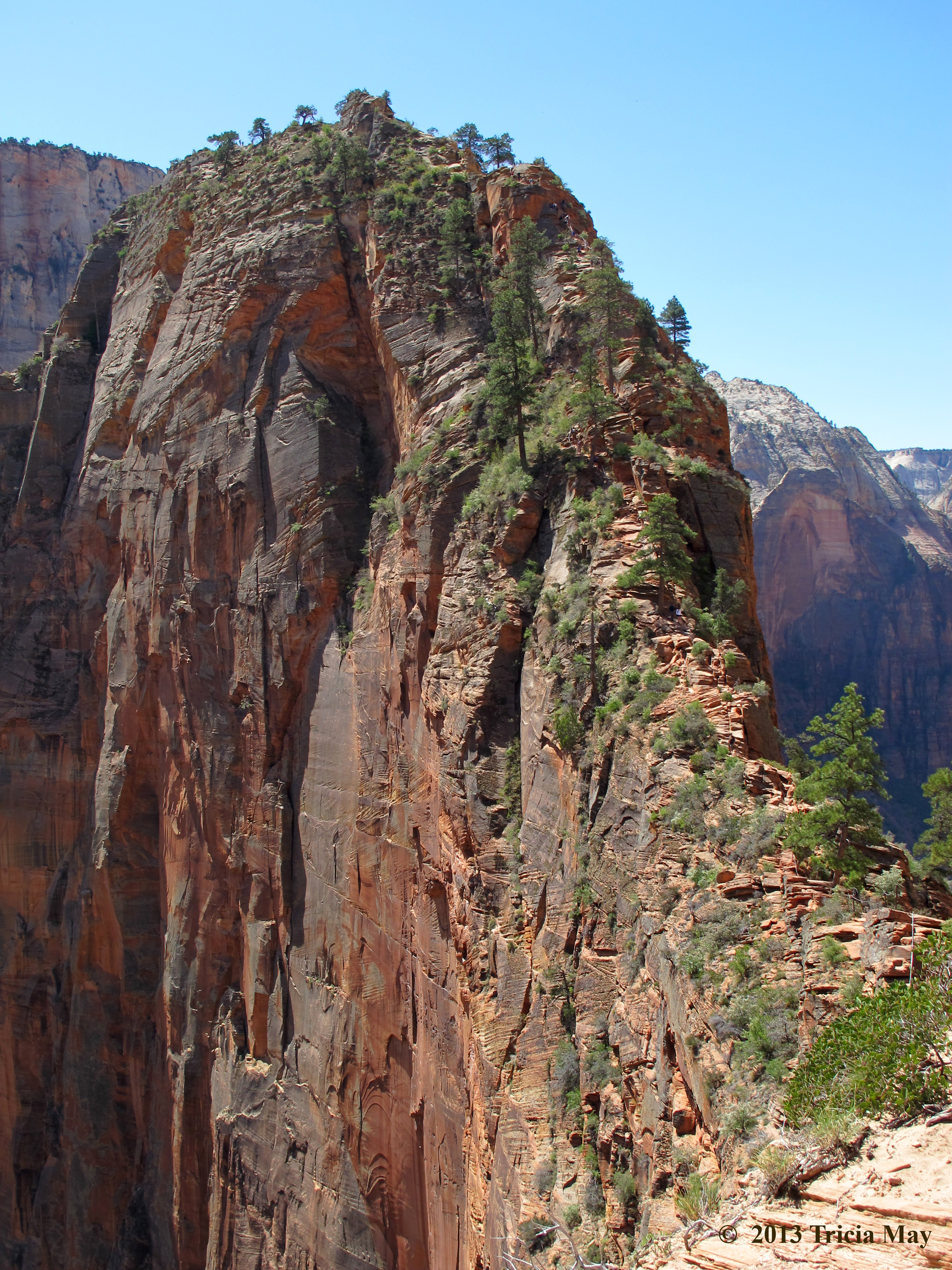
Our last full day in Zion – which of course means we were heading for Angels Landing. Listed as a difficult 5.4 mile (8.7 km) trail with 1488 feet (453.5 m) elevation gain, this is the parks most well known canyon hike. Take the shuttle to the Grotto stop and you’ll see the trailhead across the road from the picnic area.
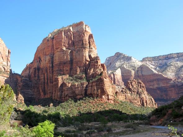
Angels Landing
Ah, it started out nice and gentle, but soon you get into some pretty serious switchbacks and any layers of clothes you were wearing start to come off. My knees and I were very happy to have my two hiking poles in hand, and I knew I would really appreciate them on the way back down.

Angels Landing switchbacks
This first batch of switchbacks end when you go under a rock over hang, and I for one was very happy for the short reprieve. Walters Wiggles, a set of 21 short, steep, stonework zigzags comes pretty quick, but once you get to the top of that, you are at Scout Lookout. Here you can visit the pit toilet and decide if you want to carry on all the way up to the top of Angels Landing.

The thin saddle up to the top of Angels Landing
If you have issues with heights, narrow trails, or steep drop offs, you may just want to stop and enjoy the view from here. The trail is chain assisted, and you will need to use them. Put any hiking poles away because you will need both of your hands to scramble up rock. This is where the fun begins!!

Ascending Angels Landing
I personally love this kind of hiking, but with the popularity of this trail, you are bound to encounter over crowding. Unfortunately, impatience comes with over crowding and impatience can lead to dangerous circumstances. We came across some people who were trying to pass others on extremely narrow sections, almost knocking someone off the side. They were either oblivious to the danger they created, or they just didn’t care because they wanted to get to the summit faster. To avoid this, I would recommend hitting the trail really early – we got to the Grotto around 10:30 and there were already plenty of people ahead of us.
Getting to the top felt good…really good. The sun was bright, the sky was blue and the wind was blessedly calm. We got out our lunches and just sat and enjoyed the view.
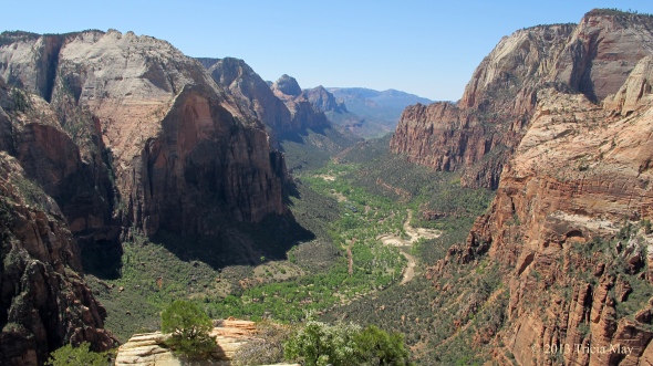
View from Angels Landing
After lunch it was time to go back down – which many people say is harder, but I just found the whole thing fun. As I said, I love this kind of stuff.

Descending Angels Landing
Going down was much faster than going up, although it was harder on the knees. As I mentioned before, I was very glad to have my hiking poles with me for the return trip.
We figured since it was our last night in Zion, we should go out for dinner, so we drove to town and went to Oscars. Excellent food! I had a huge turkey burger with fries, and as much as I wanted to try their carrot cake, I just couldn’t. No room. The service was fast and friendly and I would highly recommend it to anyone in the area.
DAY 6
Goodbye Zion, hello Bryce Canyon! This day was a bit of a travel day so we were up earlier than usual. After packing up and making a nice breakfast of bannock over the fire, we were on our way and headed through the Mount Carmel Tunnel. It’s amazing how different the scenery is on the other side of that 1.1 mile (1.78 km) stretch. The colours, the shape of the land….Before long we stopped to look at the Checkerboard Mesa, a large sandstone hill with an unusual grid like crack pattern.

Checkerboard Mesa
I didn’t note how long it took us to get to Bryce Canyon, but I think it was about two hours – two hours of beautiful scenery. Once we got to Bryce, the hunt for a campsite in the North Campground was on. The really scenic spots were taken, but what we were looking for was a spot with a lot of sun exposure. The forecast was for cold…so we wanted as much help from the sun as we could get to keep us warm. I think we did pretty well…
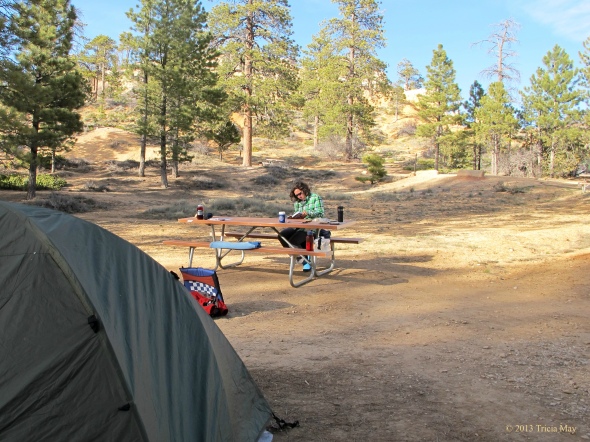
Our Bryce Canyon campsite…Loop C #64
First things first though…time for a shower! Since there were none available at our Zion campsite, we were really looking forward to this. We drove to the general store and each bought our two tokens for two dollars – that would get us an eight minute shower. Absolute heaven!! After some lunch we went off to do a couple of small hikes to stretch our legs and take in our new surroundings. On the list: Mossy Cave and Bristlecone Loop.
Mossy Cave was an easy-moderate 0.8 mile (1.3 km) trail with only 150 feet (45.7) of elevation change. That may not sound like much, but the elevation at Bryce is much higher than Zion, and it was giving my lungs a bit of a workout. It was also my first time to get up close to the gorgeous red-orange hoodoos the park is famous for.

At the Mossy Cave Trailhead
Not that far onto the trail you can choose to go left or right. Turning right lets you follow along the river to a waterfall (cross at the second footbridge to get a better look at them) or left to the mossy cave. If you choose to check out the waterfall, you can then take a short, steep trail up to some arches to take in the view.

Off the Mossy Cave trail
If you choose to turn left, don’t be too disappointed…the mossy cave isn’t so much a cave as an overhang. While it isn’t deep it is sheltered enough for there to still have some snow and ice tucked into the back of it while I was there. I’ve read that it’s quite pretty in the winter when draped with icicles.
Since it was too early in the season for the shuttle buses to be running, we got back into our car and drove to the southern end of the park to Rainbow Point. From here we would access the Bristlecone Loop, an easy 1 mile (1.6 km) trail with only 100 feet (30.5 meters) elevation gain. Rainbow point stands at 9115 feet (2778 m), so for me, the less elevation gain, the better!
There was still snow on parts of the trail but not enough to cause issues. In fact, I was very tempted to make a snowman! Anyway, the trail is very well worn and brings you through many different types of pines, until you get to the tip of the trail, marked by a gazebo. A little further on you come to the namesake of the path – the bristlecone pine.

Young Bristlecone Pine
The bristlecone pine is the longest living tree, with some specimens being over 5,000 years old. I read that every diameter of trunk is approximately 100 years of growth, so the one in the picture above is pretty young compared to this guy…

Older bristlecone pine
There are also some great vistas to be had from this part of the trail:

View from Bristlecone Loop trail
There were a bunch of great lookouts just screaming for photos to be taken on the way back, but we’d have a few days to discover them at a more leisurely pace, so we just went back to camp to prepare a hearty dinner and some hot drinks. The temperature dropped pretty quick once the sun went down.
DAY 7
Well, that was a cold night…-10C (14 F). I needed to add an additional layer of clothes part way through, but I still got up with aching bones and joints. I am not a fan of cold weather camping.
We got up really early this morning…we’re talking 06h00, so that we could go to the visitor centre and stand in line for full moon hike tickets. The tickets are free, but they go fast, and it’s first come first served the day of, with a maximum of 30 available. Well, there was going to be a full moon tonight, so there we were, sitting in the parking lot (in the car thankfully) by 06h15. The next people didn’t arrive until 07h00, and when the visitor centre opened at 08h00, there were 19 people with us.
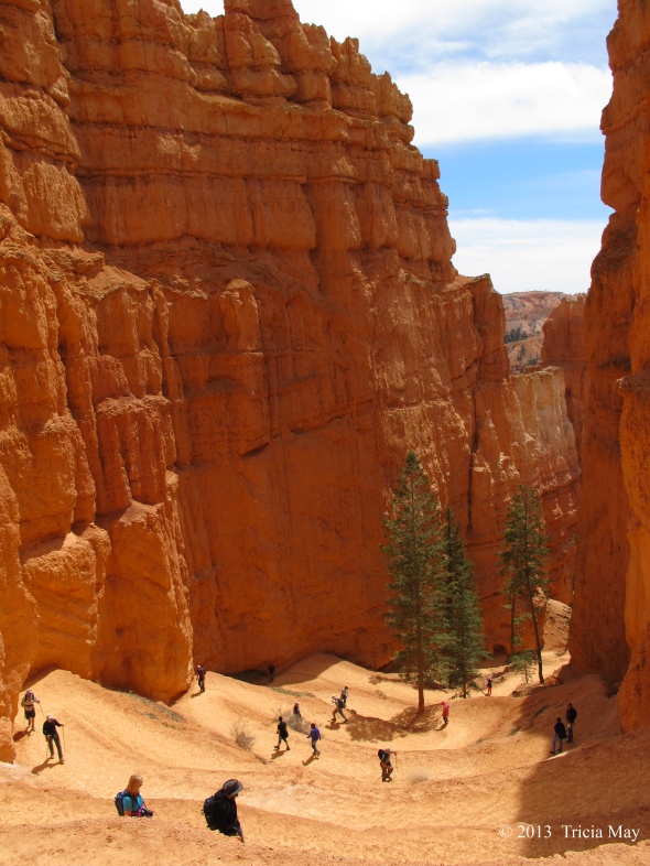
Back at camp, hot beverages were at the top of our list…we were cold. After puttering around, making lunches and doing our dishes, we were off. Today’s hike to limber us up: the Navajo-Queens Garden Loop. This is listed as a moderate 2.9 mile (4.7 km) trail with an elevation gain of 521 feet (158.8 m). We walked along the Rim trail until reaching Sunrise Lookout – the trailhead for Queens Garden.

Queens Garden trailhead view
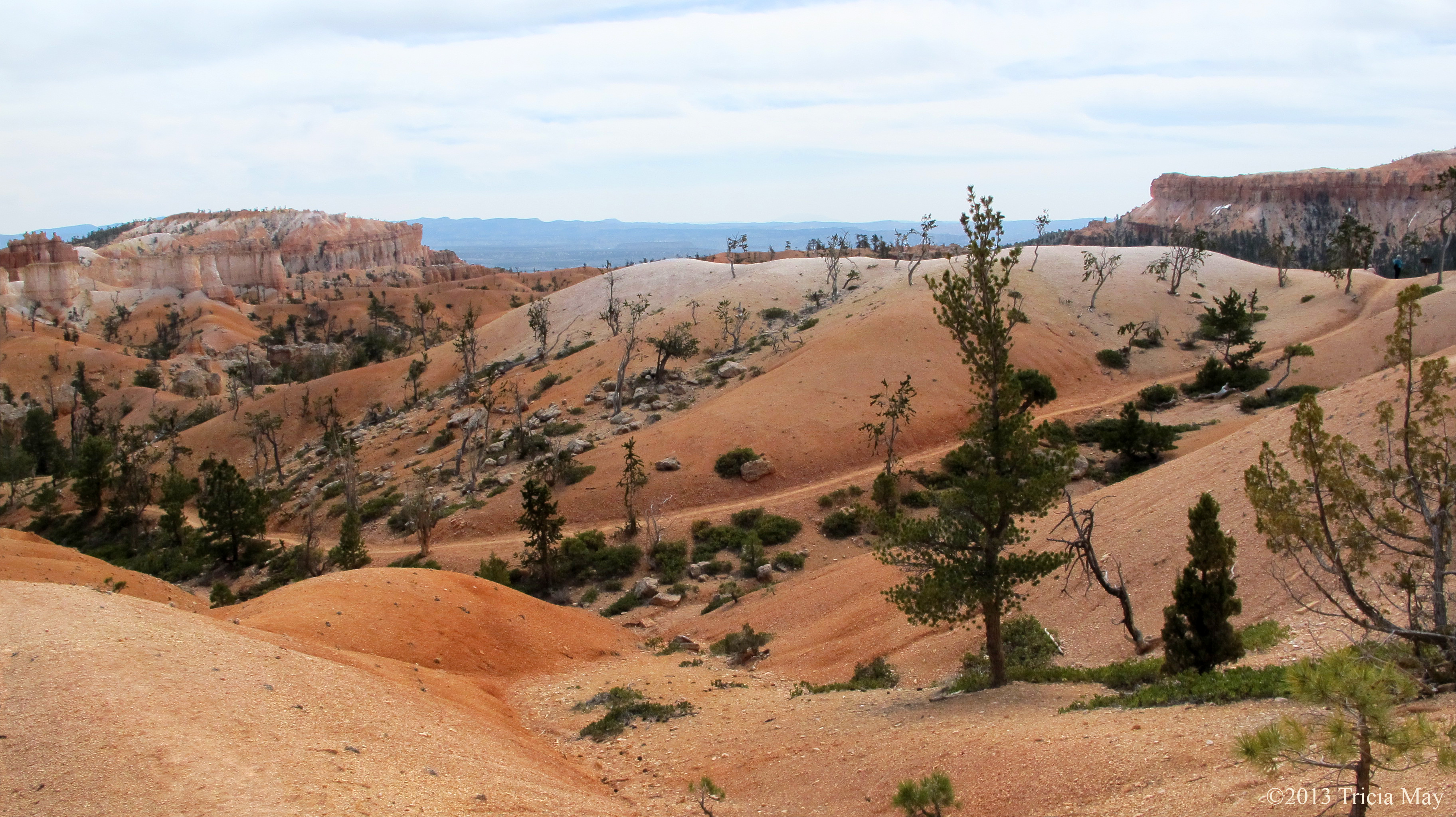
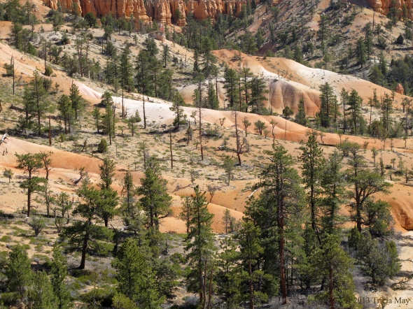
The variety of landscapes on this trail is surprising. We went from Martian like vistas….

The Martian like landscape of the Queens Garden trail
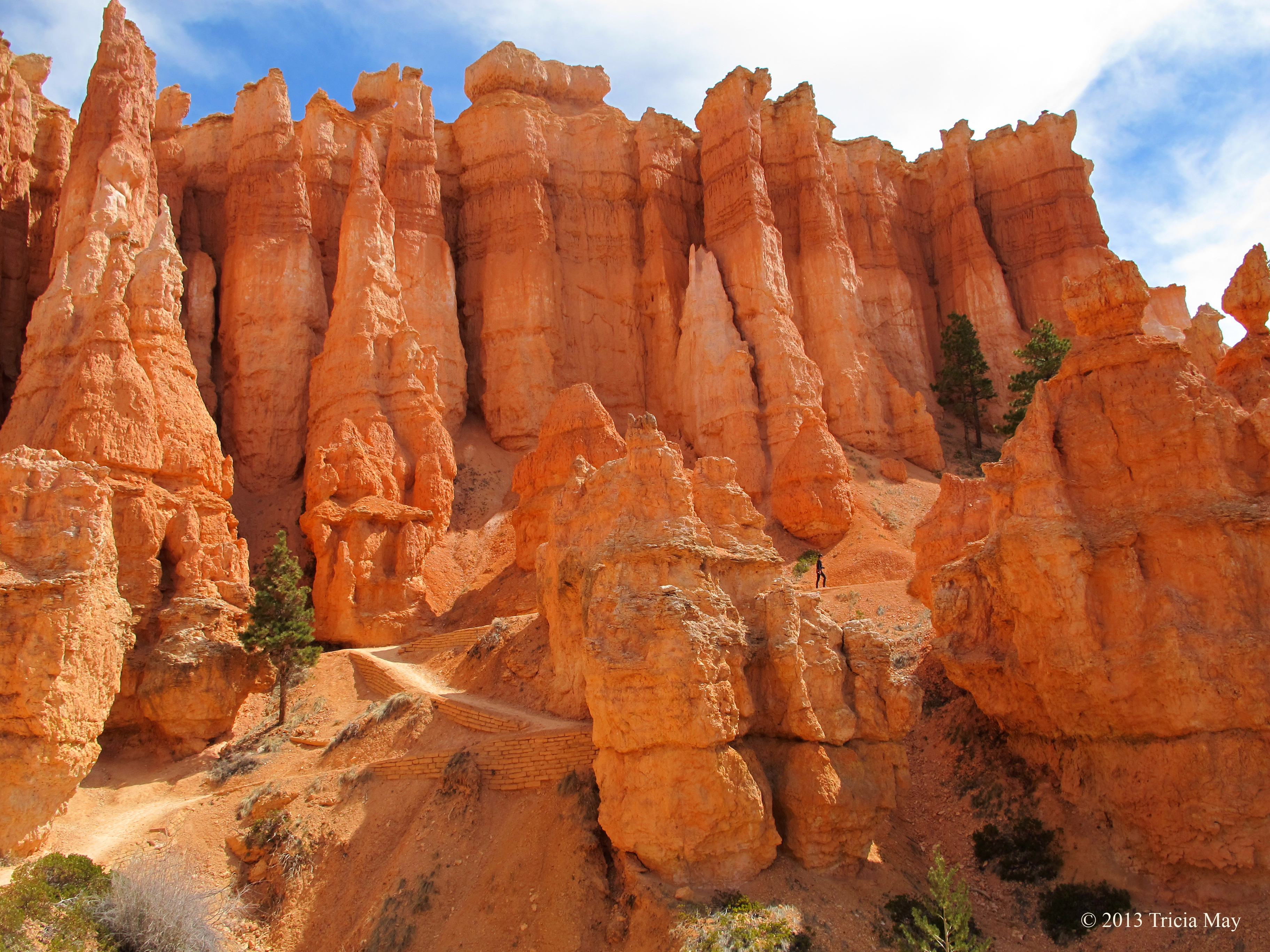
to hoodoos that tower over hikers.

Spot the hiker amongst the towering hoodoos
There is a section of the loop called ‘Wall Street’ that is often closed due to rockfall, so you may be forced to close the loop by traversing the ‘Two Bridges’ branch instead. Such was the case while I was there. We wanted to see what we could of Wall Street, so we went as far as we were allowed.
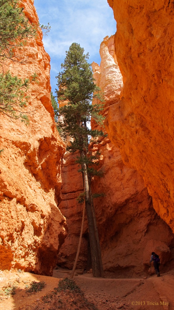
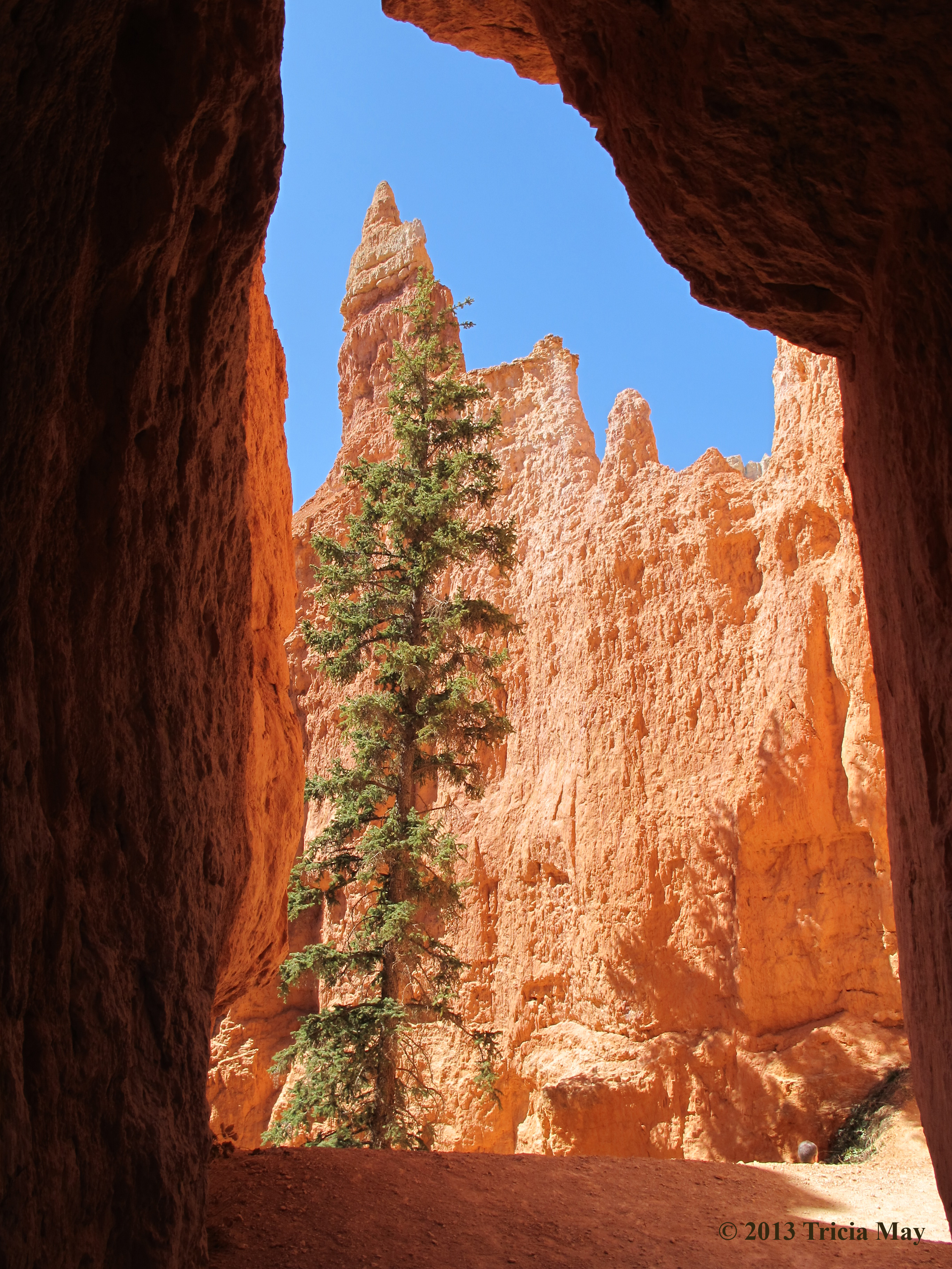
Tall pine on Wall Street
Just past this pine was our turn around point – rockfalls had closed the rest. Going back the way we came, we got onto the trail and finished the Navajo loop by going up a steep section of switchbacks.
Switchbacks on the Navajo Loop trail
Your reward once you get back onto the Rim Trail at the end? Fantastic views of the parks most recognizable feature, Thor’s Hammer.
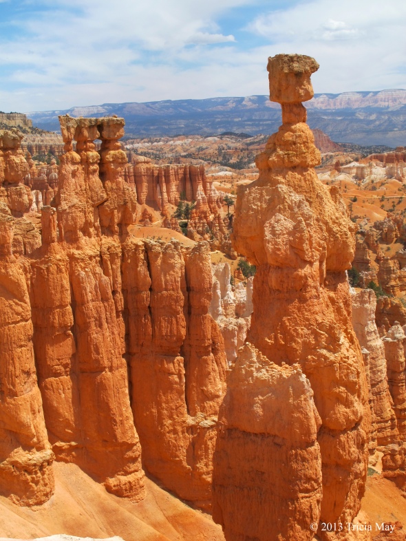
Thor’s Hammer at the end/start of the Navajo Loop
After taking in the views, we found a nice place to sit, ate our lunch, and then continued on along the Rim Trail until we reached our campsite. The plan was for a nice little nap in the sun, but the weather suddenly took a turn for the worse. We had to retreat to our tent when the wind picked up and brought with it some really, really dark clouds. The temperature dropped quickly and the wind picked up even more, so into our shelter we went. It calmed about an hour later, so we got up and took a walk around the camp grounds to warm up and get the blood flowing.
After dinner we got ready to head out on our full moon hike. We layered up and went to meet the group at Sunrise Point – the trailhead for the Queen’s Garden loop where we were that morning. Our guide led us out at 20h00, and while it wasn’t quite dark yet, we filled the time we hiked with stories about the moon – what it signifies in various origin stories in various belief systems. It was quite interesting.
At one point we stopped and watched the moonrise through a few layers of clouds. We had to keep our night vision so no flash photography was allowed.

Moon rise on full moon hike
We continued down the trail, it getting darker and yet staying bright at the same time. Once the moon broke through the final layer of cloud, our surroundings were brightly lit with no need for headlamps. The hoodoos surrounding us looked so different without their red hues…more imposing.
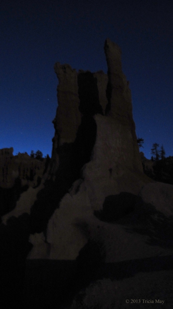
Hoodoo lit by moonlight
It was a great experience, so if you happen to go to the park during a full moon, I highly recommend getting up at an ungodly hour and reserving your ticket. We hiked back to camp, most of the way anyway, without our headlamps. Our night vision was ruined as we approached other campsites with people using lanterns, but it was nice while it lasted.
DAY 8
Another really cold night. Some water we accidentally left out overnight froze, so that’s saying something. Time to warm up, so that means getting back on the trail! But first, into the car…for the drive to today’s destination: Red Canyon in Dixie National Forest, about twenty minutes outside of Bryce.
We picked up a trail map at the visitor centre and they suggested, before heading out on a longer trail, to walk the short ones just behind the building, so we did . There was the Pink Ledges Trail which connected to the Hoodoo Trail which connected to the Birdseye Trail. Pink Ledges is only 0.4 miles (0.8 km) with an elevation gain of 200 ft (61 m) and it winds through hoodoos and ponderosa pine. The Hoodoo trail is itty bitty. At 0.3 miles (0.5 km) with an elevation gain of 30 feet (9 m) it’s over in a blink, but you do see hoodoos and some pinyon and juniper trees. The Birdseye Trail is a little longer at 0.8 miles (1.5 km) with an elevation change of 100 feet (21 m). There are some steeper sections, but its really quite tame.
Hoodoo on Pink Ledges Trail
On to our longer hike now. The visitor centre suggested we try the Buckhorn Trail which connects to the Golden Wall Trail. The Buckhorn is 0.9 miles (1.5 km) long and has an elevation gain of 500 feet (152 m). It starts down the road, in the Red Canyon Campground, between sites number 24 and 26. It has some switchbacks on the ascent and then sort of levels out to reveal some great views.

View from Buckhorn Trail
It is here that we connect to the Golden Wall, a 2.8 mile (4.5 km) long trail with 505 feet (154 m) elevation gain. There are lots of ponderosa pine and golden coloured rock walls, but sometimes it felt like we were walking on Mars. We didn’t know what scenery we would have from one minute to the next – around every turn it was something new.

The Golden Wall trail
These trails are much more rustic, maybe less maintained, than the trails in Bryce. Often only wide enough for single file hiking, one foot span at a time. They are also not nearly as busy. For all the time we were there, we only ran into four other people. There are options of connecting to other trails and continuing on, but we decided to head back to the car. The trail we were on ends at the highway, so we turned right and walked parallel to it on a paved walking/biking path. It didn’t take long to get back to the visitor centre.
It was a really nice hike – quiet, varied scenery…perfect if you want to get away from the crowds at Bryce for a day.
DAY 9
Still cold at night, about -6C (21F), but I managed to stay pretty cozy. The campers across from us did not, judging by the way they got up in the middle of the night, loudly complaining about how cold it was, and then drove off. Hotel in town maybe?
Anyway, we had a bit of a lazy morning, and didn’t leave camp for the trailhead until 10:05. Today’s hike: The Fairyland Loop. Rated as a difficult 8 mile (12.9 km) trail with 900 ft (274 m, but 2309 ft (704 m) cumulative) elevation gain and estimated duration of 4-5 hours. The official starting point is Fairyland Point, and if the shuttle is running while you’re there, note that it does NOT stop here. Our campsite was about a half mile away, so we walked along the Rim Trail until we got to Sunrise point – where the Loop meets the Rim.
The view at Fairyland Point
Again, spectacular views. There were vast expanses of hoodoos, strips of white, orange, burnt orange and red sand with pines scattered throughout. So beautiful. Anyway, the trail wasn’t busy at all but it was very well beaten with clean, even paths. You have the option at one point of taking a small off shoot trail to check out the Tower Bridge formation. It’s about 200 feet (61 m) in and there were some nicely placed logs among the trees to sit and rest if you like. It’s short, but worth it.

Tower Bridge on the Fairyland Loop trail
The thing about this trail…it meandered. A lot. Which was nice because it meant gentler climbs (part of the time) and more “wow” moments at every turn. I hadn’t really adjusted to the altitude yet, so I really didn’t mind its meandering nature. Don’t let the word fool you though…it was a hard hike. There were lots of saddles to climb up and over – lots of elevation gains and losses. But with it being a loop, you get to pick which direction you want to hike it in, which can make it a little easier on your knees. We chose counter clockwise for the simple fact that we were closer to Sunrise Point than the actual trailhead itself. And I am soooo glad. I wouldn’t want to climb up what we went down, which is about 900 ft (274 m). This graph from the National Park Service might give a better picture:

But there is some flat stuff too…

Gentle meandering trail on the Fairyland Loop
On the more open parts of the trail, prepare for wind…lots and lots of wind. At one point it was threatening to push me off the path and the temperature dropped quite a bit as well. But it was in the wide open areas that you got the best view of Boat Mesa, a huge formation of sandstone that has managed not to erode into hoodoos.

The Shipwreck Rock in Boat Mesa

You can’t have a good hair day in this wind
Make sure to bring lots of water and snacks (or lunch) with you…you’ll need the fuel. There were plenty of very nice, scenic places to stop and take in the view while eating, or just to catch your breath. More than once we were hiking up and up thinking we were almost at the top, only to turn a corner and be faced with another steep incline. Slow and steady people, slow and steady.

Hoodoos along the Fairyland Loop
Once we reached the official trailhead at Fairyland Point, we stopped for lunch and then continued along the Rim Trail back to our campsite – the loop completed. It was very nice to end on the flatter Rim, so I highly recommend doing this trail counter clockwise and starting it at Sunrise Point. If you want a great hike in this park without a lot of company, this might be for you. It took us just over four hours to complete.
After a snooze in the afternoon sun and then making a dinner of flat bread and spaghetti, we were off to the lodge for an astronomy talk. If you are at all interested in learning about the stars above your head, this talk would be well worth your time. Fascinating videos and a great history lesson on how discoveries came about and who actually made them, presented by a man passionate about the topic. It was a full house, so if you go, you may want to go early. After the presentation you could make your way to the visitor centre to look through the telescopes they had set up to get nice, close up views of the stars.
DAY 10
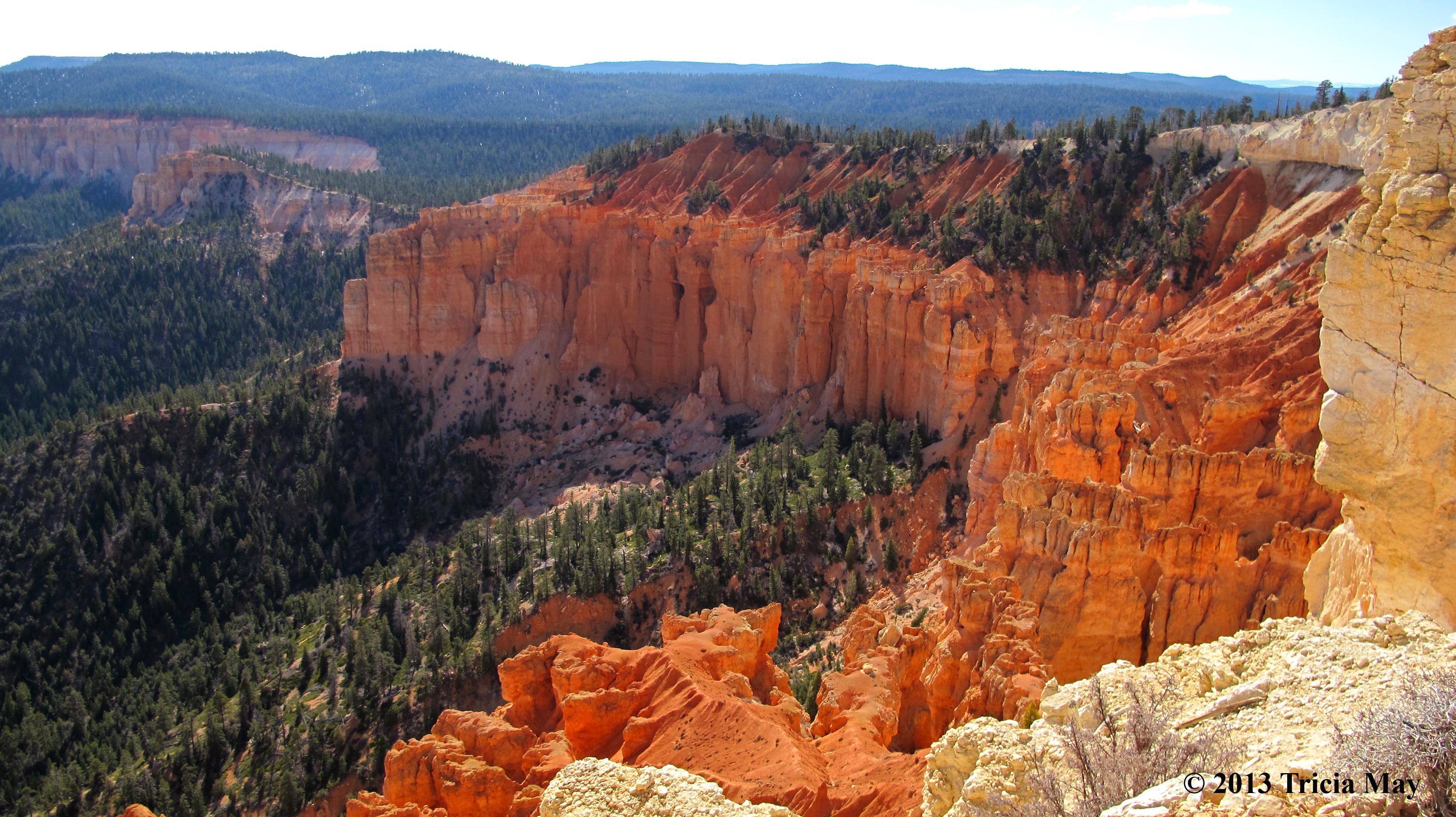
Sigh – our last day in the park. We had one last hike to complete: the Peekaboo Loop. It is described as a difficult 5.5 mile (8.9 km) hike with a cumulative elevation change of 1500 ft-1800 ft (457 m – 549 m). We started it from Bryce Point, but you can also access it from the Navajo Loop (Sunset Point) or the Queen’s Garden Loop (Sunrise Point). This is a horse trail as well, so if you come across anyone on horseback, step to the side and let them pass. They have right of way.
This trail goes up and down. A lot. Here’s the graph from the National Park Service for proof.

But doesn’t this view make it worth it?
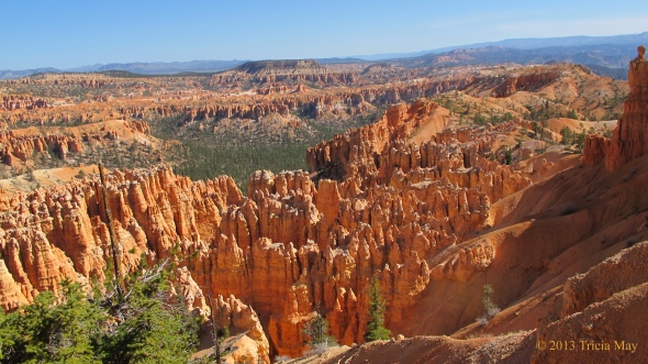
View from Bryce Point, the start of the Peekaboo Loop
It’s a mile (2.6 km) straight down when the trail starts…which means you finish the trail by going a mile straight uphill. But don’t think about that. Just think of all of the beautiful scenery you’ll encounter. This loop offers some of the best views in the park, so it’s a must see.

On the Peekaboo Loop
Once we completed the initial mile down, we had the option of going left or right. We went right. Part way down Lynda spotted a hoodoo that we immediately dubbed “the Voyageur” since that is exactly what it looked like…a man hauling a backpack full of furs from the fur trade era in Canada.

The Voyageur hoodoo
There are a lot of well known hoodoo formations on this trail, like the cathedral with its strong buttress like features

The Cathedral on the Peekaboo Loop
Or the Fairy Castle, with its beautifully delicate red spires

Fairy Castle on the Peekaboo Loop
Lynda and I came to the conclusion that this trail is named the Peekaboo because you never know what you’re going to see around each corner. Each turn had us gasping at the beauty of it. Stunning.

On the Peekaboo Trail
We knew the end of the loop was near when we came across the washrooms…yep, there were pit toilets and picnic tables on this trail. Not long past that was the junction point – time to walk that final mile back uphill. I huffed and puffed, but caught my breath on the flatter parts.

A flatter area on the final mile up
I was quickly running out of steam, but we pushed to the top before stopping for lunch. And how rewarding was this view after finishing a good hike? It was spectacular. If you want to watch the sunrise during your visit to the park, this is the best spot to see it – not Sunrise Point like the name would suggest. Don’t take it from me – this came straight from a Rangers mouth. This particular view was from Inspiration Point, but it’s just down the road, so this is basically what you’d see from Bryce Point.
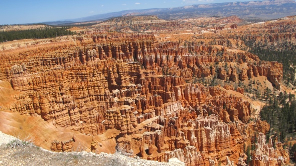
The view from Inspiration Point
This was also a very nice parting view for us since we would leave the next morning. We spent the rest of the afternoon organizing our gear, then we showered up and went for a nice dinner at the lodge, finishing up the night with a lot of star gazing.
This trip was everything I had hoped for. If you like to hike but don’t want to carry a huge backpack into the backcountry, this is a great option. Well kept trails with gorgeous scenery and not swamped with people…at least not in the spring. I hope you enjoy it as much as I did.