Something a little different….

As the name of this post implies, this one is going to be different from my regular kind of content. This past fall, I lost one of my jobs…one that I’d had for 22 years. It was sudden – as everyone was given one day warning kind of sudden. So I needed to find another source of income, and jobs in my field are scarce, and getting scarcer.
I had taken a three hour lesson a few months before on making chainmaille jewellery – you know, something fun to learn. And it was fun. I really enjoyed myself, even if I was mostly thumbs for the first couple of hours. Now, with my need to make some more income, and the extra time I had on my hands, I thought, hey…what about making some jewellery.
Well, now I’ve made a bunch of stuff and need a place to display and sell it. My intention is to set up an Etsy store, but I haven’t found the time yet, as my current job (and life) are keeping me busy. What I’ve made so far, I’ve been posting on my personal facebook page, sharing with friends. Sales have been word of mouth, but I need something a bit more permanent to direct people to. So. This post. This is going to be my gallery until I get my online store up and running.
Please note that every piece is made with anodized aluminum and has very little weight.
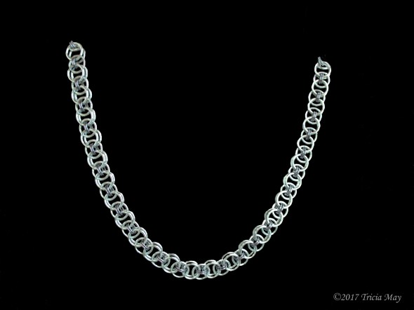
I’ll begin with the first thing I ever made. Necklaces and bracelets in a byzantine pattern. Only necklaces are shown, but bracelets are available in each colour combination as well. Lengths can easily be shortened or increased by demand.
If anyone would like to place an order, leave me a comment. Or, if you’re coming here from my personal facebook page, feel free to message me.
Thanks for looking.
**All prices are in Canadian and do not include shipping

Silver and light pink Byzantine – circumference 2 cm 16″ $35 Bracelet 8 1/4″ $20

Silver and sky blue Byzantine – circumference 2 cm 16″ $35 Bracelet 8 1/4″ $20

Silver and seafoam green Byzantine – circumference 2 cm 16″ $35 Bracelet 8 1/4″ $20

Silver and blue Byzantine – circumference 2 cm 16″ $35 Bracelet 8 1/4″ $20

Silver and red Byzantine – circumference 2 cm 16″ $35 Bracelet 8 1/4″ $20

Silver and icy black Byzantine – circumference 2 cm 16″ $35 Bracelet 8 1/4″ $20

Silver and Champagne Byzantine – circumference 2 cm 16″ $35 Bracelet 8 1/4″ $20

Champagne and pink Byzantine – circumference 2 cm 16″ $35 Bracelet 8 1/4″ $20

Silver and green Byzantine – circumference 1.5 cm 16″ $35 Bracelet 8 1/4″ $20

Silver and blue Byzantine – circumference 1.5 cm 16″ $35 Bracelet 8 1/4″ $20
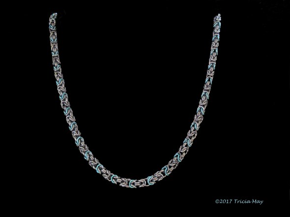
Icy black and sky blue Byzantine – circumference 1.5 cm 16″ $35 Bracelet 8 1/4″ $20

Icy black Byzantine – circumference 1.5 cm 16″ $35 Bracelet 8 1/4″ $20

Champagne and orange Byzantine – circumference 1.5 cm 16″ $35 Bracelet 8 1/4″ $20

Icy Black and red Byzantine – circumference 1.5 cm 16″ $35 Bracelet 8 1/4″ $20

Silver and light blue Byzantine – circumference 1.5 cm 16″ $35 Bracelet 8 1/4″ $20

Silver and red Byzantine – circumference 1.5 cm 16″ $35 Bracelet 8 1/4″ $20
Flower pendants are 1.5″ across and DO NOT include the chain
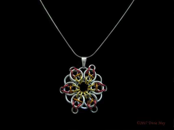
Yellow, orange, red $15

Yellow, orange, brown $15

Silver, light green, dark green $15

Silver, light blue, dark blue $15

Red, silver red $15

Red, orange, dark purple $15

Light pink, red, light purple $15

Light pink, red, orange $15

Icy black $15

Light pink, light purple, light pink $15

Light pink, red, light pink $15

Light purple, red, dark purple $15
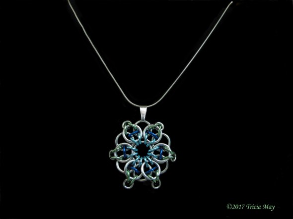
Light blue, dark blue, sea foam green $15
Rondo pendants are 1.5″ long 1.25″ across and DO NOT include the chain

Silver and Light blue $20

Silver and dark green $20

Champagne and silver $20

Silver and red $20

Silver and light green $20

Champagne and light pink $20

Silver and dark blue $20

Icy Black and red $20

Silver and light pink $20

Silver and dark purple $20

Silver and Icy Black $20
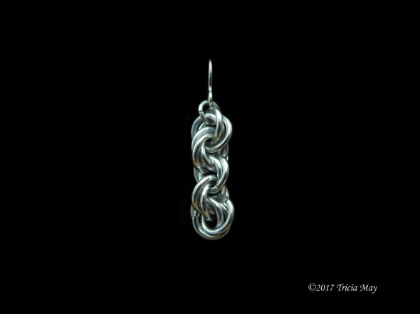
Spiral Necklaces

Silver spiral length: 21″ $30

Icy black spiral length: 21″ $30

Champagne spiral length: 21″ $30
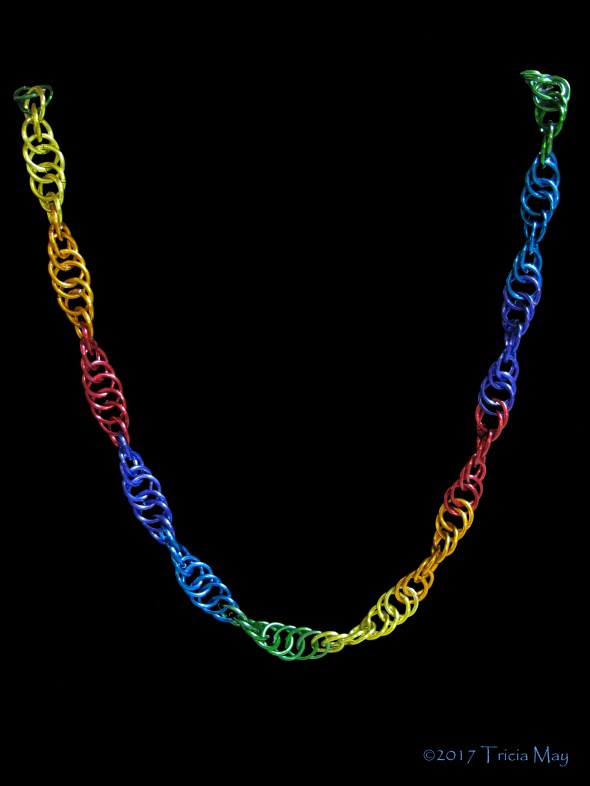
Show your pride spiral Length: 21″ $30

Asymmetrical Champagne with pink glass beads Length: 18″ Depth: 1.5″ $45

Symmetrical silver with blue glass beads Length: 18″ Depth: 2″ $45

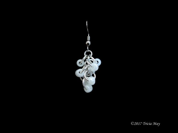
Icy Black with white pearl glass beads. Icy black Byzantine chain Length: 18.5″ Depth: 1,5″ $55

Icy Black with aqua glass beads. Icy black byzantine chain Length: 17.5″ Depth: 1 1/4″ $55

Silver with amethyst coloured beads. Silver byzantine chain Length: 17.5″ Depth: 1 1/4″ $55

Silver with blue glass beads. Silver Byzantine chain Length: 18″ Depth: 1 1/4″ $55

Silver with multifaceted green beads. Silver byzantine chain Length: 17.5″ Depth: 1 1/4″ $55

Icy Black with pearl glass beads. Icy Black byzantine chain Length: 17.5″ Depth: 1 1/4″ $55

Champagne with pink glass beads. Champagne byzantine chain Length: 17.5″ Depth: 1 1/4″ $55

Silver with jade green coloured beads. Silver byzantine chain Length: 17.5″ Depth: 1 1/4″ $55

Icy Black with white and silver coloured beads. Icy Black byzantine chain Length: 17.5″ Depth: 1 1/4″ $60

Silver with red and orange beads. Silver byzantine chain Length: 17.5″ Depth: 1 1/4″ $60

European 4-in-1 Silver and icy black with clear and silver beads Length: 19.5″ $45

European 4-in-1 Champagne and bronze with bronze beads Length: 19.5″ $45

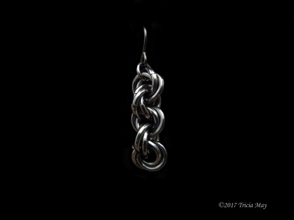
Helm – Champagne and brown Length: 19″ $40 Bracelet: 8″ $20
Helm – silver and icy black Length: 19″ $40 Bracelet: 8″ $20

Icy Black Byzantine chain with triple drop down of icy black and red Length: 18″ $80

Silver Byzantine chain with triple drop down of silver and red Length: 18″ $80
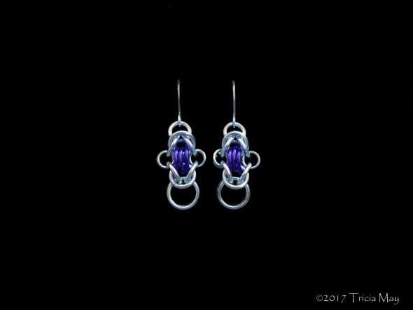
Rondo earrings in silver and dark purple Length: 1.5″ (including hook) $20

Rondo earrings in silver and icy black Length: 1.5″ (including hook) $20

Rondo earrings in silver and dark green Length: 1.5″ (including hook) $20

Rondo earrings in silver and light blue Length: 1.5″ (including hook) $20

Rondo earrings in silver and light green Length: 1.5″ (including hook) $20
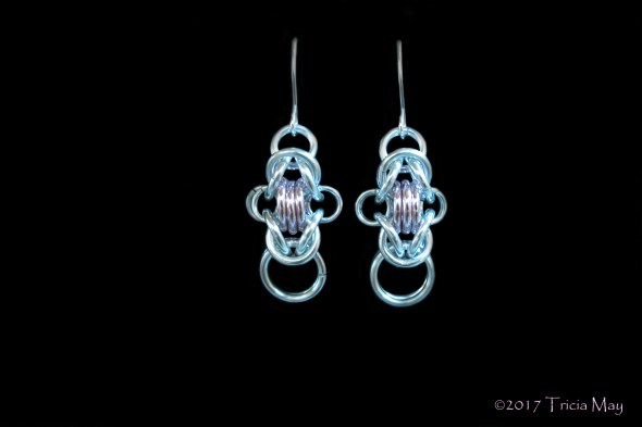
Rondo earrings in silver and light pink Length: 1.5″ (including hook) $20

Rondo earrings in icy black and red Length: 1.5″ (including hook) $20

Rondo earrings in silver and dark blue Length: 1.5″ (including hook) $20

Rondo earrings in silver and red Length: 1.5″ (including hook) $20
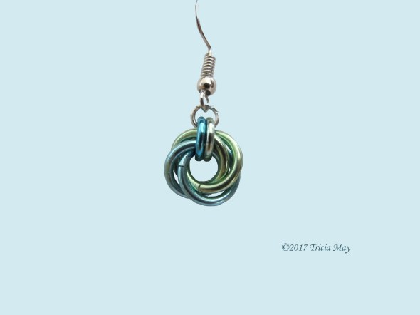
Mobius chain earrings
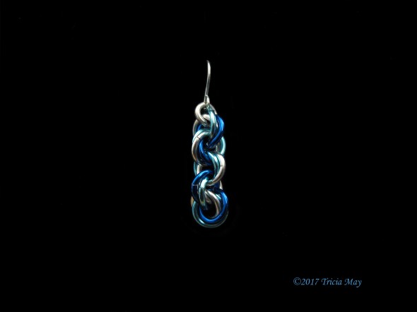
Mobius chain earrings – silver, light blue, dark blue Length: 3 cm Across: 1 cm $15

Mobius chain earrings – silver, light pink, champagne Length: 3 cm Across: 1 cm $15
Mobius chain earrings – silver Length: 3 cm Across 1 cm $15
Mobius chain earrings – Icy black Length: 3 cm Across: 1 cm $15
Mobius Earrings
Mobius earrings – light blue and sea foam green Length: 2.5 cm Across: 1 cm $15

Mobius earrings – Silver and Icy black Length: 2.5 cm Across: 1 cm $15

Mobius earrings – Silver and Sea foam green Length: 2.5 cm Across: 1 cm $15

Mobius earrings – silver Length: 2.5 cm Across: 1 cm $15

Mobius earrings – Silver and red Length: 2.5 cm Across: 1 cm $15

Mobius earrings – silver and light blue Length: 2 cm Across: 1 cm $15
Beaded earrings
Beaded earrings – light blue (clear) Length: 2.5 cm Across 1 cm $15
Beaded earrings – white Length: 2.5 cm Across 1 cm $15

Beaded earrings – light blue Length: 2 cm Across: 1 cm $15
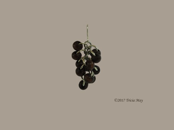
Beaded earrings – dark brown wood Length: 2.5 cm Across: 1 cm $15

Beaded earrings – dark brown Length: 2.5 cm Across 1 cm $15
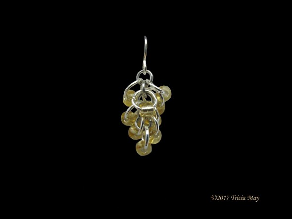
Beaded earrings – yellow Length: 2.5 cm Across: 1 cm $15
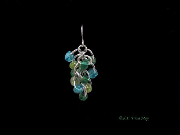
Beaded earrings – Light blue, light green, dark green Length: 2.5 cm Across 1 cm $15
Beaded earrings – Dark blue (clear) Length: 2.5 cm Across: 1 cm $15

Beaded earrings – Dark blue Length: 2.5 cm Across: 1 cm $15
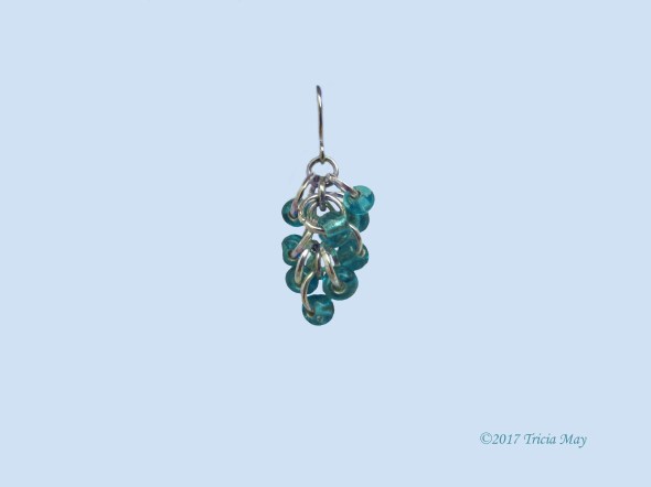
Beaded drop down earrings

Beaded drop down earrings in silver and light pink Length: 3/4″ $15
Beaded drop down earrings in silver with blue crystals Length: 3/4″ $15
Beaded drop down earrings in icy black with aqua Length: 3/4″ $15

Beaded drop down earrings in silver with light blue Length: 3/4″ $15

Beaded drop down earrings in silver and amethyst glass beads Length: 3/4″ $15

Beaded drop down earrings in silver with green crystals Length: 3/4″ $15

Beaded drop down earrings in icy black and pearl beads Length: 3/4″ $15
Crosses – Chain NOT included

Cross – Icy black and silver Length: 4 cm Across: 3.5 cm Circumference: 2.5 cm $20

Cross – Silver Length: 4 cm Across: 3.5 cm Circumference: 2.5 cm $20

Cross – Champagne and silver Length: 4 cm Across 3.5 cm Circumference: 2.5 cm $20

Cross – Light pink and silver Length: 4 cm Across: 3.5 cm Circumference: 2.5 cm $20

Cross – Light pink and Champagne Length: 4 cm Across: 3.5 cm Circumference: 2.5 cm $20

Cross – Brown and silver Length: 4 cm Across: 3.5 cm Circumference: 2.5 cm $20

Cross – Colours of the LGBTQ flag to show religious tolerance Length: 4 cm Across: 3.5 cm Circumference: 2.5 cm Price: $20

Japanese Lace bracelet – silver Length: 8″ Across 3/4″ $25
Christmas tree ornament Length: 2″ $10
Favourites of 2016
Before this blog became what it is now, it was just kind of a website where I would post some of my favourite pictures. Well, it got hacked, I lost my content, and I started from scratch.
I like that it’s become more of a photographic travel blog, but I miss posting the random stuff as well, so that’s what this post is. Some of my favourites from the past year.
This first one is from Bruce Pit, a dog walking park in Ottawa with great trails for people too.
Bruce Pit
Ice carving of a dancer…with a dripping foot, at our annual winter carnival, Winterlude.

Winterlude ice sculpture
This massive snapping turtle was ambling across the road at the entrance to Mud Lake, a wetlands conservation area near my place in Ottawa.

Snapping turtle
I have a love/hate relationships with zoos. I hate animals being in captivity, but I realize that they provide a good exposure and learning environment for people, especially kids. These are from the Toronto Zoo in the spring.

Polar bear keeping cool

Sumatran Tiger

White lion cubs
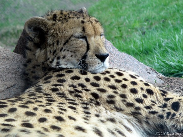
Sleeping cheetah
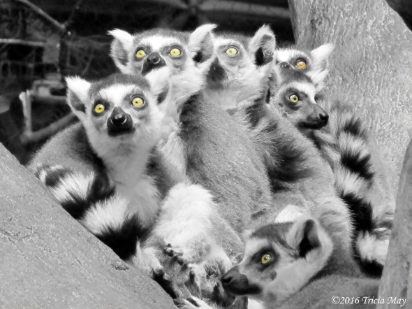
Ring-tailed lemurs
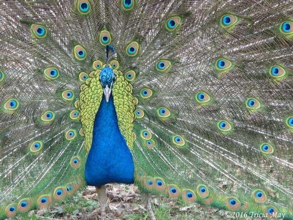
Peacock
Speaking of spring, I love the colours of new growth. Take samaras, more commonly known as ‘helicopters’, from maple trees.
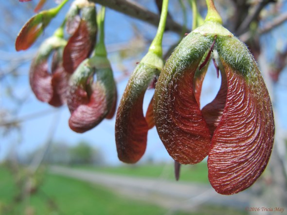
Maple seed pods, or ‘helicopters’
Ottawa is home to a huge tulip festival thanks to Princess Juliana of the Netherlands. During WWII, Ottawa sheltered the royal family, and Princess Juliana gave birth to Princess Margriet at the Ottawa Civic Hospital. By 1945 they were back in the Netherlands, and as a thanks for their stay, and for Canada’s role in their liberation, Ottawa was sent 100,000 tulip bulbs. For every year of of her reign, Queen Juliana sent thousands of bulbs to Ottawa, which were planted throughout the city. Ottawa currently plants over one million tulips every year, and that doesn’t count those planted by people in their home gardens. Normally I would take literally a hundred photos during the festival, but this year, with a combination of work and bad weather, I barely took any.

Tulip

Tulips across from the National Art Gallery
On my walk home, I often pass this stand of crab apple trees. Their blooms were impossible to resist.

Crab apple trees by Lincoln Fields transit station

Crab apple blossums

One of my favourite bike paths brings me to Shirleys Bay, yet another wetland in Ottawa’s west end.
Near the local boat launch at Shirleys Bay

Lily of the Valley
During the summer, my girlfriends and I rented a cottage on Prince Edward Island. Minutes from a provincial park, a view of the ocean from our deck, and great weather made for a wonderful vacation.
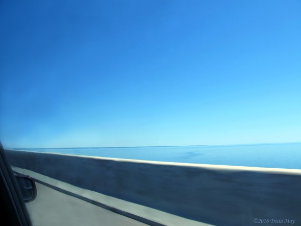
Crossing the 12.9km (8 mile) Confederation bridge from New Brunswick to PEI
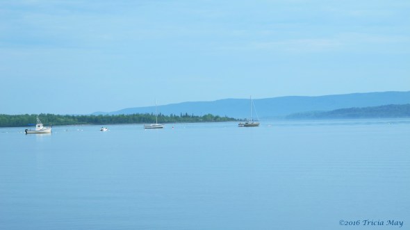
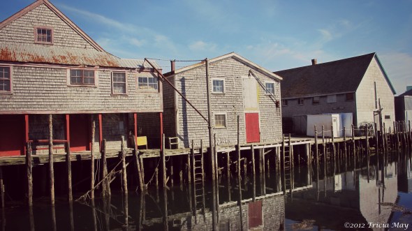
Building at Malpeque harbour

Lighthouse (under renovation) at Cabot Beach Provincial Park
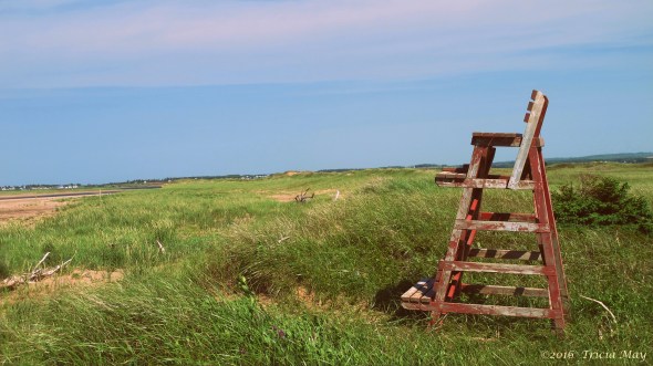
Lifeguard chair at Cabot Beach Provincial Park

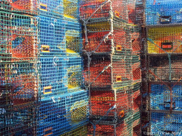
Lobster traps at Malpeque Harbour

Lobster traps at Malpeque Harbour

Crab baskets

Cabot Beach Provincial Park
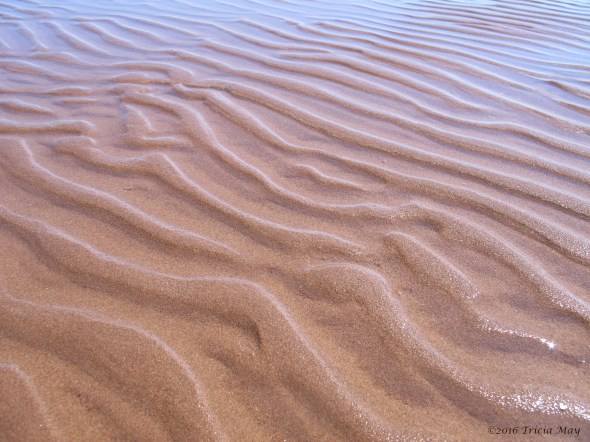
Cabot Beach Provincial Park
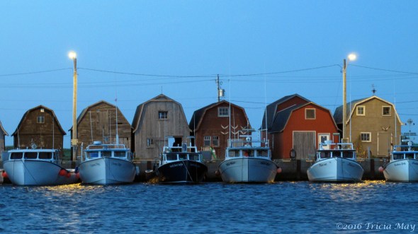
Malpeque Harbour
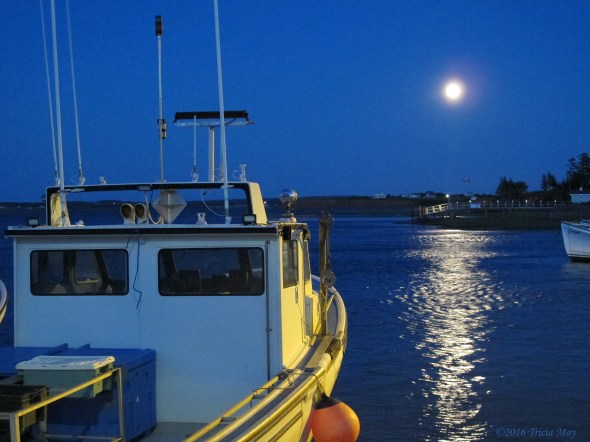
Strawberry moon on the summer solstice

Point Prim Lighthouse

Path to Basin Head Provincial Park beaches

Basin Head Provincial Park

Taken along Highway 20 from the passenger side window
Autumn…my favourite season. The colours, the sound of leaves crunching underfoot, the scent of them on the ground, the briskness in the air. Perfect.

Colourful maple tree
I love a good snowstorm. This is the view from the base of the Rideau Canal lock system in Ottawa, with the Alexandra bridge crossing the river to Gatineau.

Ottawa snow storm
Those are some of my favourites from 2016. Enjoy.
Grand Manan, New Brunswick
I don’t even know how many years we’ve been doing it, but once a year some girlfriends and I do a camping weekend. Usually we stay relatively close to home – maybe an hour to an hour and a half away, but in 2012 we decided to go further afield. Our destination was the island of Grand Manan in New Brunswick. It’s relatively small (34 km long and 18 km wide), but it’s the largest island in the Bay of Fundy. We caught the ferry to the island at Blacks Harbour and we were on our way.

View from the ferry
The trip to the island took about 1.5 hours and we spent quite a bit of time on the large observation deck…even though it was really cold with the wind whipping off the Atlantic. When we got too cold we took advantage of the on board restaurant and warmed up. Before we knew it, we were there.
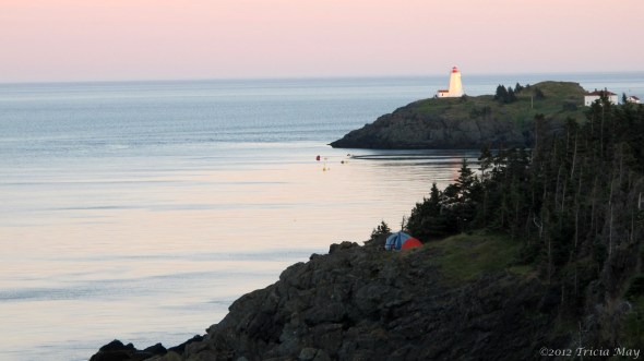
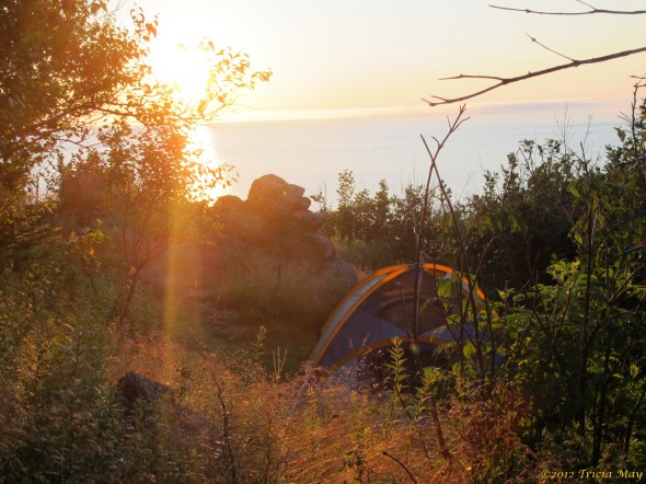
Our campsite was amazing. We stayed at the Hole In The Wall Park and Campground and had selected a cliff edge spot. We were not disappointed…it really was right on the cliffs edge, perched above the feeding route for migrating whales.

My favourite place to sit
We were there for five days and had absolutely no plans to do anything but chill and relax. With a view like this and perfect, sunny days, why would you want to do anything else? Oh, I haven’t shown you the view when you turn your head to the right….

View from our campsite
Gorgeous, right?
After setting everything up we did a bit of exploring and walked to the feature the campground is named after. The hole in the wall rock formation. I’m not sure of its height, but you probably don’t want to take the trail that leads to its surface if you’re afraid of heights.
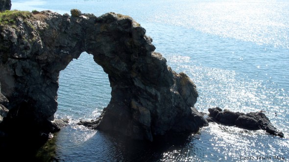
The Hole In The Wall rock formation
Now turn around and this is what you see…

By the Hole In The Wall
A quick walk and we’re back at camp, settled in to enjoy the beautiful view as the sun goes down.

Swallow Tail lighthouse at dusk
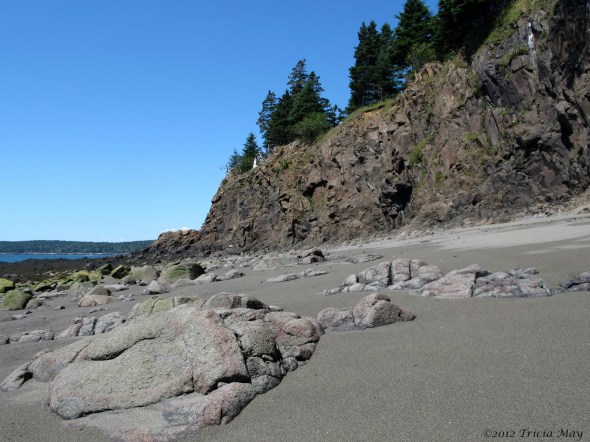
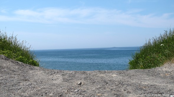
We thought we would visit a couple of the beaches/parks since it was such a nice day and decided to start with Red Point in the Seal Cove area. We read that it was an interesting place for geologists because two different geological eras were clearly visible. I thought it might be interesting because you can collect magnetic sand (with the use of a magnet) off the beach.
Red Point beach
I found my attention drawn away from the magnetic sand to these things instead. Not sure what they are exactly, so I’m calling them self inflated seaweed thingies. They were everywhere, covering every rock that had recently been submerged with the tide.

Self inflated seaweed thingies….
We then took a connecting trail to Anchorage Provincial Park where we stopped and had a picnic lunch. Not a bad place to sit and relax. Windy, but nice. If you’re interested in birding there is a bird and game sanctuary there as well.

Anchorage Provincial Park
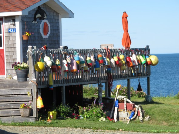
On the drive back we passed a few homes with awesome displays of colourful buoys…this one was my favourite.
Colourful buoys
Back at the campsite my friends went for a nap, so I went wandering…

Rusty wagon wheel in a field

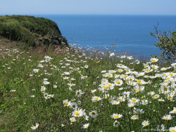
Windswept daisy
Day three turned out to be a pretty busy day, and it started earlier for me than the others. I’m a morning person (they are not) and one of the benefits is getting to see the sun rise…and what a sunrise it was.
Once the others were up and moving, we took a short drive and checked out the Swallowtail Lighthouse…the one we could see from our campsite.

Boat house with Pettes Cove in the background
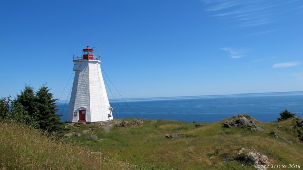
Swallowtail Lighthouse

View of our campsite from Swallowtail
We wandered around a while but couldn’t stay too long…we had an appointment to keep. We were going whale watching! Woohoo! It was a quick drive down to Seal Cove where we caught our tour boat, Day’s Catch, with Sea Watch Tours.
The wind was quite cool, but we were kept warm with hot chocolate and the excitement of seeing whales.

Whale!

Another whale!
They were putting on quite a show for us. I don’t have a zoom lens besides the one my camera came with, so in most of my shots, the whales looked tiny. But not these two…I could almost touch them they were so close. So awesome to see out in the wild!
Seal Cove
Another rosey sky as the sun goes down
After yesterday’s spectacular sunrise, my friends decided they wanted to get up and see it for themselves. We were all up at 05h30, bundled up against the chill, facing the Atlantic, waiting for the show to begin.

One of the many fishing boats heading out
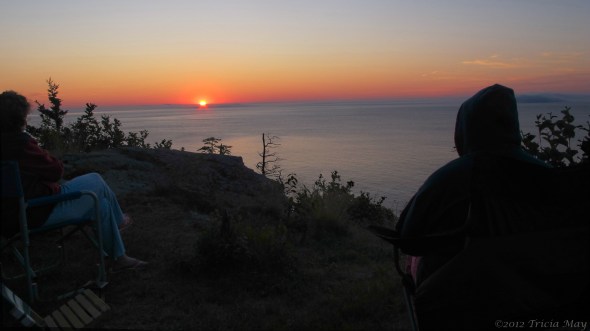
The girls watching the sunrise
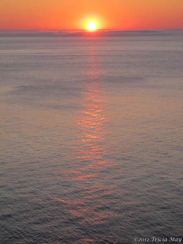
Another spectacular sunrise on the Atlantic – with a fog bank in the distance
Once my friends had their fill, they decided to go back to bed. It was still way too early for them to be up.
Our campsite at dawn
I was wide awake so I made myself a hot beverage, settled into my chair with a book and enjoyed the quiet…until the fog horn started. Wow, that thing is LOUD. With good reason. Within a few minutes I couldn’t see my hand in front of my face so I can’t imagine how unsettling it would be to be blind on a boat at sea.

Swallowtail Lighthouse getting swallowed up by fog
Yet even with all that noise, my friends somehow slept through it. Amazing.
Once they got up and had breakfast, we decided to get a better look at Anchorage Provincial Park, where we had been just a couple days before. It was warmer and less windy – perfect for wandering.
Path to the beach
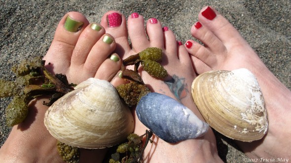
Beach feet

A walk in the mist
A short drive away was Southwest Head. My friends were tired and didn’t want to walk very far, but they were happy to wait in the car for me while I did.

Shore along the Southwest Head
Southwest Head

Rocky path

Shore along the Southwest Head
Since it was our last full day on the island, we decided to treat ourselves to a nice dinner out. When we had gone to the docks for whale watching we spotted McLaughlin’s Wharf Inn Bed and Breakfast and noticed they had a nice looking restaurant. We looked it up and the reviews were great, and luckily they took walk ins. The food and service were fantastic – I would highly recommend it.
I don’t live where fishing is a part of life, so I wanted to wander the wharf and see what I could see.

Remnants of lobster traps along a wall
Window
Traps

Rusty chains


Seal Cove


Seal Cove Harbour
That was our last full day – we’d be heading out the next morning to start our long drive back home. But that meant there was one last sunrise, and one last ferry ride.

The last sunrise of our vacation

Our campsite from the ferry
All told, it was a perfect little vacation. If you’re interested in going someplace where your main plan is to relax but maybe do a bit of stuff…this is the place for you.
Cuba

Cuba. Land of Castro, Che Guevera, revolutions, embargoes and salsa dancing. I was finally going.
Relations with the US were improving, travel restrictions were starting to lift, and who knew how long it would be until the embargoes were lifted. I wanted to see the country before any of these changes affected the island and it’s unique culture.

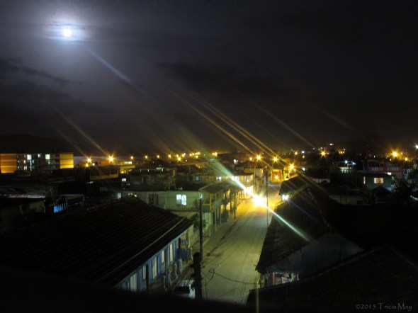
Classic Cuban taxis
I’m not an all-inclusive resort kinda gal…I wanted to eat, breathe and experience the true Cuba. And what better way than to stay with local families in casa particulars along the way. And I was going to feel the heat – I was going in July.
Due to massive flight delays, I got to Havana much, much later than I had expected. I had asked my Casa family to arrange a ride to their home and the cab driver they got me, Humberto, was fantastic! He showed me where to change my money, and while I was waiting, bought me a cold drink. That’s Cuban hospitality for you. The next bit of hospitality came only minutes later when street closures, due to pop up construction, had us going in circles, getting no closer to the casa. After a quick phone call, we were told to stop – the owner would walk to us and carry my bags to his home. I was very glad for the escort because the area had no streetlights. After a quick hello to my hosts, it was off to bed – I had things to see the next day!
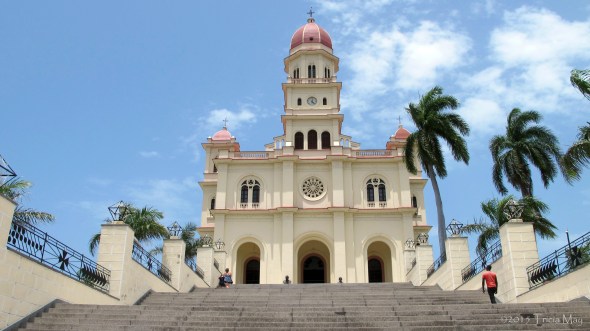
My first stop was just around the corner…the Catedral de San Cristobal de la Habana

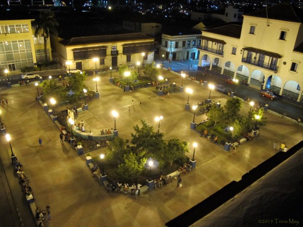
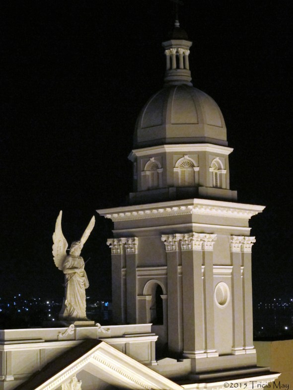
Catedral de San Cristobal de la Habana in Plaza Square, Old Havana
I was wandering around pretty early, so it was quiet , but it didn’t last long. Soon everywhere I went was full of vendors calling out their wares, be it fruit, peanuts, souvenirs or whatever. Then there’s the music. Music is everywhere. Salsa, jazz, more salsa…you can’t escape it. Good thing I like music!
Anyway, down the street, only a minute or two away, you come to Plaza de Armas, the oldest plaza in Old Havana (1519).

Ionic columns at the Palacio de los Capitanes Generales – Plaza de Armas
The square is home to the Palacio de los Capitanes Generales, once residence to 65 governors of Cuba (1781-1898), then the US governor, then the early seat of the Cuban government (1902-1920), and then Havana’s city hall (1920-1967). It is now the Havana Museum. Interesting tidbits…the structure surrounds a courtyard with a statue of Christopher Columbus by Cucchiari, and the area in front of the columns is wood instead of stone so that the sounds of carriages and horses were muffled, lessening the disturbance to the sleeping governor.
Also in the square is Parque Cespedes, a small space shaded by tall trees, featuring a white marble statue of Manuel de Cespedes. He was a revolutionary hero who started the Ten Years War, which ultimately led to Cuban independence.
My favourite part though? The book stalls that surround the square.

Book stalls that surround Plaza de Armas
Also part of the Plaza de Armas is Castillo de la Real Fuerza, the oldest of the four forts guarding the harbour. A courtyard full of cannons and mortars greets you at the entrance, and it is home to the Naval Museum. It’s also, thankfully, air conditioned.

Castillo de la Real Fuerza
By the time I got here, it was so hot, my clothes were soaked through with sweat. My umbrella was great for providing mobile shade, but nothing could help with the heat. I kept wandering. I passed through Plaza de San Francisco which has a bench statue with Chopin, made it down to the Capitol building, did a bit of shopping on Calle Obispo, and located the ETECSA (internet centre) with its line down the block and around the corner. Just a tip – most hotels sell ETECSA cards and you can often use their internet – some for a fee, but for the most part, not. At least that was my experience. Much better than waiting hours – yes, hours – in line to send an email.
I eventually made my way to the malecon, hoping there would be a breeze of some sort. Nope. But it did have great views of Castillo de los Tres Reyes Magos del Morro, one of the other forts defending the harbour.
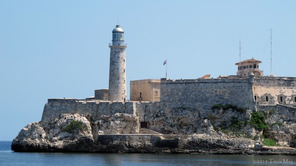
Castillo de los Tres Reyes Magos del Morro (Morro Castle)

Along the malecon

These kids have the right idea
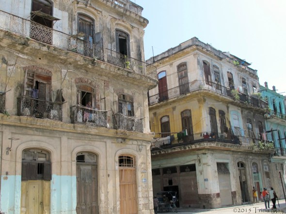
My favourite part of the day, however, was just wandering the streets. Soaking up the sounds, the smells, the look of the back streets. I like getting lost and finding my way back. You never know what you’ll get to see.

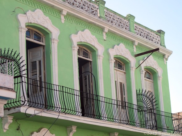
A gorgeous building in Old Havana
As a female, travelling by myself in Havana, I never felt threatened or worried. Maybe annoyed sometimes by the constant catcalling, but always safe. Seriously though, the catcalling. They don’t mean anything by it, it’s a cultural thing that’s just normal and maybe they think that we like it, that it’s a compliment. But when you’re walking on your own, or even with others, and all you hear is “Pretty lady!” “Pretty lady…ooh, you are beautiful pretty lady!” “Where you come from pretty lady?” Ooh, and the kissing sounds…it can be a little wearing. But I always felt safe…it was never threatening. Just annoying.
Old Havana
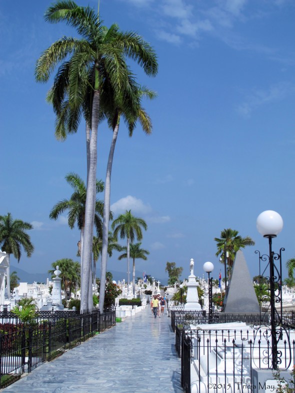
I would be coming back to Havana for a few days at the end of my trip, so one last stop outside of Old Havana was on my schedule before heading out; the Necropolis Cristobal Colon – 56 hectares of blinding white tombstones with some lovely shade trees thrown in.

Necropolis Cristobal Colon
It has monuments to former leaders, a chess champion (it has a queen on his gravestone), a spectacular memorial to a large number of firefighters that died in a 1890 fire, and some odd ones, like a section to radio and television reporters.

Grave of chess master Jose Raul Capablanca

White marble tombstones – Necropolis Cristobal Colon
I think the most touching one, however, was one I just kind of stumbled upon. It was being serenaded. There was an old man, a younger man (his son?) and a guitarist singing the song Quizas, quizas, quizas (or Perhaps, perhaps, perhaps in English). They motioned me over, but I didn’t want to intrude, although to them it wouldn’t have been intruding. It was just so touching to see and hear.
Okay – day two. A quick flight to Santiago de Cuba was in store, and it would be my base, off and on, for day trips. The terminal for domestic flights from Havana was a disorganized zoo, but I made it onto my plane…which had no air conditioning. Sitting in a tin can with no airflow on a sunny day when it’s 35C outside is one way to lose weight. The flight itself was problem free and I landed in the hottest city in the country.
My casa family was fantastic – Carmen and Jorge. They were an older couple who never had children, so everyone that stayed with them became family. I certainly felt that way. The dinner I had with them that night (Pea soup with pork, salad, a huge plate of rice and chicken with pineapple and plantain with plantain chips and homemade ice cream to finish it off) set the bar pretty high for meals. They wanted me well fed and happy. And I was.

Carmen – Casa particular ‘momma’ extraordinaire
With the flight and settling in, I didn’t have time to do much, but there was time for music. There is always time for music. I found myself on the rooftop patio of the Casa Granda, a hotel adjacent to Parque Cespedes, listening to a live band. The view wasn’t bad either.
Parque Cespedes, Santiago de Cuba
Basilica Metropolitana Santa Ifigenia
Day three was a day tripping day. I’m on a tour and we’re hitting a bunch of the local highlights. First up…Revolution Square. Every town has their version of it, but this one was quite striking. It was dedicated to Antonio Maceo – a local who rose to become second-in-command of the Cuban Army of Independence in the Ten Year War. He was wounded 24 times before being killed in a battle outside of Havana in 1896.

Plaza de la Revolucion – Monument to Antonio Maceo
Those large shards coming out of the ground symbolize the machetes they fought with and there is an eternal flame in a marble lined bowl at the base on the other side.
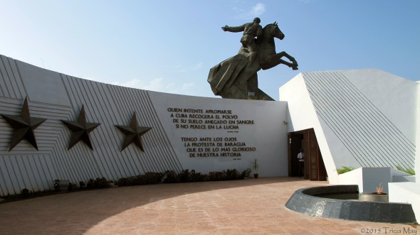
Plaza de la Revolucion – Monument to Antonio Maceo
Next on the itinerary is a school. In its previous life, Cuartel Moncada, or Moncada Barricks, was the site of an armed attack that many say was the start of the Cuban Revolution. The goal was to storm the barracks, retrieve any stored weapons, and send false messages to the army using the secure military communications equipment inside.
The battle did not go well for the revolutionaries. Many were killed, captured and then executed, or some, like Castro, apprehended and jailed. While imprisoned, Castro wrote a speech entitled “History will Absolve Me” which was smuggled out page by page. This became the manifesto for his movement.
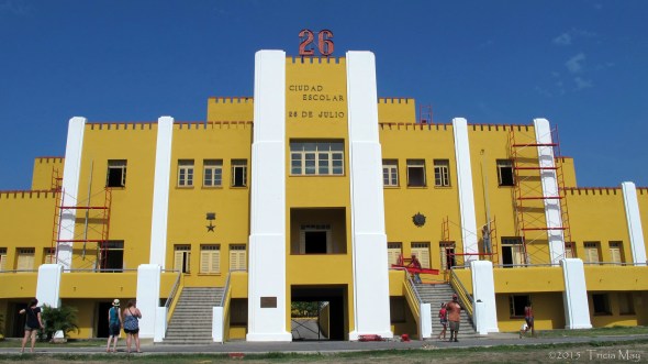
Ciudad Escolar 26 de Julio – Cuartel Moncada
These days, part of the building is a standing monument to the battle, bullet holes and all. The ones currently in the wall are not the originals…Batista quickly had those filled in. But Castro had the holes redone using photographs. This section of the building now houses the Museo Historico 26 de Julio (also known as the Museo de la Revolucion).

Bullet holes (redone) in Cuartel Moncada from the battle on July 26, 1953
Cementerio de Santa Ifigenia, final resting place to about 80% of the key figures in Cuban history, was my next destination. Make sure you wear sunglasses here…the white marble is blinding on a sunny day.
The white marble of Cementerio de Santa Ifigenia
This is a huge cemetery. It is also to be the final resting place of Fidel Castro…which is why they raised the entrance fee and added a photography fee. It is undergoing renovations to make it worthy of him, and someone’s gotta pay. What draws most people to this cemetery though is the mausoleum of Jose Marti – a Cuban national hero. He was an intellectual who also became a key strategist in the war for independence from Spain. Castro used the Marti strategies in his own fight for independence.
The mausoleum is impossible to miss. The hexagonal tower (each side representing one of each of the original six provinces of Cuba) was built atop soil from all Latin American countries.
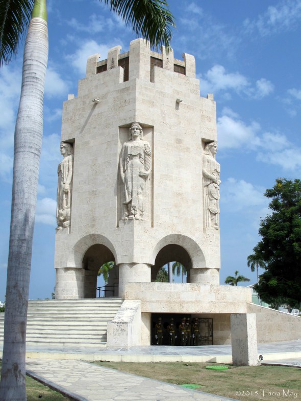
Mausoleum of Jose Marti
It is designed in such a way that during daylight hours there is always a sun beam entering the mausoleum. That was because of something that Marti wrote: “Do not bury me in darkness / to die like a traitor / I am good, and as a good man / I will die facing the sun.”

Statue of Jose Marti in his mausoleum
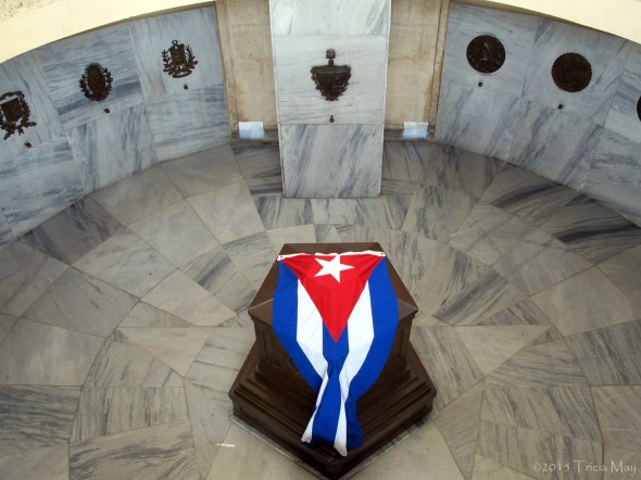
The wooden casket of Jose Marti
Even to this day he is so loved and respected that the military stands on guard 24/7, with ceremonial shift changes happening every thirty minutes.
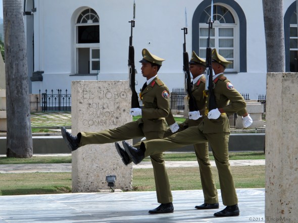
Changing of the guard at the Marti Mausoleum
It was a bit of a drive to the next spot – the Basilica de Nuestra Senora del Cobre. Cuba’s only basilica sits high on a hilltop in the village of El Cobre. Gorgeous. You can see it in the distance as you make your approach – it’s cream colour just glowing bright, popping out of the surrounding green.

Approaching the Basilica de Nuestra Senora del Cobre
Basilica de Nuestra Senora del Cobre
It was built in 1927, but there has been a hermitage occupying the site since 1608. It is a shrine to the Virgin of Charity – the patron saint of Cuba, to whom miraculous powers have been attributed. There is an entire wall full of crutches and prosthetics, left by people who prayed to her.

Crutches and prosthetics left for the Virgin of Charity
Ernest Hemingway even had a character in “The Old Man and The Sea” promise to make a pilgrimage to the Virgin de Cobre, and when he won his Nobel prize for Literature, he dedicated it to her, placing it in her shrine. There are also glass cases that display baseball jerseys, and medals from both the Olympics and Pan Am Games, left as thanks to the Virgin.

Basilica de Nuestra Senora del Cobre
One last stop before heading back to town…Castillo de San Pedro del Morro. It’s an enormous rock fortification at the entrance to Santiago Bay, about 14 km from the city. It’s also a UNESCO World Heritage site.
Approaching Castillo de San Pedro del Morro
Apparently it is the best preserved example of Spanish-American military architecture, based on Italian and Renaissance design principles. All I know is that I really liked it. The views were spectacular, and I could imagine people running around, up and down the (many) staircases and manning the cannons. You could practically smell the gun powder.
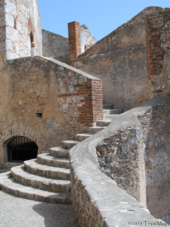
Staircase in Castillo de San Pedro del Morro

View from Castillo de San Pedro del Morro
On the way back to the casa we were redirected several times by loud, boisterous crowds which I just assumed was a protest of some sort. Nope. It was the beginning of Carnival season so the conga would just spring up. When I hear conga, I think conga line. This was no typical conga line! Carmen met my roommate and I at the door, made us dump our bags, and led us up the street a couple of blocks to reach the street behind the house. She motioned for us to stand up on the steps leading to a home and then we just stood and waited. We didn’t wait long for this massive group of people to slowly groove towards us, drums pounding a constant rhythm that just made you want to move. And that’s what this crowd did. I don’t think I can quite explain just what it looked like. Think of a crowd maybe 15-20 people across…maybe more, for about three or four kilometers, slowly kind of gyrating to the music and down the street. People on the edges grabbing you to try to drag you in (Carmen would slap their hands and give them the evilest of eyes…like she’s gonna tell their momma). Whistles blowing, people laughing and calling out. Really kind of hypnotic. It goes on for hours and only stops when the last of the people fade away. I wish I could have taken a video or photos, but Carmen made sure we didn’t take anything with us…even our pockets had to be empty. I don’t think I’ll ever experience anything like that again. Incredible.
Okay – travel day. Time to trade in the heat of Santiago for the cool(er) breezes of Baracoa…a more laid back town where the country’s chocolate is made. Sounds like my kinda town! After a quick stop at a local market to pick up some fresh snacks, we were on the road.

Getting some freshly squeezed sugar cane juice
And what a road it was. The journey took between five and six hours, depending on if you stopped for breaks to stretch your legs or eat. If you Google map it, there are three different routes listed…we took the Carr. Central de Cuba, the route that hugged the coast, the route that took La Farola.
We made one ‘sight seeing’ stop before getting to Baracoa…to Guantanamo. We could see the naval base and the surrounding area, and on the local map it’s listed as “illegally occupied by the United States.” There was a lot more security in this area than anywhere else we went to, with road side inspections included. Very desert like in this area with just scrub brush and an invasive species of plant this just sucks up all the water, killing everything else. It was a very somber stop.
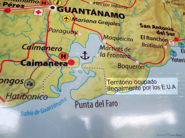
Map of Guantanamo Province with Guantanamo Bay labeled as “Illegally occupied by the United States of America.”

View of Guantanamo Bay
La Farola – a 55 kilometer road that travels over a mountain pass with so many hairpin turns that we were warned to take motion sickness drugs if we thought we needed them. Hmmmm. The views along the route were spectacular. It started out in grey granite and ended in lush growth along the Atlantic coast with scenic lookouts dispersed throughout. Just be aware that you happen to stop for photos, locals will most likely appear out of nowhere to sell you bananas, oranges or cucuruchu, a local sweet made of coconut, sugar and orange, guava or pineapple. Yum!
Along La Farola
My first impression of Baracoa when I stepped off the bus – cool. Not cool as in awesome or amazing, but temperature wise. Strong breezes right off the ocean made a huge difference, especially when compared to the landlocked sauna that was Santiago. Now, I’m not saying that it wasn’t hot, because it was still around 35 C…but with a refreshing, constant breeze.

Baracoa…can’t you feel the refreshing breeze?
My casa here was lovely. The upper floor of a home with a rooftop patio with chairs and a nice view. I spent a few hours up there after dinner, music and dancing.
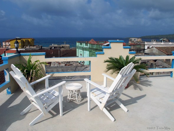
Rooftop patio at my casa in Baracoa
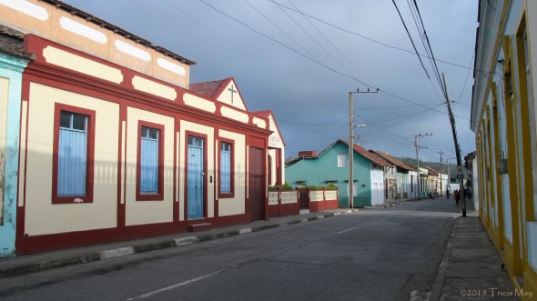
Baracoa was cleaner, brighter, felt safer, and just had a much better vibe to it than Santiago. You felt like you could go out at night without too much hassle, you know, beside the ‘normal’ stuff. It’s a small town too, kind of quaint, or antique as someone put it which is rather accurate as it is the oldest colonial city in the Americas. It’s remote, and was pretty much isolated from the rest of Cuba until La Farola was finished in the early 1960’s.
There wasn’t much to do in the actual town, but it was a great anchor for excursions. The first thing I chose to do was tour a cocoa plantation and then head to a beach. The plantation was pretty cool. It didn’t just grow cocoa – it grew tons of various fruit and the area was used more for educational purposes than crops. I did see cocoa though. Did you know that one cocoa tree produces about 100,000 flowers (each a potential fruit), but only about 1% actually turns into a fruit? Kinda disappointing, huh?

The fruit from a cocoa tree. Those globs of gelatinous goo are cocoa beans.
How someone figured out that a soft mushy bean with no real taste, covered in a white gelatinous goo could be turned into the deliciousness that is chocolate, I have no idea. But I’m glad they did.

Fresh cocoa bean
At the end of the tour they made us this fantastic traditional version of hot chocolate called chorote made with coconut milk, fresh cocoa, a bit of cornstarch to thicken it up and a dash of cinnamon. It was heaven in a cup. I attempted to make it for myself once I got home, but it tasted nothing like theirs. I’ll keep trying though.

The best hot chocolate I’ve ever had…chorote
It was a short drive to Maguana beach after that. I’m not much of a beach person, but I thought, why not? White sand, clear blue water, a gentle breeze, a hot sun and cool shady spots. Perfect. I want to mention that the main beach had a lot of hawkers trying to sell everything from jewelry to wooden carvings, and they came by frequently. So. If you want to be left alone, walk all the way over to the right, cross the rivulet of water and you are on a part of the beach they can’t go to. A little slice of heaven. Just keep track of the water level…it goes under at high tide.

Private area of Maguana Beach
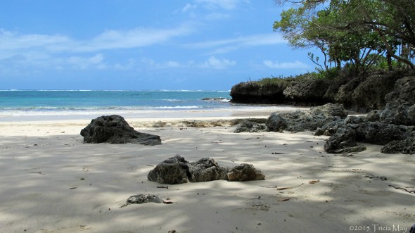
Private area of Maguana Beach
The next day, my last one in Baracoa, I had decided to hike in Alejandro Humboldt National Park – a UNESCO World Heritage Site. What makes this park so different is that a lot of the underlying rock is toxic, so it has forced the adaptation of many species, creating new ones along the way. No one knows how many, although studies are ongoing. The problem is that the vegetation is so dense and the water itself toxic to humans, that all food, water and equipment have to be hiked in, so in these temperatures, people can last only a few days at a time.

Parque Nacional Alejandro de Humboldt
This hike was just what I needed…getting out in nature and just smelling that green smell. The smell of trees and dirt and sun and growing things. With a tinge of mango in the air. The first part of the trail cut through all these mango trees…and they were all ripe and falling like missiles around us. I was literally walking with my arms above my head to fend them off.

Heavily laden mango tree in Parque Nacional Alejandro de Humboldt
If they didn’t split completely when they hit the ground (or us) we could pick them up and have a snack. Even the horses we saw along the way were eating them off the ground. It was also hard not to slip in them…splattered ripe mangos are like ice!

Mangos that fell down around our heads
Other parts of the trail were slippery as well, but that was due to the rain we had before we arrived at the park and the fact that the ground was clay. Going down a hill, no matter the degree of the slope, when the terrain is wet clay it’s hairy. I swear I almost dislocated a shoulder a few times by grabbing at trees as I felt myself going down. I never fell the entire way, but it was a close thing.

Hiking in clay and loose rock

I have no idea what type of tree this is, but the needles are wicked sharp

Coconut tree in Parque Nacional Alejandro Humboldt
One cool part of this trip was when we reached a wide area of water that we needed to cross. A man was there with his cart, watering his oxen. He came over and offered us a ride so we wouldn’t get our feet wet so we piled in…and held on because that thing was rocking all over the place. He kept going when we reached dry land and we really picked up some speed until one person got too nervous to continue and made him stop. I tipped him a bit as a thanks.
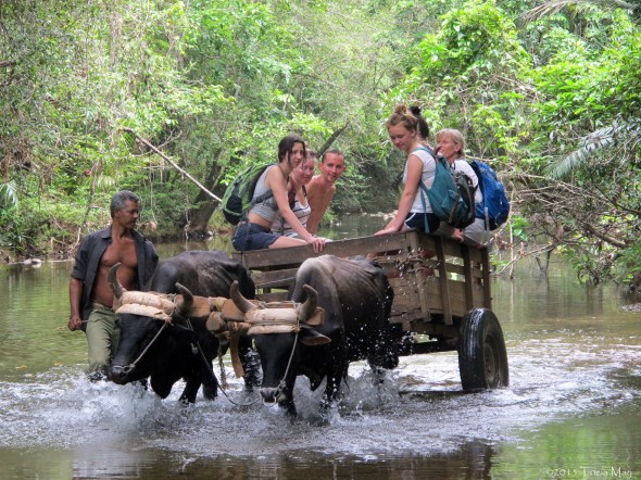
Ox cart ride in Parque Nacional Alejandro de Humboldt
Baracoa at night
Early the next morning, before I left, I went to the church in the main square as soon as it opened because I wanted to see the “Cruz de la Parra”. It’s a meter high wooden cross that was supposedly left by Christopher Columbus at the harbour entrance in 1492. It has been carbon dated, and is about 500 years old, so who knows. Over time it has unfortunately lost quite a bit of its length as people took parts of it, but it is now out of reach.

“Cruz de la Parra” at Catedral Nuestra Senora de la Asuncion
I just think its so cool that I was only a few feet from something that was once in the possession of Columbus. I know that I’d been in towns that he established, but this was different. Really tangible. It was only then that the age of the town I was standing in hit me. This town was more or less cut off from the rest of its country for four hundred years. My country will only be celebrating is 150th birthday next year. Wow.
I had a bit of time left before I departed so I wandered around a bit – something I hadn’t really had time to do, unfortunately.
Baracoa streets, early in the morning

Baracoa
I was now headed towards Camaguey, but it was too long for one day, so there was another stop in Santiago. I took advantage of the little time I had left there to tour a rum museum and not much else.
The next day was another long travel day with a couple of stops thrown in, with the first being Bayamo. Bayamo was the second settlement in Cuba and the setting for quite a few historic events during the War of Independence from Spain. When Spain’s Queen Isabella was dethroned in a coup, the elite of Bayamo rose up in revolt and that kicked off the Ten Years War. Against the rules, they played a martial song in the parochial church which eventually became the Cuban national anthem.
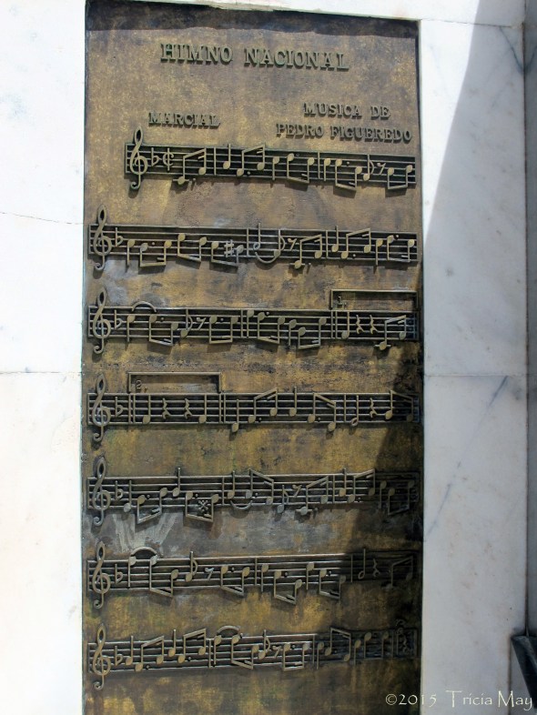
Cuban national anthem
In October of 1867, with a small band of 150 men, Carlos Manuel de Cespedes seized Bayamo from Spanish forces. But the Spanish were back two years later, and instead of handing it over to them, the people of Bayamo chose to burn their city down, leaving only the center of the city remaining as it was. And a very pretty area it is. The church where they played the anthem is still there, shining bright in it’s newly restored form. There wasn’t much time to look around since we were only there for about a half hour, but it felt quite mellow.

Iglesia Parroquial del Santisima Salvador, Bayamo
Iglesia Parroquial del Santisima Salvador, Bayamo

Museo Provincial (bright yellow) and home of Cespedes (pink), Bayamo
Back on the bus, you could just see the landscape changing. So far on this trip we hadn’t seen any cows – no beef on the menus, just pork. But now we were passing fields with grazing cattle. And I mean really large fields….as far as the eye could see. Every now and then we’d drive past huge swaths of sugar cane, but there was definitely a change in the animals we were seeing.
One thing I haven’t mentioned before now are the roads of Cuba and how you must have NO FEAR behind the wheel because it’s a constant game of chicken. I’m not kidding. If you’re driving along and the other side of the road is in better condition, you just swing your vehicle over until oncoming traffic is really close and then you switch back to your lane. Until you can move back over. And you also have to take into account all of the horses and carts and mules and bikes and whatnot that are also sharing the road. It can get quite hairy, so most of the time I just chose not to pay attention and trust our driver. Trust the driver…he does this for a living……trust the driver….
Camaguey. The third largest city in Cuba is also known as the “city of squares” because there are so many. I think it should be called the city of churches because it has fifteen of them.

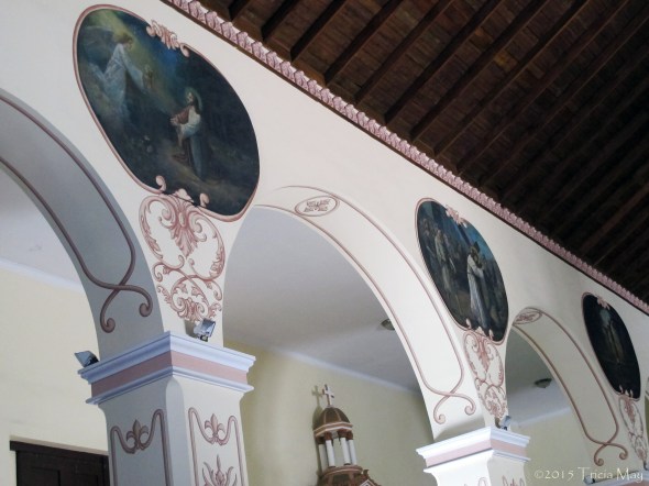
Catedral Nuestra Senora de la Merced, Camaguey

Interior of Catedral Nuestra Senora de la Merced
Given it’s size, the city didn’t feel that big. It felt kind of small and quaint, but that may be partly because of it’s maze like layout. Seriously…it could get confusing, but at least I wasn’t looking for anything specific. I just wandered around with no real plan and enjoyed the architecture, colours, and general feel of the place.

Camaguey
Camaguey

Taxi waiting for a fare, Camaguey
When the night with its cooler air arrived, everyone came out to play and socialize. Not kidding…kids were easily out until midnight with their families, playing in the squares. The later it got, the more people were out. I’d seen this everywhere in Cuba, but never more so than in Camaguey.
One kind of unique thing about this city…they used to constantly suffer from water shortages so these giant earthenware containers (up to 2.5 meters tall and 1.5 meters wide) were made to collect rain water. Placed under the gutters, they were partially buried to keep them cool, but the size and the quantity of how many you owned became status symbols. They represented your wealth. There are still some scattered around the town.
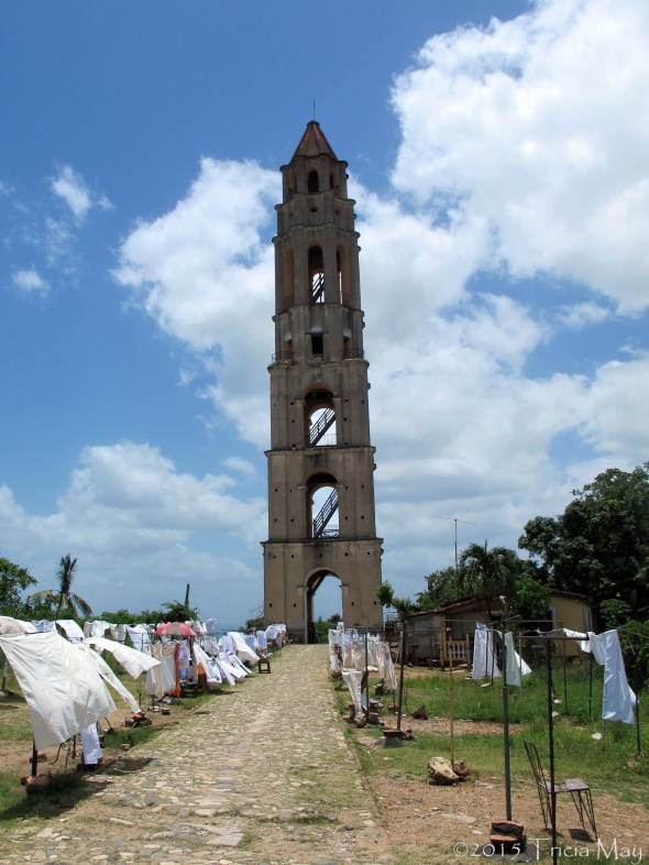
Iznaga tower
I climbed up it…after paying a fee…to take in the view. Lovely rolling fields of green for as far as the eye can see with mountains in the distance. The stairs were very steep and very narrow, and while I had no issues with that, I saw others that did. Not everyone made it to the top.

View from Iznaga Tower

Dominoes in the street

Canchanchara
After letting the food settle for a bit, it was off to the Casa de la Musica – an outdoor venue by the Plaza Mayor. There was an area with tables in front of the stage, but the majority of people sat on the rows of concrete steps that led up the side of a hill. This place could, and did, hold hundreds every night. The bands were always amazing, and changed about every hour or so. The bottom area was filled with people dancing (with different degrees of rhythm), but everyone was having fun.
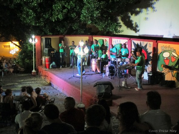
Casa de la Musica
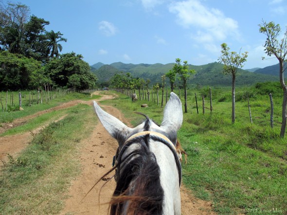
My first full day was a day of horseback riding in the Gran Parque Natural Topes de Collantes, part of the valley of sugar mills I mentioned earlier. From what I gathered beforehand, it would be a three hour trip. What I didn’t catch, was that it would be three hours each way, making for a total of six hours on a horse. For a person who can’t remember the last time she rode one.
Where I start my horseback riding day
Anyway, the scenery was gorgeous and we had a few stops along the way such as an old sugar cane plantation where we could sample sugar cane juice. Where we stopped to rest the horses there was a guy with coffee beans. He proceeded to manually grind (pound) the beans with a huge mortar and pestle contraption and make us coffee however strong we wanted it. Stir with a piece of sugar cane and drink. The last stop was at a waterfall, but I hadn’t been told about this part, so I had no swimwear… but everyone else in the group did. Oh well.
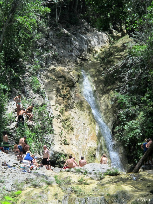
Waterfall in Gran Parque Natural Topes de Collantes
I don’t have many photos from the horseback riding because inexplicably all three of the camera batteries I had with me died quick deaths. I may have been the heat because it was bloody hot and they were almost in direct sun with just a thin bit of cloth protecting them. I hate that though…I would have taken soooo many pictures because it was just so pretty!
My view from Carmaletta’s back
After saying adios to my horse I had a bit of time to walk around, get lost, and then find my way back for salsa lessons and supper. I had taken Cuban street salsa a few years back and hoped that I hadn’t lost it all. I knew I could still do the basic stuff since I’d been dancing since I got to Cuba, but anything more than that was a toss up. One of the instructors saw that I had some experience and showed me some more advanced moves. Wheeee…just zipping around the dance floor, twirling, spinning, giving the hand flourishes….So. Much. Fun.
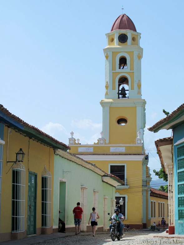
Convento de San Francisco de Asis, Trinidad

The quiet streets of Trinidad

Ruins of Iglesia de Santa Ana – Trinidad
The next day was a short hike in Parque el Cubano that reminded me so strongly of home. The smell of the green, the rise of the hills, the sound of cicadas….What didn’t seen like home was the large wall of wasp nests. Hundreds, if not thousands of them. Lets just say I used my zoom lens to take a photo of that. You could tell by the colour of them that they weren’t home, but I wasn’t going to take any chances.
Hiking in Parque el Cubano
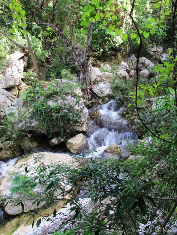
At the end of the trail was a lovely waterfall with a convenient perch to jump into the water from above.
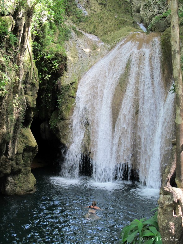
Waterfall in Parque el Cubano
I stuck to the shallow end which I was fine with. Just the cooling off felt nice. After about an hour the area got too full of people for me so there was the short hike back and then another quick jaunt to a beach. I’m not really a beach person, but I did want to put my feet in the Caribbean. It was much warmer than I thought it would be.

Warm Caribbean waters

Underground club (literally) – Disco Ayala

Palacio de Valle – Cienfuegos

Pedestrian mall in Cienfuegos
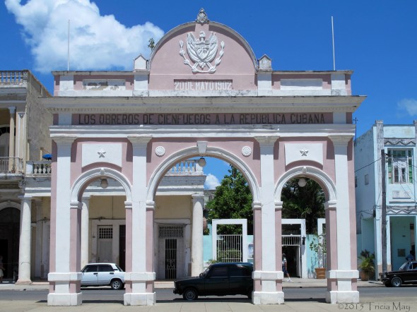
Triumphal arch in Cienfuegos

Monument to Che Guevera

Monument to Che Guevera
Under the monument was the Che museum which gave a detailed account of his history from childhood to the capture of Santa Clara in 1958. Che’s remains, found in Bolivia, were laid to rest in an adjacent mausoleum in 1997 and there was empty space for the 37 other guerrillas who lost their lives in their last campaign. It was a beautiful tribute. Very solemn.

Site of the train derailment in Santa Clara

Lluvia de Oro on Obispo

Old cannon balls in Old Havana

Mural of Che Guevara in Old Havana

By El Capitolio

Cars on Paseo de Marti

Along the malecon…love those classic cars

Not so official looking no parking sign

Hemingways typewriter
After a nice dinner out, it was back to my casa so I could pack up and get ready to leave for 0500 the next morning. Humberto, my taxi driver when I arrived, would be picking me up.
First Time in New York
A few months back a friend gave me insanely cool news…that she and the choir she sings with, would be performing at the Lincoln Center for International Women’s Day. Say what?! There was no way I was going to miss seeing her up on that stage, so a trip to NY was now in the works. The concert was scheduled for Monday, March 10 so I thought I would go down for the weekend and play tourist with my friend’s husband while she was in rehearsals. They would be driving down from Toronto on the Friday while I would be flying in that same morning, so I had most of the day to myself. After dropping my bag off at my hostel, I set out on my own, heading towards Bryant Park and the New York Public Library.

Carousel in Bryant Park
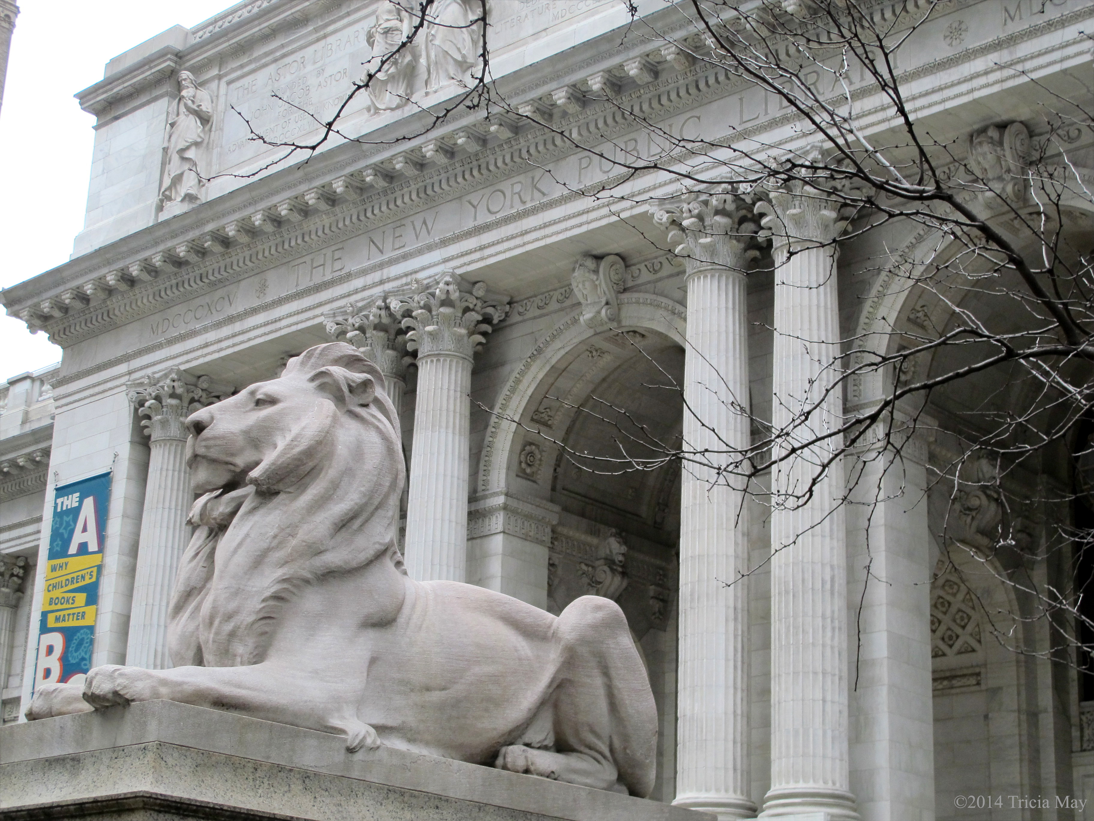
Fortitude the lion, New York Public Library
I wasn’t sure what to expect from the library…I was just told that if I ever got to New York that I had to go inside. I love books, so hey, why not. I was not expecting this:

New York Public Library
Or this:
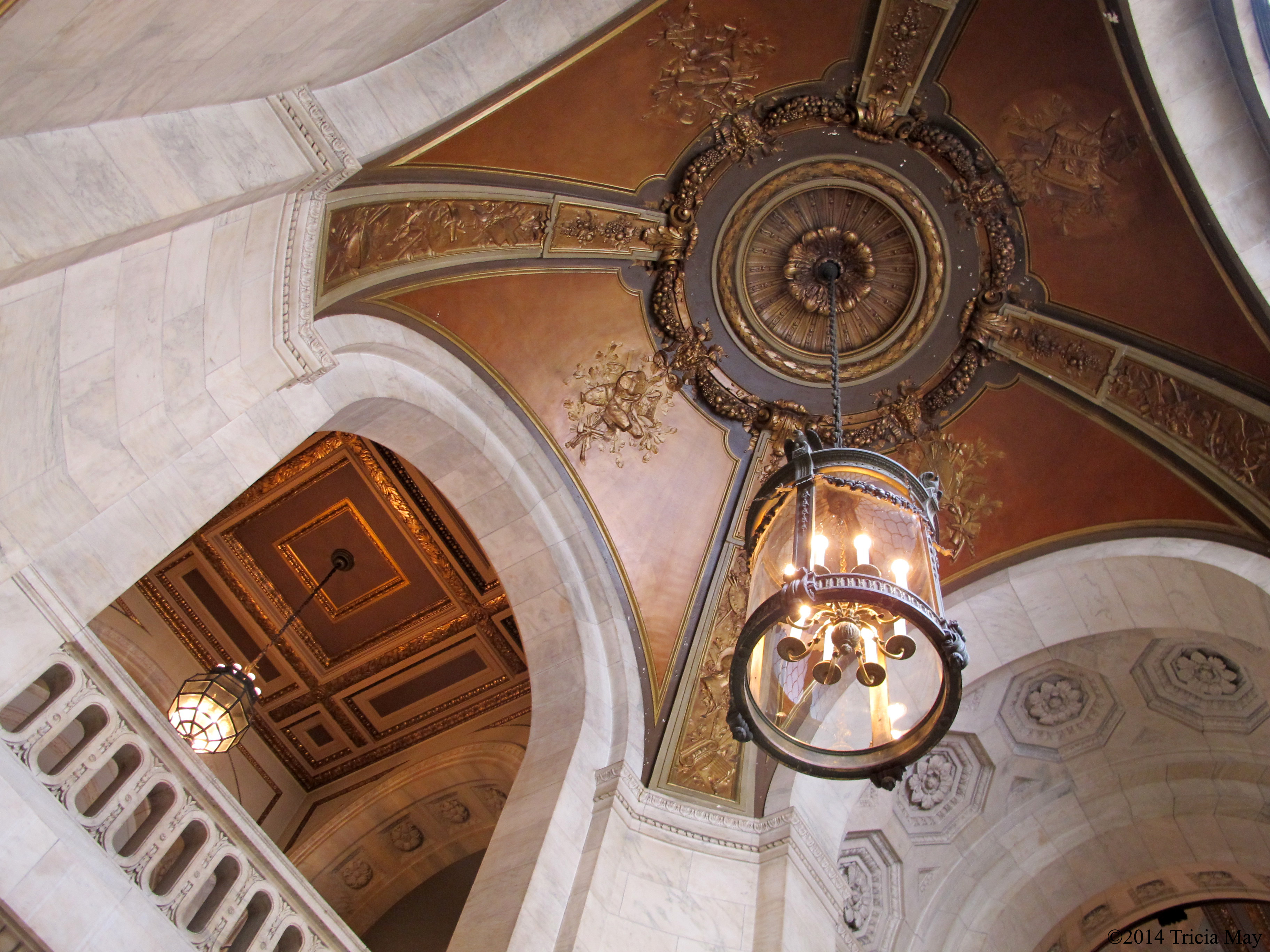
New York Public Library ceiling
We sure don’t have libraries that look like this where I come from! What an environment to just sit and be quiet in. To read a book, a newspaper, to study, to surf the internet….so calming and peaceful, especially considering the constant bustle of the city just outside the doors. I could have stayed there for quite some time, but there were so many things I wanted to see and such a short amount of time to do so.
From there, the rest of my day was spent walking. Walking, walking and more walking. I went into Grand Central Station ( I never knew there were so many shops in there),

- Grand Central Station

and then just started walking south. I turned around not long after the iconic Flatiron Building. What a beauty.

The Flatiron Building
I took a gazzilion photos of it…it’s just so iconic and such a beautiful piece of architecture.

The Flatiron Building
And how could I resist photographing Macy’s. It’s a store that I’ve never been in, but one that I’ve heard about and seen so many times….I still didn’t go in though. I thought I would have more time later to check it out, but I never did.

Macy’s and the Empire State Building
I headed back uptown to my hostel in order to meet my friends for dinner and afterwards took a little walk to Rockefeller Center.

Atlas with Rockefeller Center
And look at the place all lit up…

Rockefeller Center at night
And it wouldn’t be a proper visit to the Big Apple without at least checking out this sign…

Late Night with David Letterman sign
After a good nights sleep I was up for some exploration. My friend had rehearsals all day so her husband and I went off on our own, starting with a bus tour to get a better sense of what we wanted to see. Along the way we learned some interesting tidbits, like the owner of Macy’s died on the Titanic, the Chrysler building was the worlds tallest building…but only for eleven months, and that Wall Street had an actual wall that separated the Dutch and American settlers that the British eventually tore down.
On the bus I also caught my first glimpse of the Brooklyn bridge…

Brooklyn Bridge from a bus tour
We decided to get off at Central Park and just started to wander while eating lunch from a food truck. It didn’t take us long to see some fantastic sites.

Skating in Central Park
While I wish it was warmer out, it was still nice to see people skating, because how classic is this? Or this? I don’t know how many times I’ve seen this bridge in tv shows and movies, so it was cool to see it in person.

Gapstow Bridge in Central Park
I could walk around this park for hours, but of course there were other things to see, so we turned ourselves into the direction we wanted to go and found ourselves on the Mall where we encountered this busker…the bubble man.

Busker in Central Park
Pretty impressive – and funny when they would pop and the kids would kind of squeal as they got sprayed by the soap. We finally made it to our destination for the day – the Metropolitan Museum of Art. I have always loved Egyptian art, so this was going to be so interesting for me. What a collection!

Statue of Kaipunesut
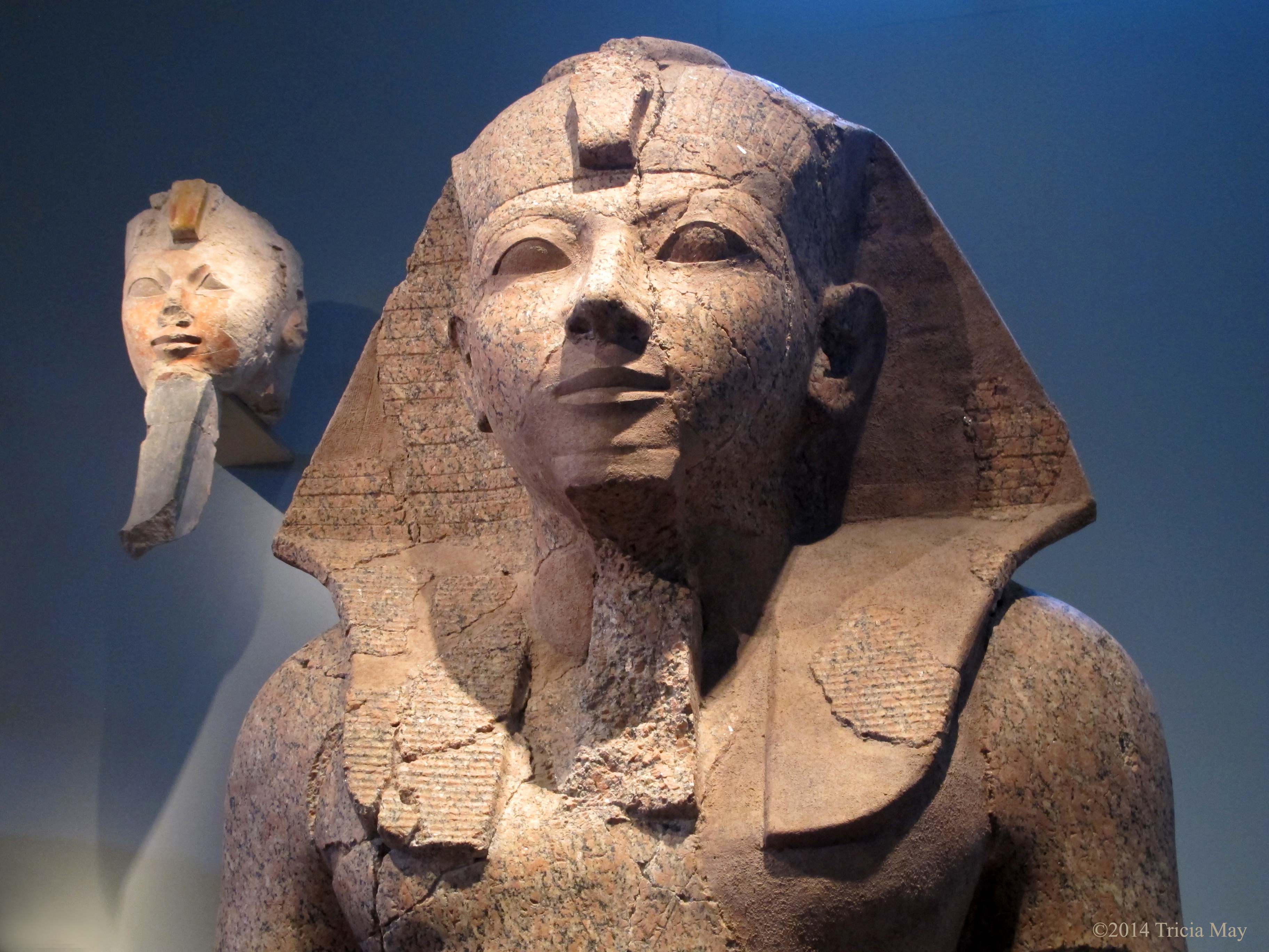
Large Kneeling Statue of Hatshepsut

Offering Bearer – Dynasty 12

Coffin and Mummy of Khnumhotpe

Temple of Dendur Reflection
I could fill this post up just with information and pictures from the exhibit, but that’s not what you’re here for. After leaving the Egyptian exhibit, we went into an atrium area with some gorgeous pieces, like these:
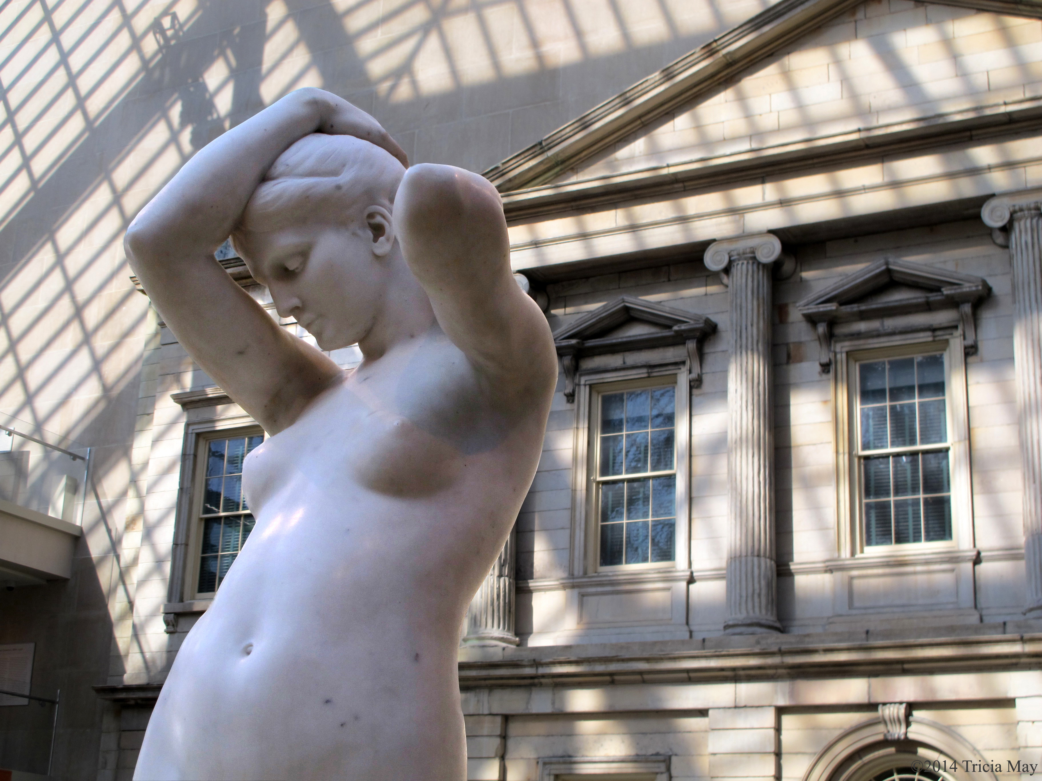
Evening by Frederick Wellington Ruckstull

Diana – smaller cast of the one on Madison Square Garden
We also checked out the Modern Art gallery, the Impressionists and a display about Papua New Guinea. Now that had some interesting cultural pieces the like I had never seen, like body masks.

Body Mask from Papua New Guinea
By this point I was getting pretty sore of foot and a little museumed out, so we took off and went back to the hotel. Rejoined with my friend, it was time for dinner and then a visit to the Top Of The Rock for some night time vistas of New York from above.
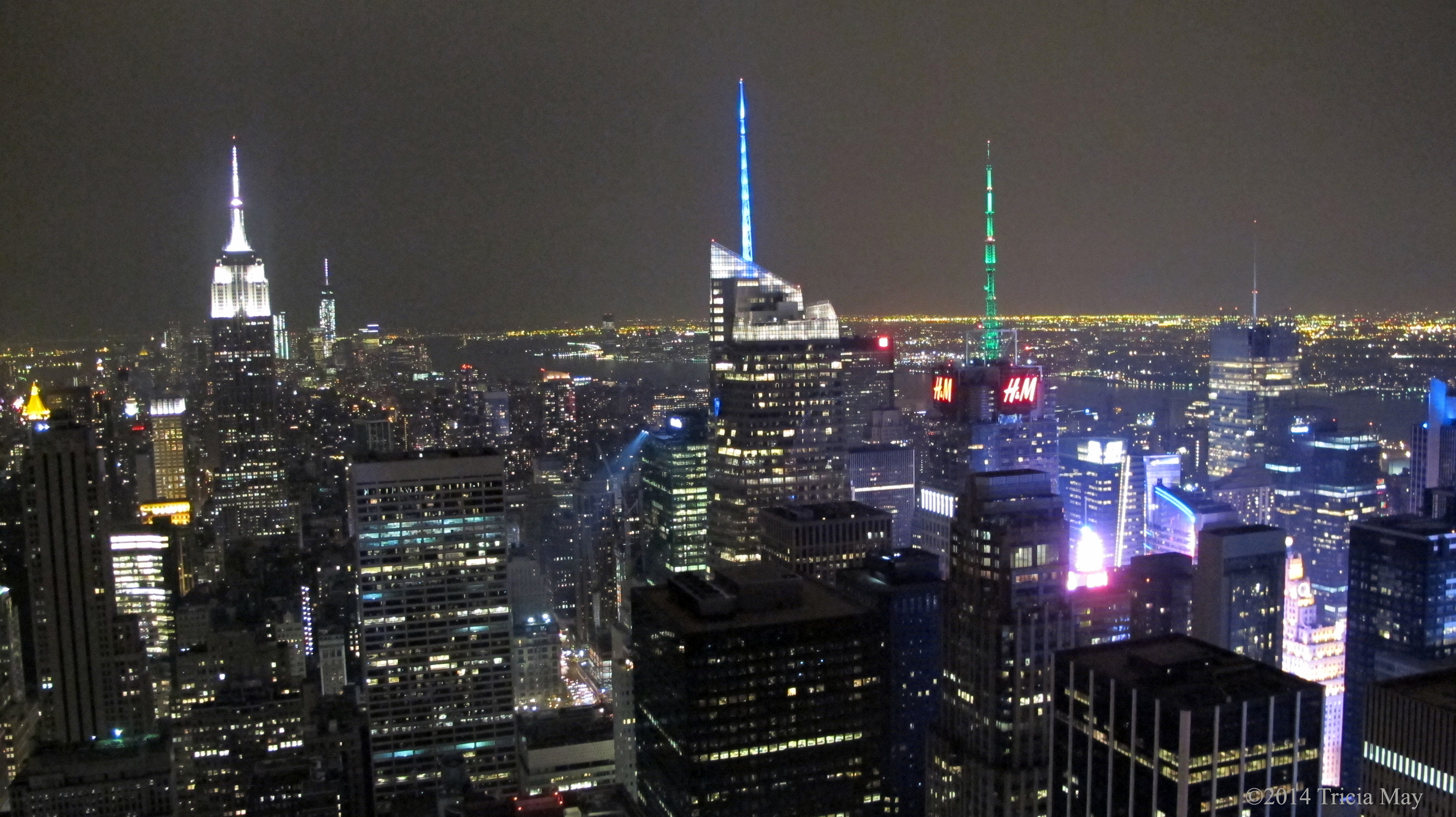
View from Top of the Rock
Day three…what a jam packed day this turned out to be. With my friend still in rehearsals, it was another day of playing tourist with her husband. First up was a walk to the Intrepid Air, Sea and Space Museum at Pier 86 at W 46th Street in the Hell’s Kitchen area. The museum is a retired USS aircraft carrier which also showcases the submarine USS Growler, a Concorde SST, a Lockheed A-12 supersonic reconnaissance plane, and the Space Shuttle Enterprise. As an engineer who’s job is to work on planes, my friends husband was kind of in heaven.
We checked out the submarine first – I can’t imagine living and working in such close quarters.

USS Growler at dock

The hatches are not meant for large men
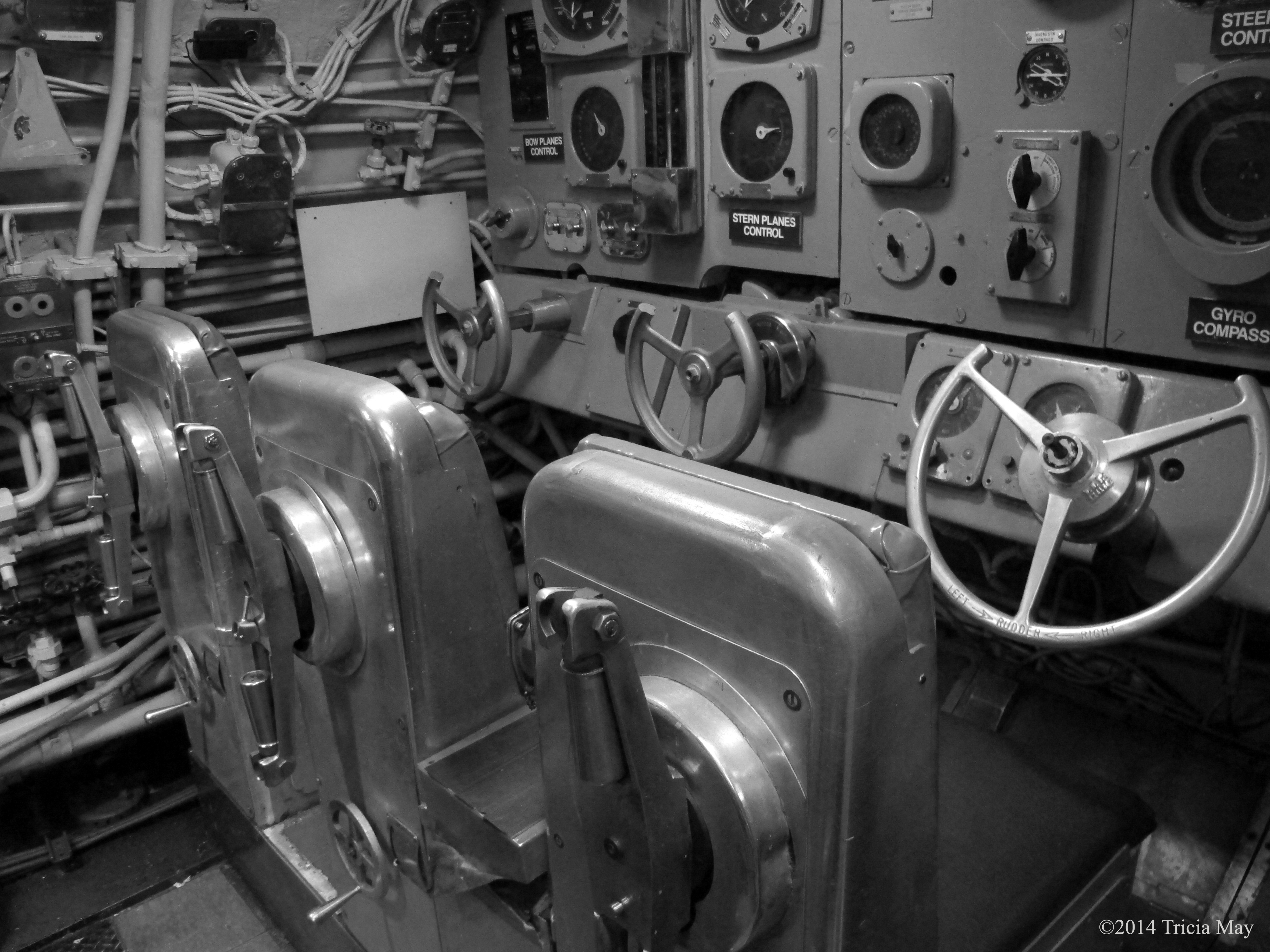
Control room of the USS Growler
Next up was the carrier and its flight deck. There are many planes tucked inside, as well as on display outside. There are volunteers on site to answer any questions you may have, and my friends husband had some pretty good technical chats with them as I wandered around. A bit of a crowd was actually gathering around them because they were really talking about how the planes reacted in different situations…angles and airflow and stuff that I had no understanding of. He was having a great time.
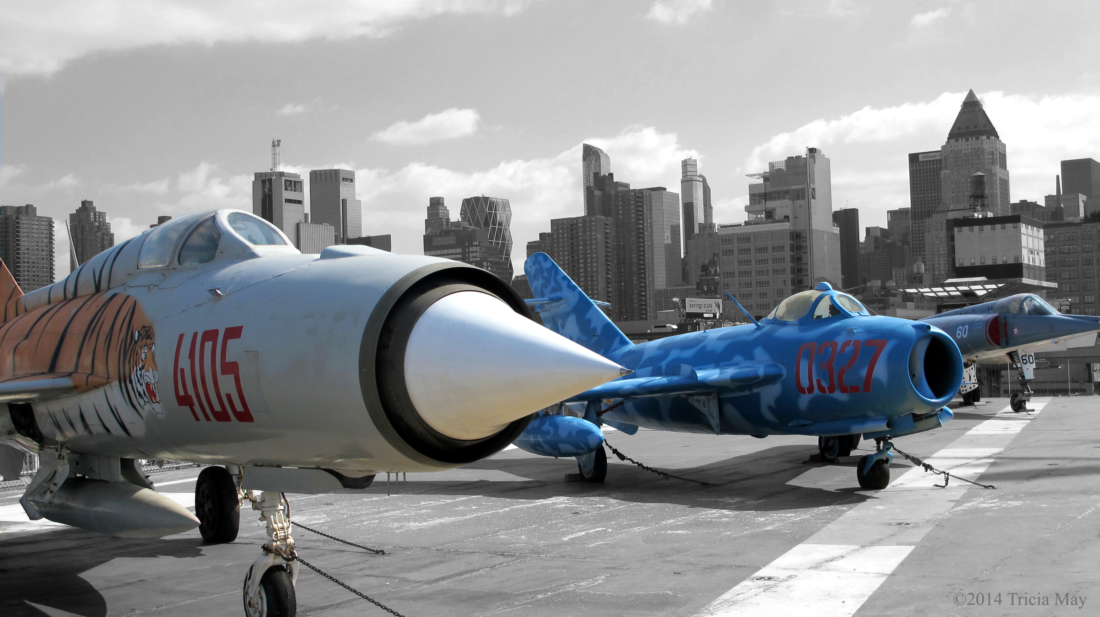
Mikoyan Gurevich MiG-21 PFM and MiG-17 on the USS Intrepid
We spent a little bit more to have access to the Space Shuttle Enterprise…but who wouldn’t? It’s a freaking space shuttle! It makes no difference to me that it never made it into space – it’s a space shuttle! My friends husband pretty much felt the same way. We both just kind of stood there looking at in wonder when we first saw it.

Space Shuttle Enterprise on the USS Intrepid
We would have liked to have toured the Concorde that was outside, but it was closed. I find it sad that the main purpose for this majestic piece of machinery is to now provide shade for picnic tables.
Anyway, we left the ship to head further down the pier in order to catch a water taxi to Brooklyn…we wanted to walk across the bridge. It was a pretty breezy day, but the walk was nice.

Brooklyn Bridge across the Hudson

Crossing the Brooklyn Bridge
Our plan had been to cross the bridge and walk down to the water taxi stop by Wall Street, but those plans were thwarted by a huge demonstration – we couldn’t get anywhere near it. Turns out 50,000 ultra-Orthodox Jews took to the streets, taking over ten blocks of Manhattan, to protest the Israeli army plan to draft their orders young members into the military. To get where we wanted to go, we had to basically walk to the other side of the island to Battery Park and catch a water taxi from there. We had time to look around while we waited, and we came across the Merchant Marine Memorial.

American Merchant Mariners Memorial at Battery Park
When the water taxi arrived I was half frozen – the wind was very cold and strong, so I happily climbed inside. Going back to Manhattan this way you get a fantastic view of the skyline.
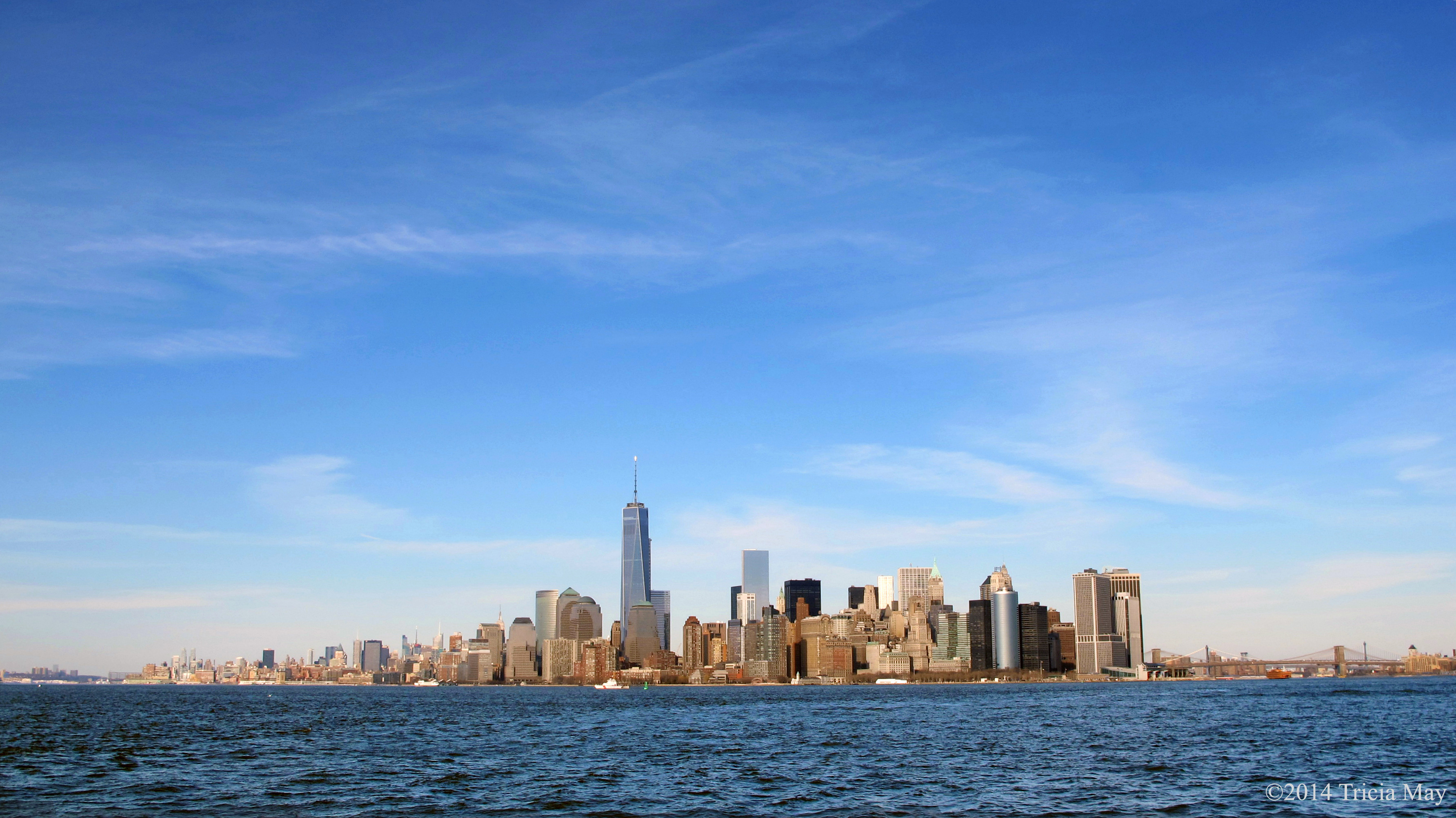
New York skyline from water taxi
As we approached the Statue of Liberty, the captain very kindly slowed down…almost stopped, to allow everyone to get all the photos we wanted.

Statue of Liberty
We got off after that, and we looked up and judged by the sky that we could make it to the Empire State Building for sunset, so off we went. We got up in plenty of time, and man, was it worth it.
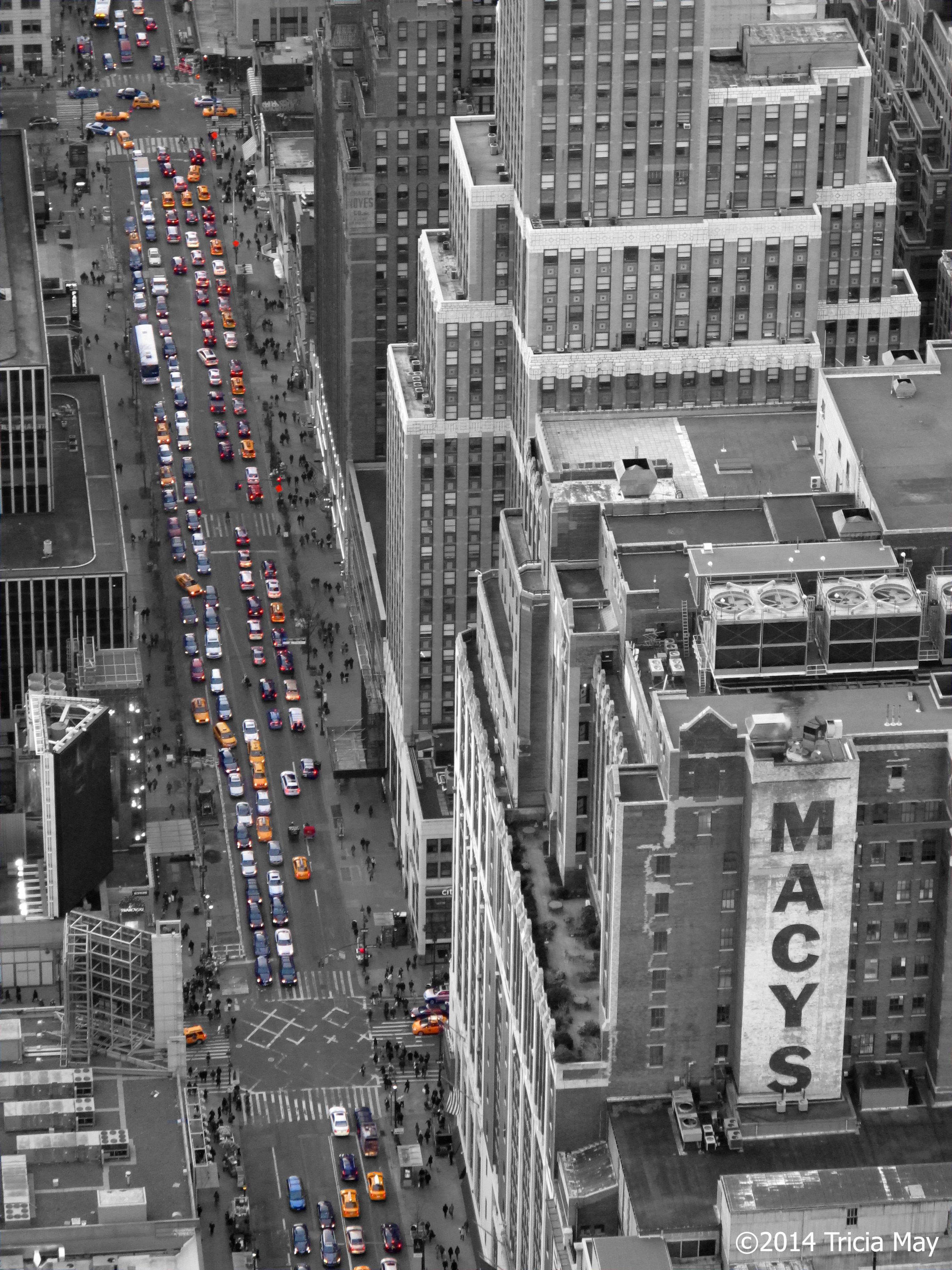
View from the Empire State Building
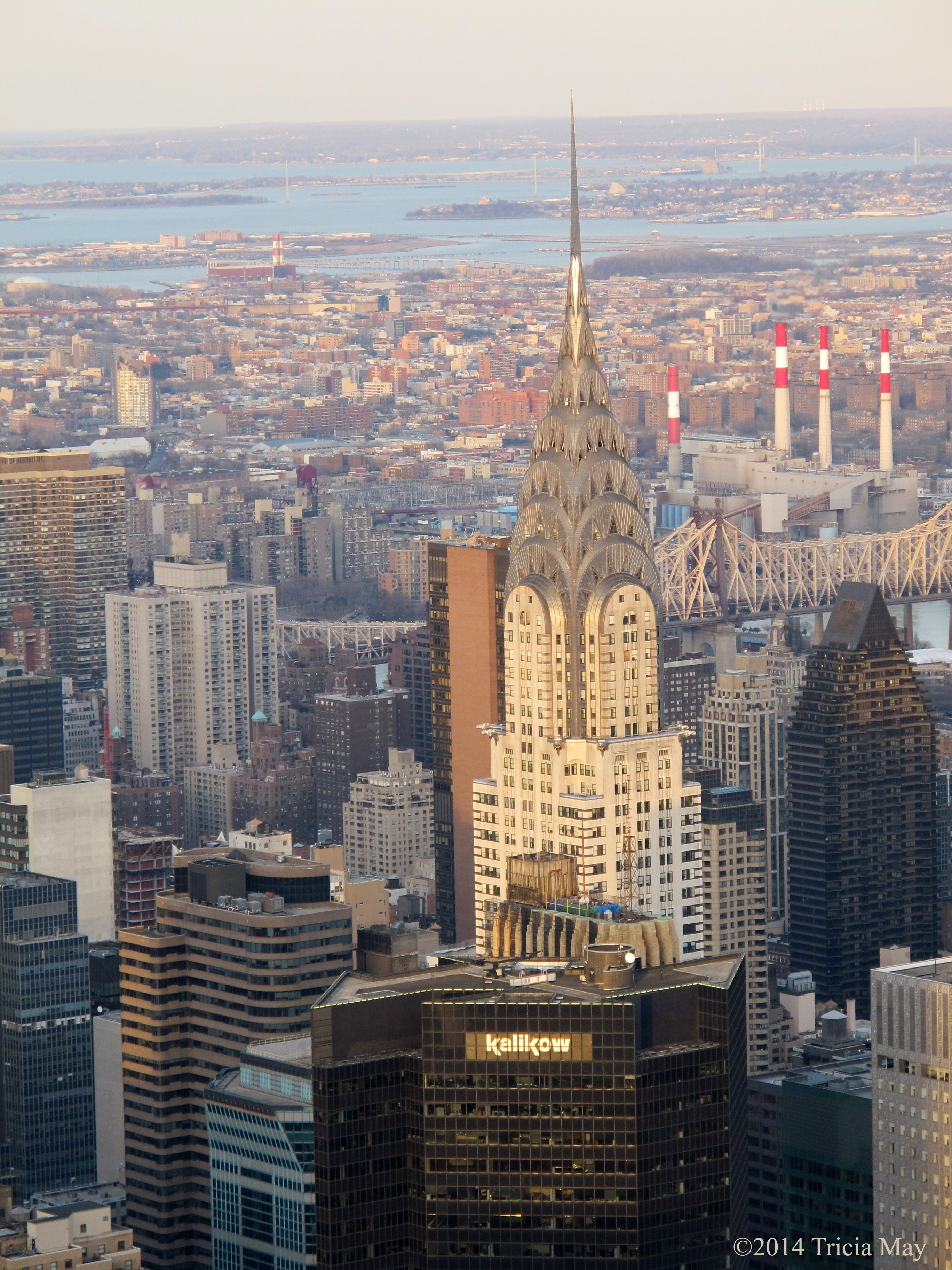
View from the Empire State Building

View from the Empire State Building

View from the Empire State Building
The next day – my last in New York, was to be spent at the Museum of Natural History before going to hear my friend perform at the Lincoln Center.
Who doesn’t like starting their day with dinosaurs? This guy greets you at the door.

Allosaurus at American History Museum
There was also a living butterfly exhibit there that day, so of course I had to go. Hundreds of butterflies flying around you, some landing on you….very cool.
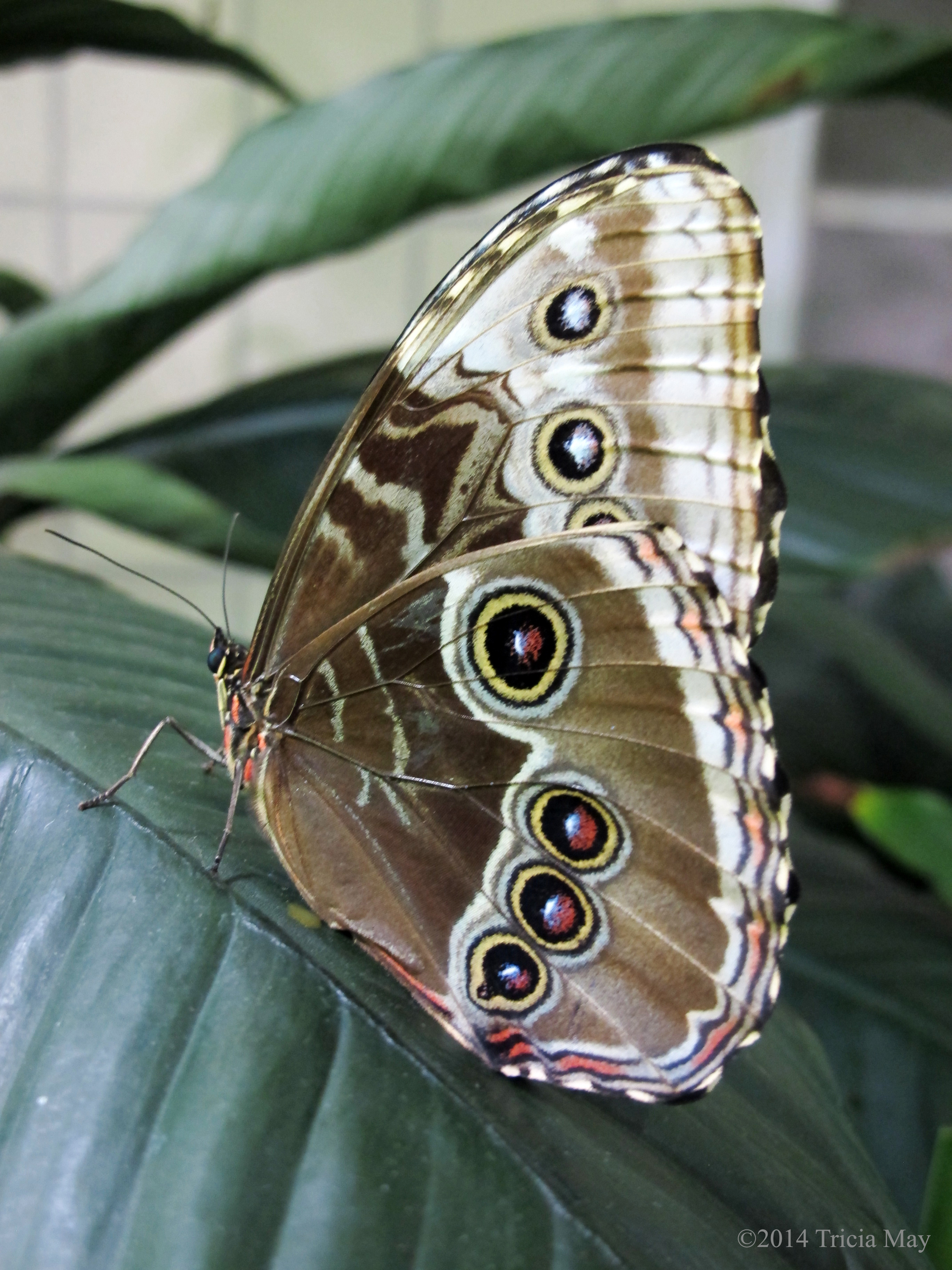
The Butterfly Conservatory – American Museum of Natural History
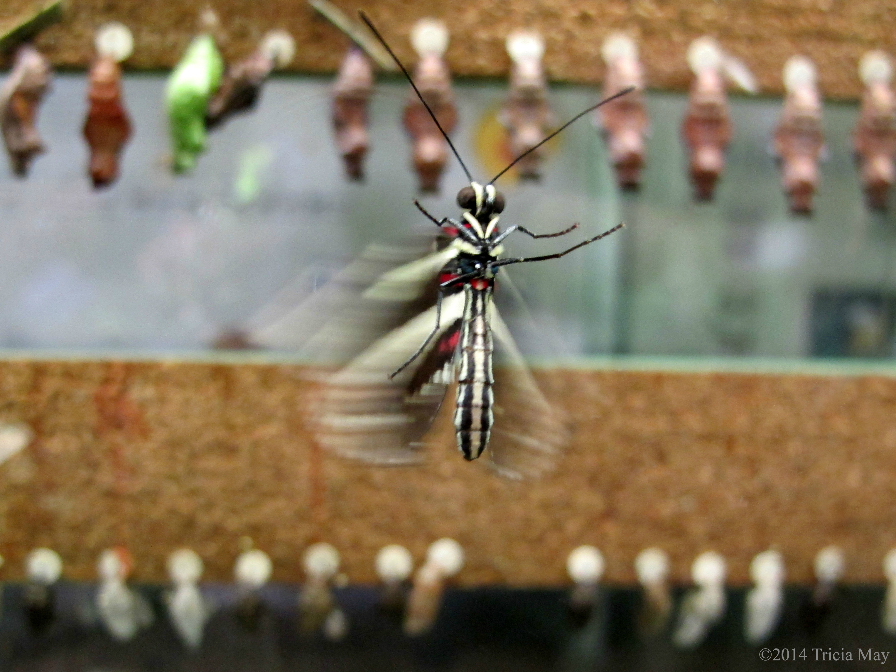
The Butterfly Conservatory – American Museum of Natural History
As cool as the butterflies were, it was time to go to the space exhibit and the Neil deGrasse Planetarium to watch “The Dark Universe”. Very cool 25 minute film where you zoom through the cosmos, enveloped by stars that go whizzing past. Almost dizzying at times, but the effects are fantastic.

Hayden Big Bang Theatre – Museum of Natural History

Saturn and Jupiter – Museum of Natural History
And the store had some pretty cute stuff too.
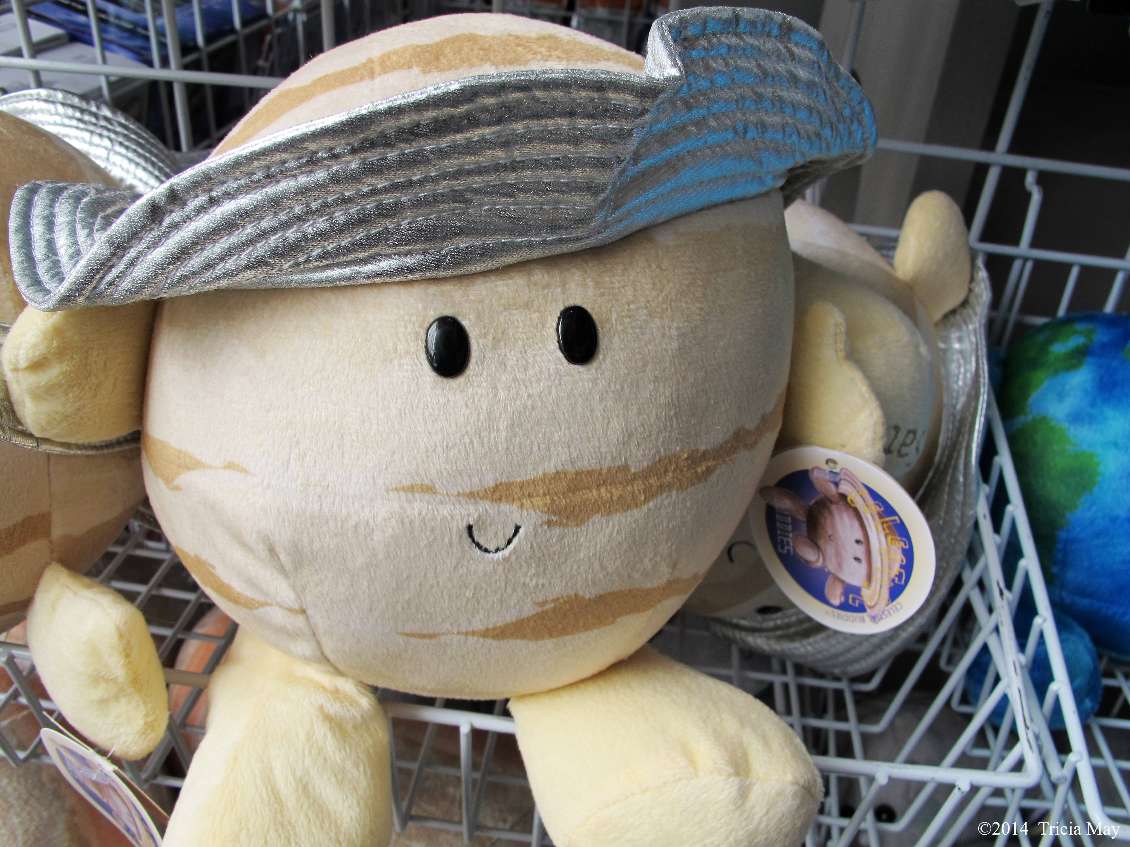
Cuddly Saturn
A tour through the dinos and we were done
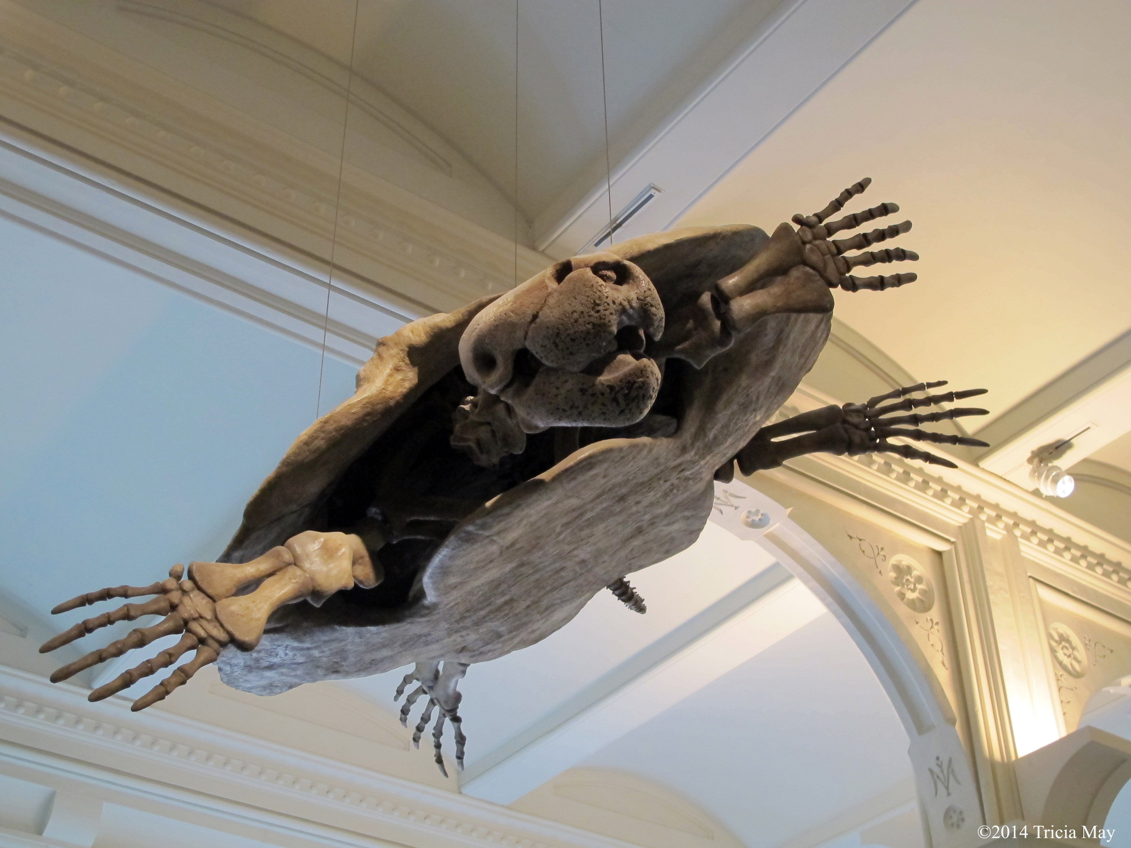
Stupendemys
I had just enough time to get back to the hostel, rest, get dressed, and walk to the Lincoln Centre. The concert was fantastic and I was so proud of my friend. What a fantastic opportunity for her, and a great excuse for me to come to New York.
The Never Ending Winter of 2013/14
I love winter. Seriously. I’m the type of person who rubs fresh fluffy snow on my face to feel the cold, to smell the unmistakable clean crispness that only comes from a new snowfall. I do this with bare hands. I love the squeak under my boots, the blinding sparkles that comes with the flat flakes that I refer to as diamond dust. The rosy cheeks, the tingle that comes after you get back into a warm setting. I love it all.
For a reasonable amount of time.
Spring seems to have forgotten us here in Canada this year. We are currently in the last week of March, and it should not be this cold. I just looked it up…the usual average temperature for this time of year is about 6C. That’s above zero. Yesterday…-30C in the wind. Even I am starting to have enough.
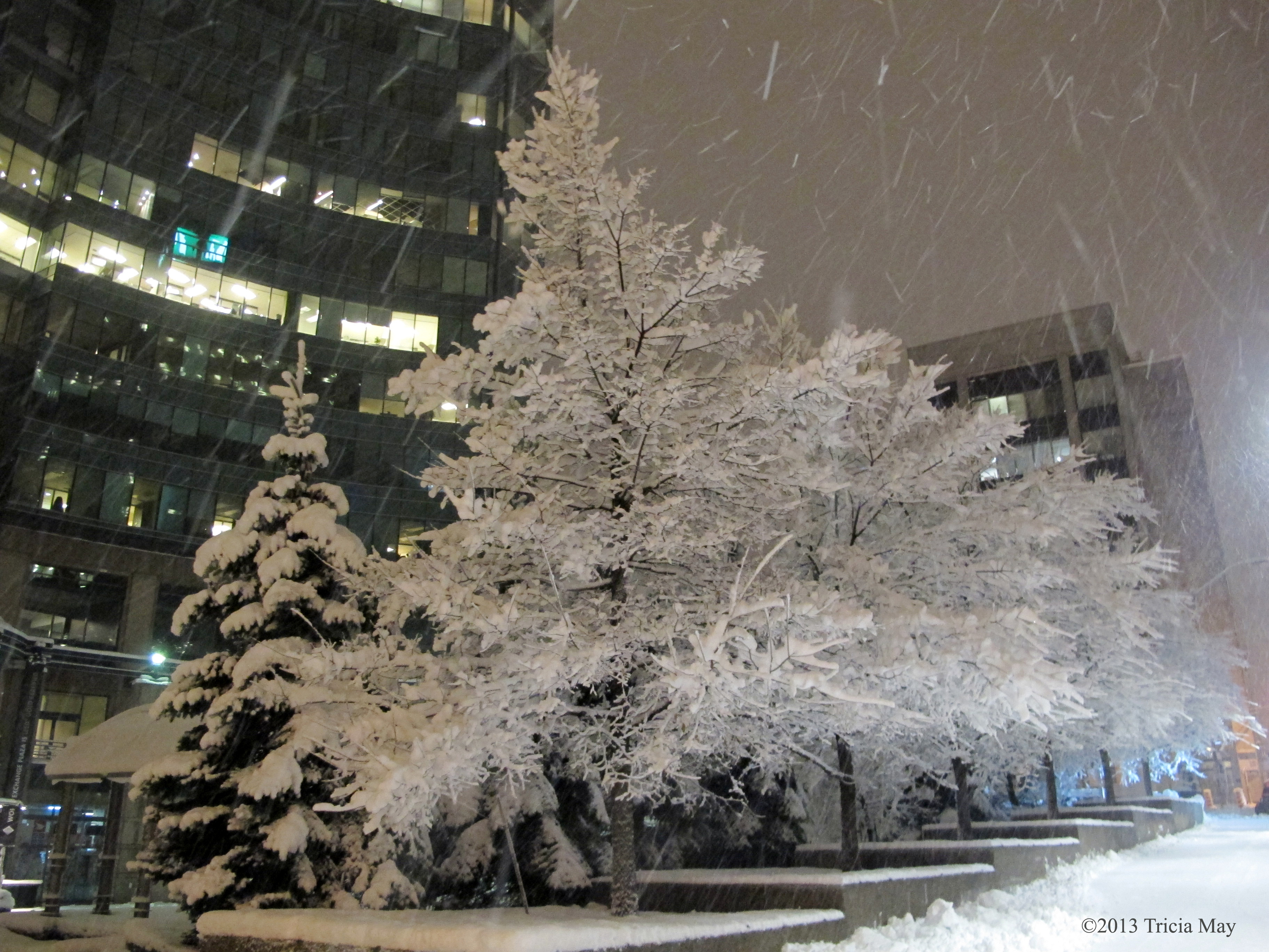
One thing I normally love about winter is getting out on my skiis and taking pictures. Because of a knee injury I wasn’t able to go but once , so that may have something to do with my grumpiness. I still managed to take some, but walking in the white stuff was rather painful, so I didn’t get many. Here are a some of my favorites. Enjoy.
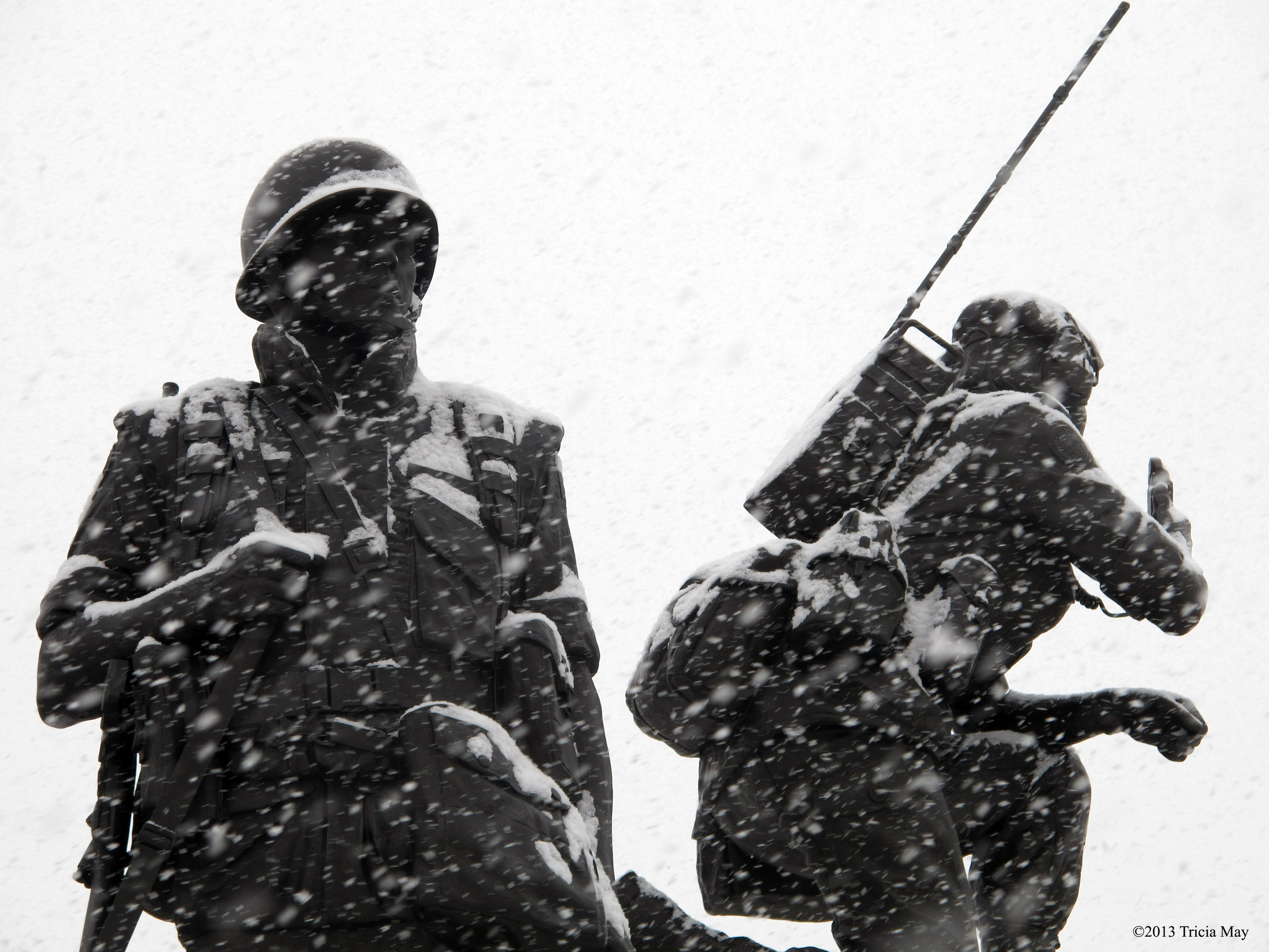
Peacekeepers Monument

Maman outside the National Art Gallery
On my way to work
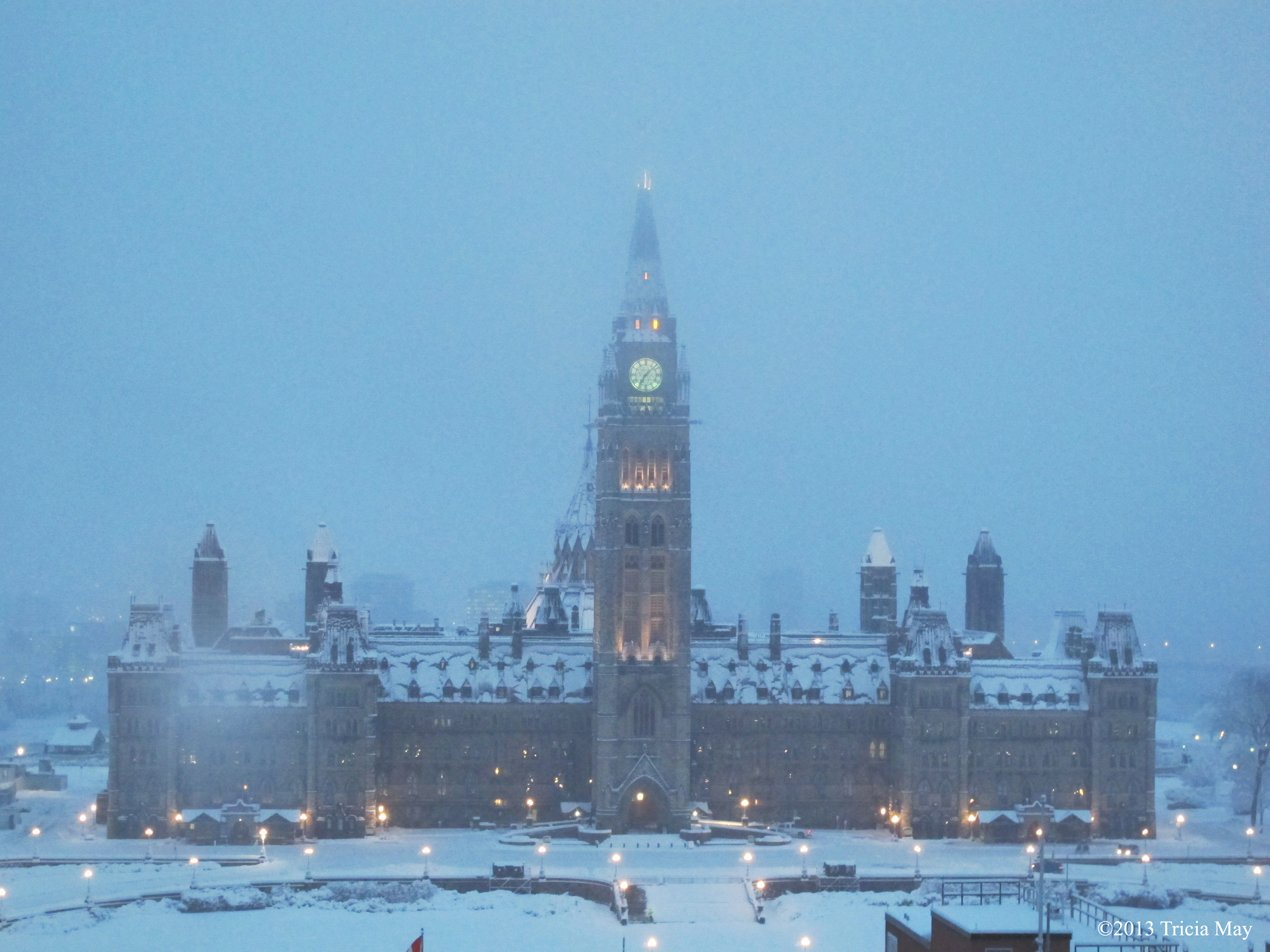
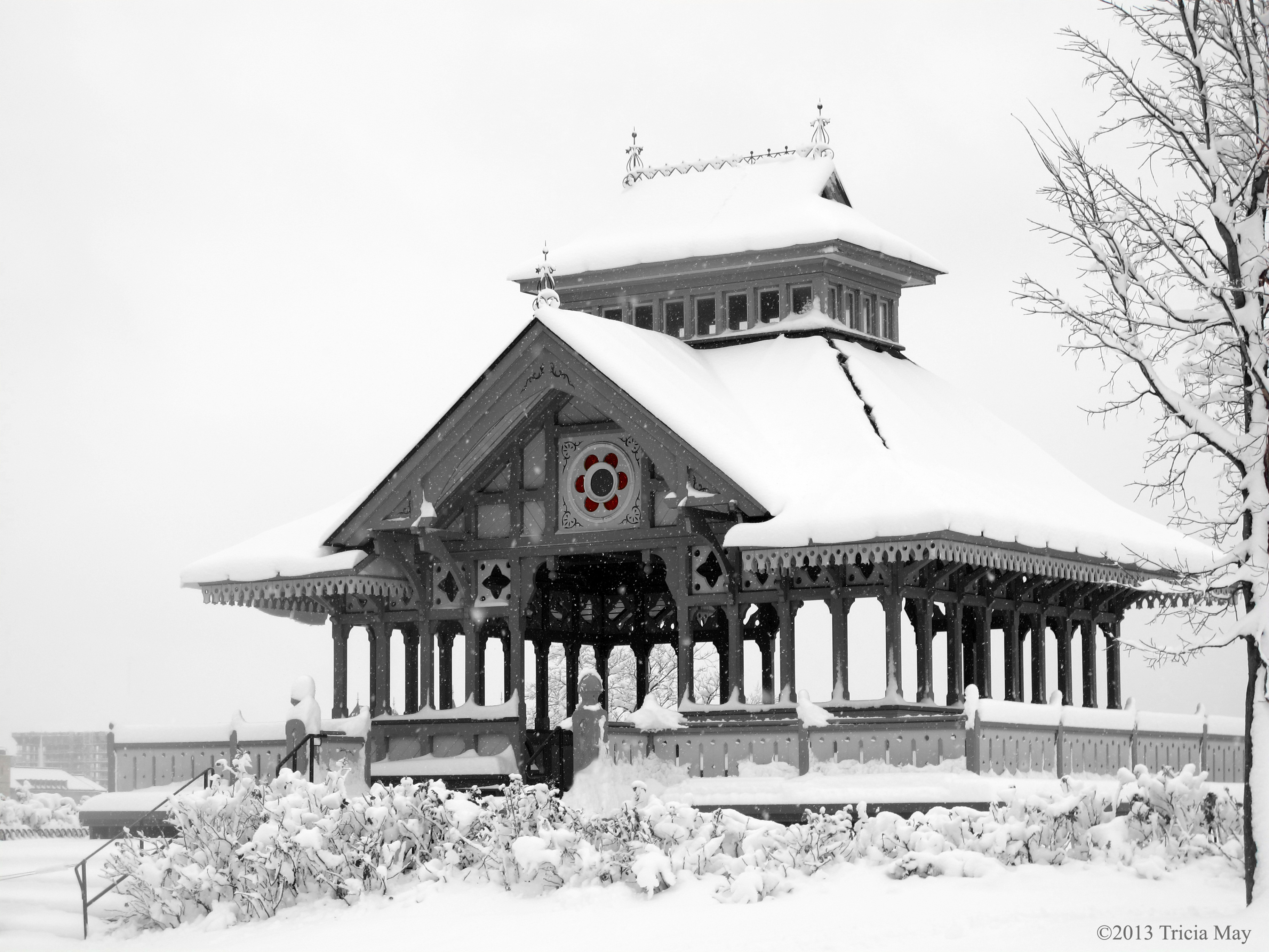
Parliament Hill on a snowy morning
The Cenotaph after a snowfall
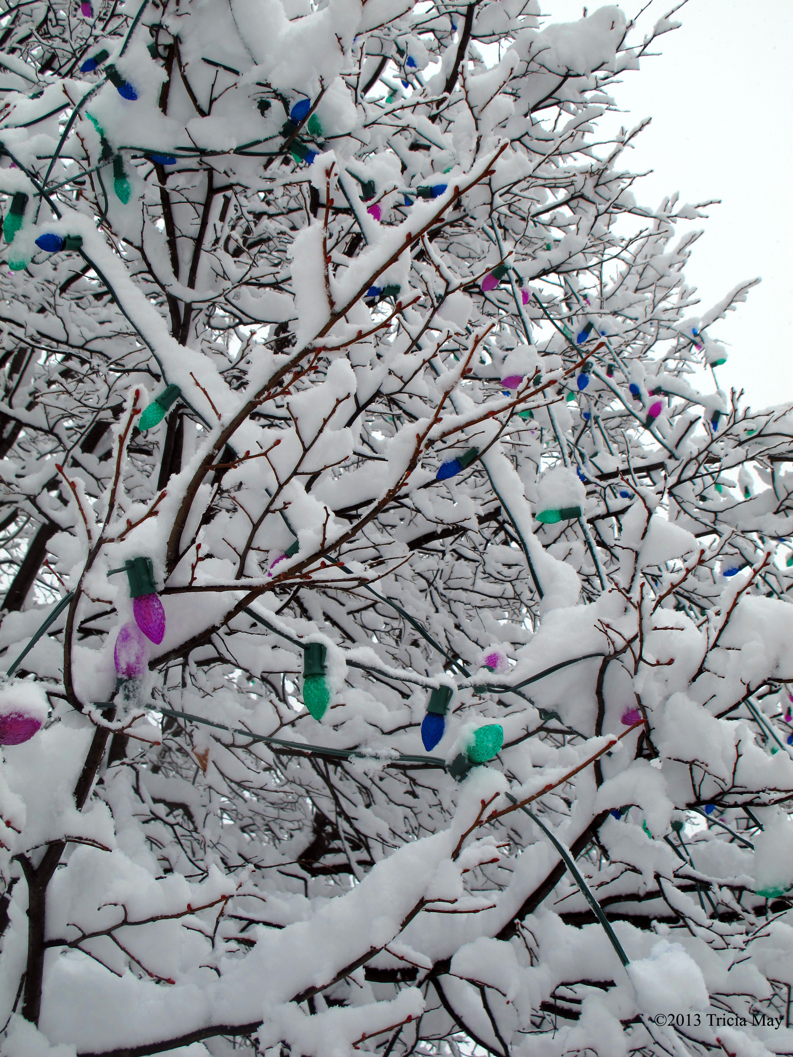
Coloured lights in a tree

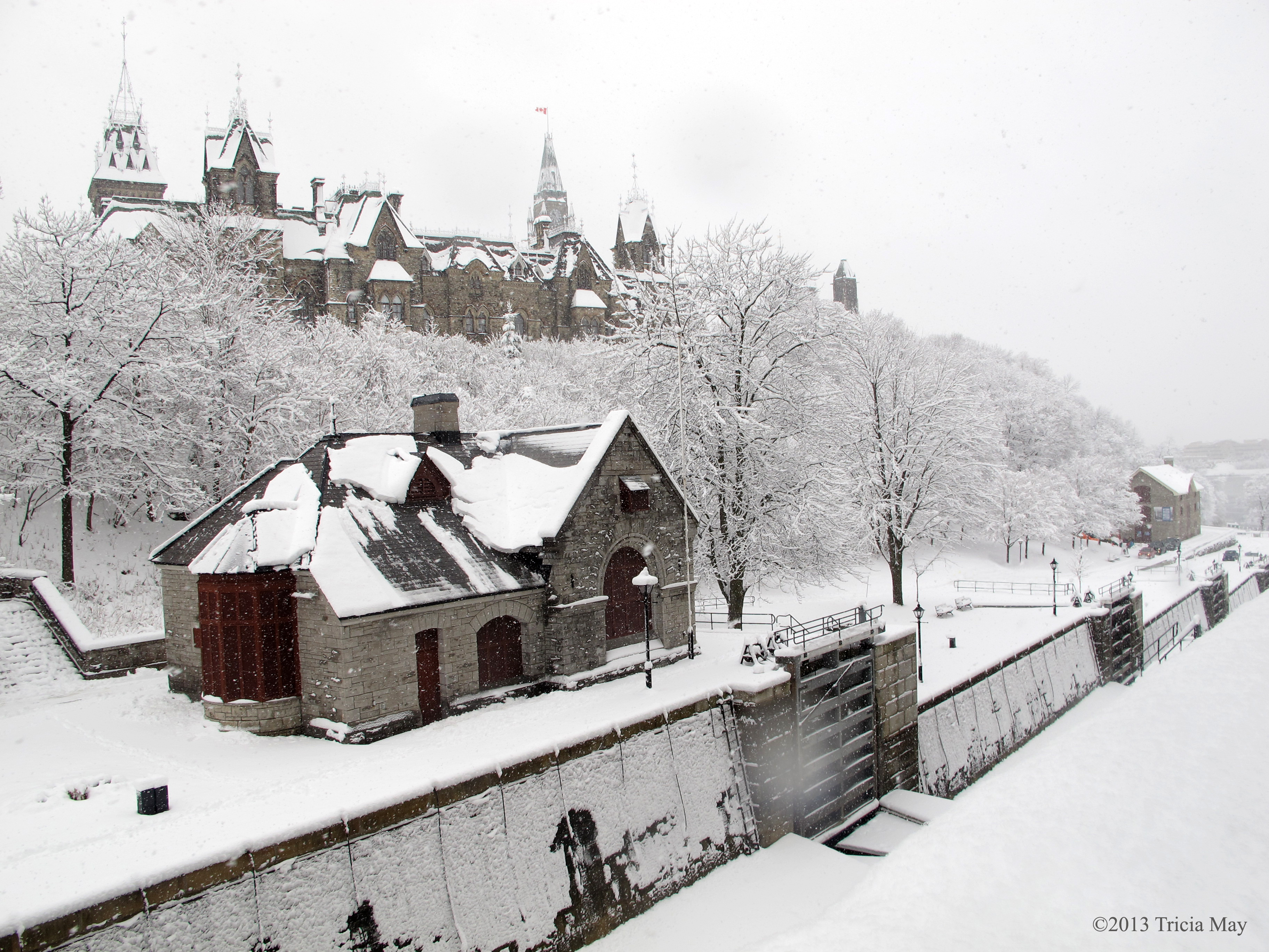
The Rideau Canal with Parliament and the Chateau Laurier Hotel

It’s gonna be a tough ride home for someone

The Rideau Canal with Parliament Hill in the background

Walking along Elgin Street

Stairs off of Elgin Street
Lockmaster’s Office along the Rideau Canal

Beside the Chateau Laurier Hotel

The Peacetower from Major’s Hill Park
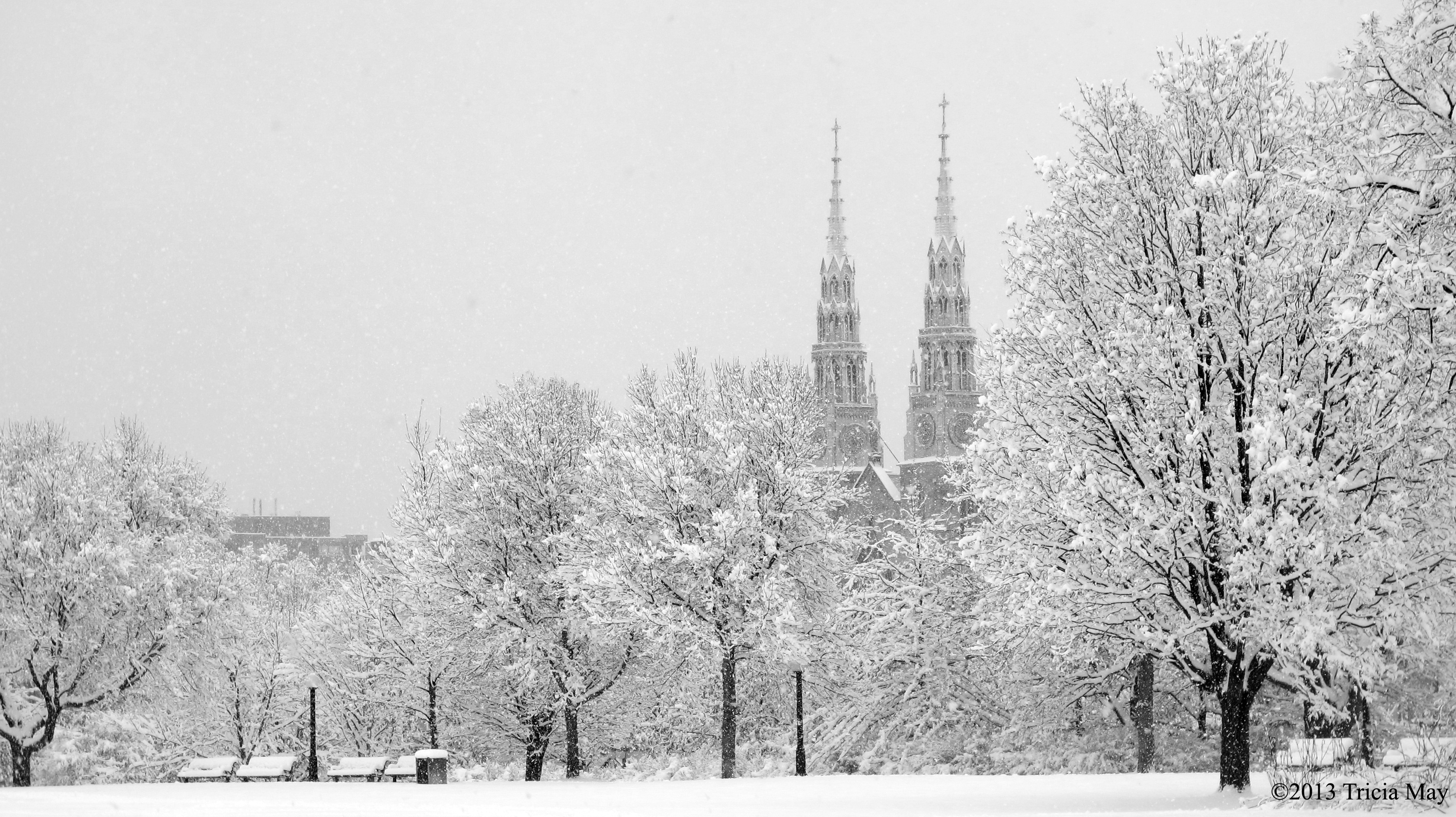
Notre Dame Basilica through Major’s Hill Park

Fence along Parliament Hill
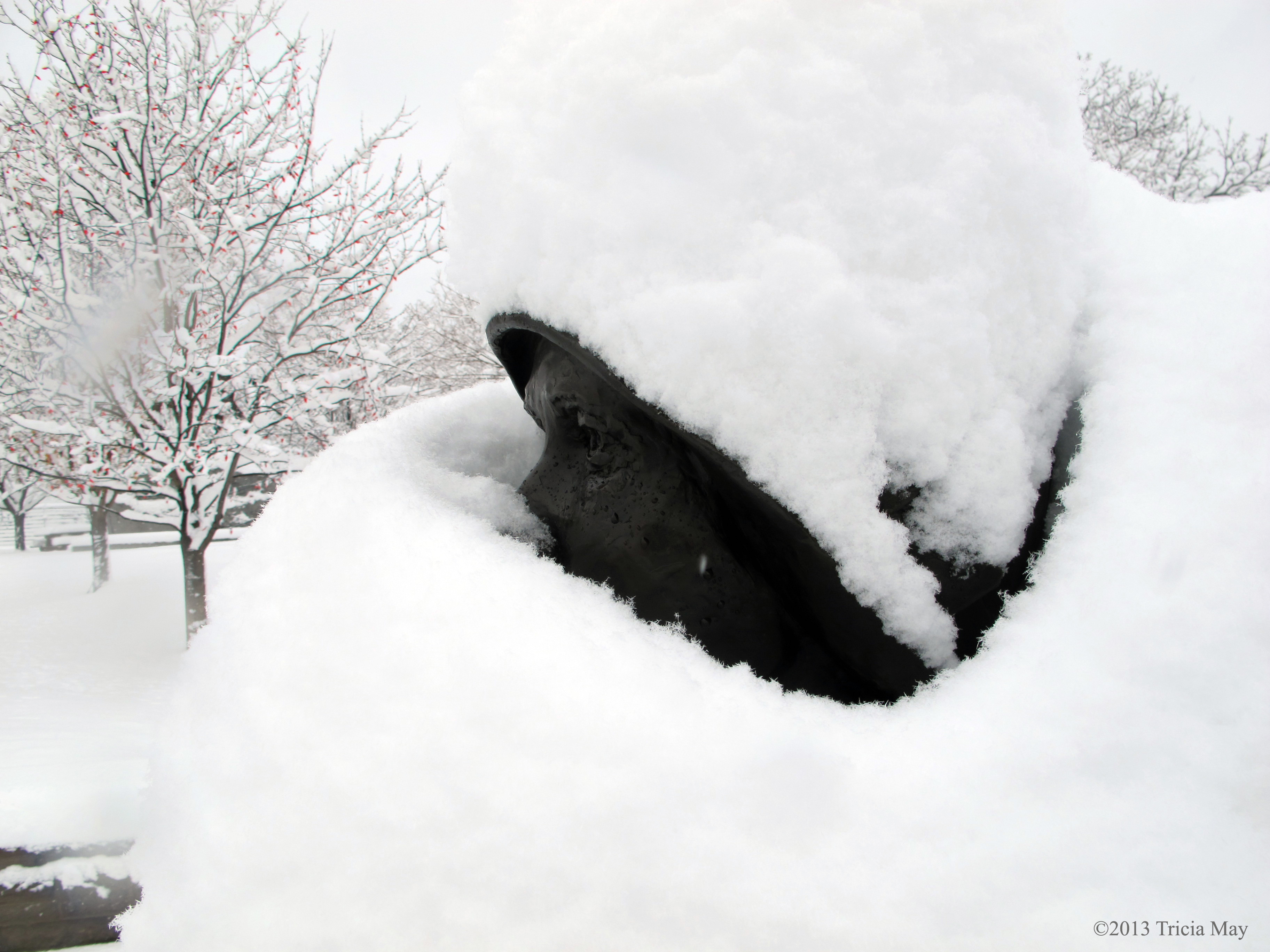
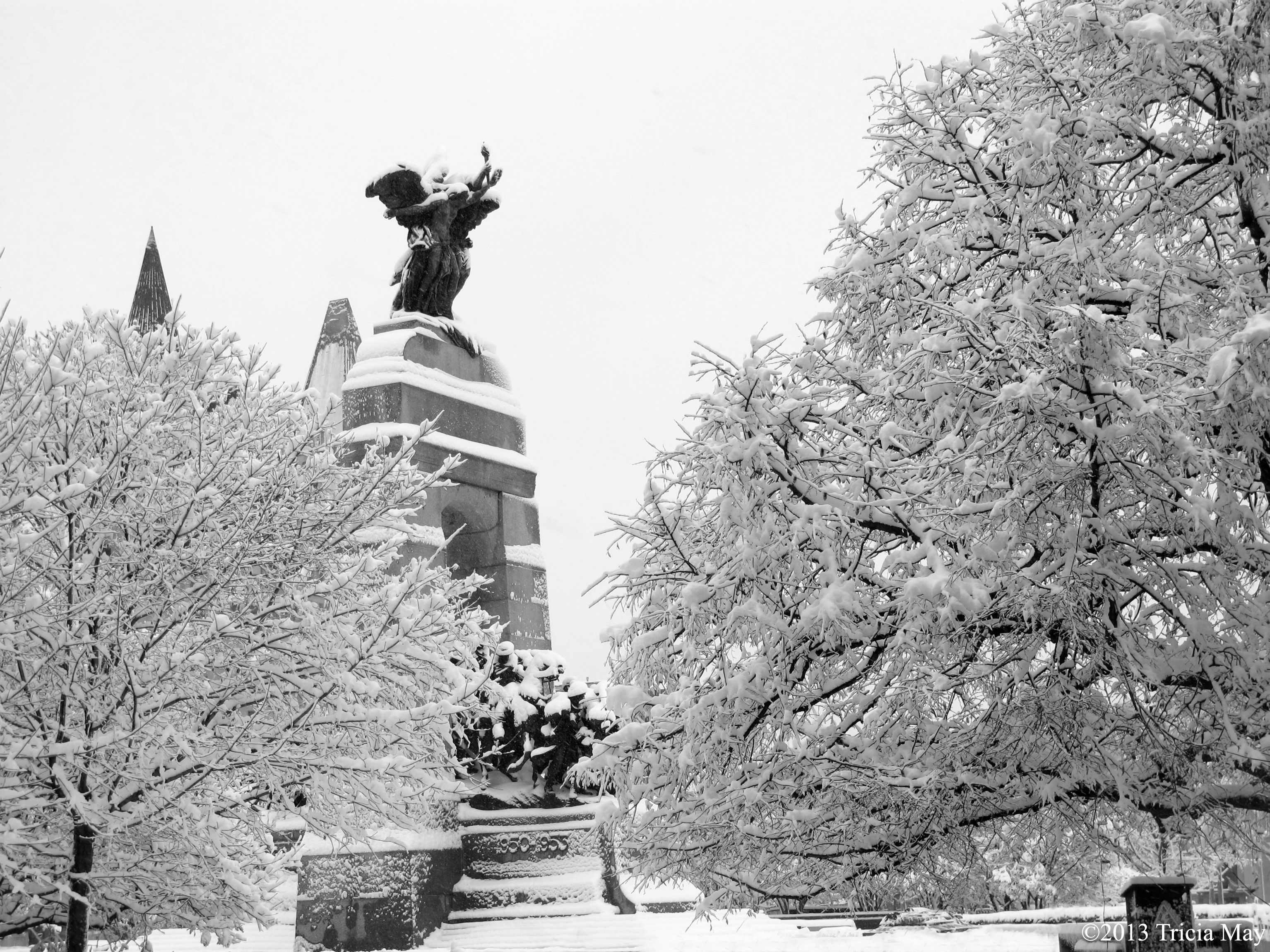
Peeking through the snow at the “Women are Persons” monument
Police and Peace Officer Memorial
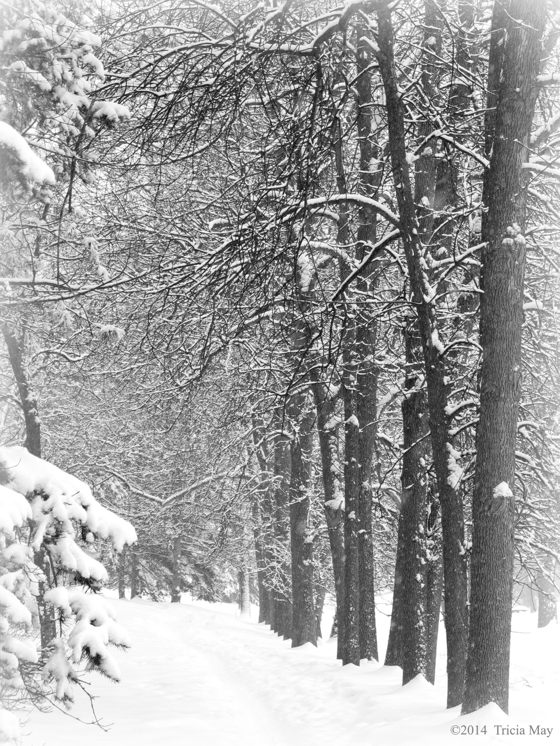
Going home along the Ottawa River Parkway
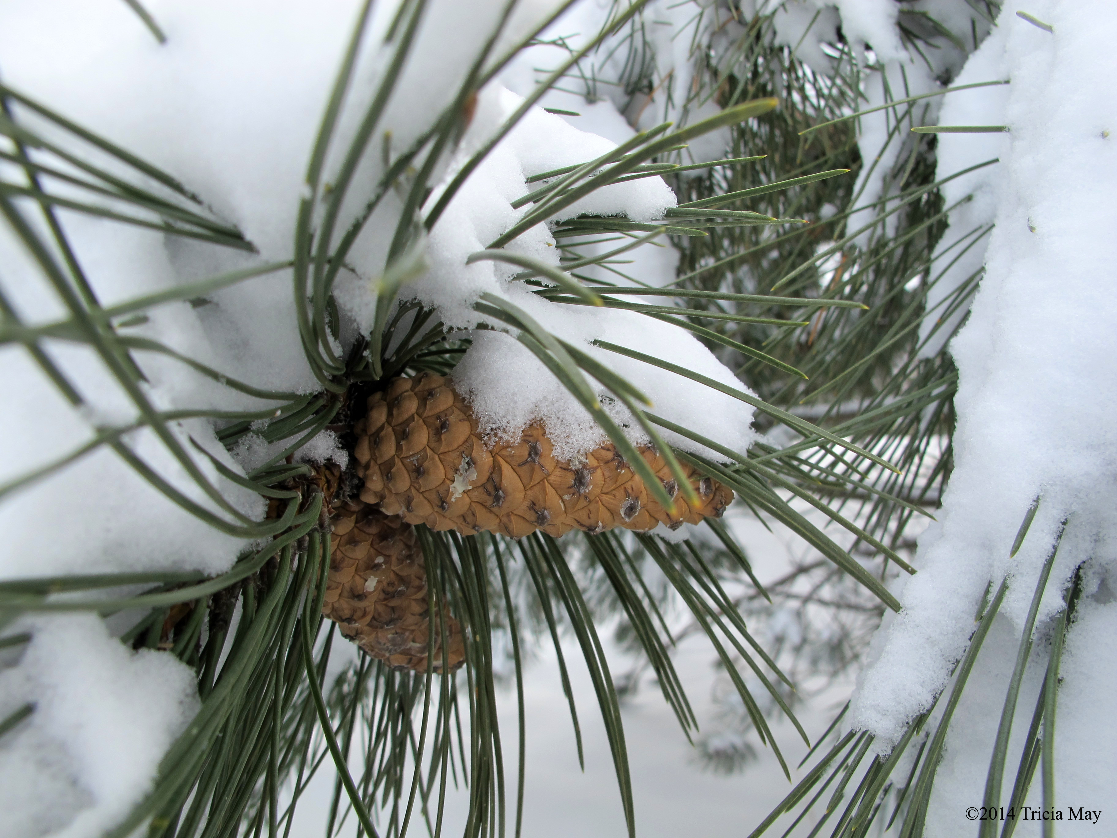
Snowy pinecones

Birch tree along the Ottawa River

Birch along the Ottawa River

Just some fungi and some snow
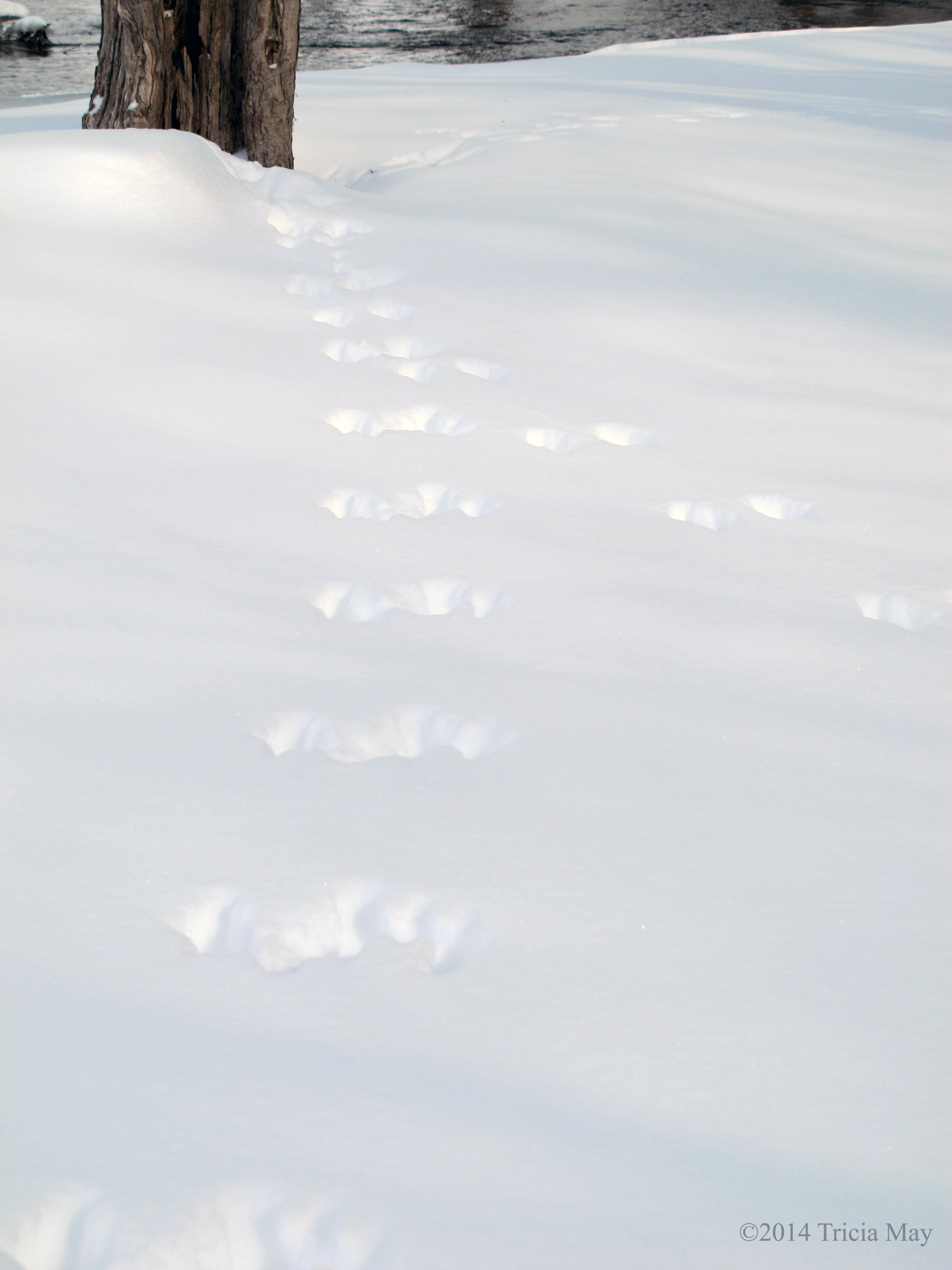
Tracks in the snow
Along the Ottawa River
Early on a snowy Sunday morning in downtown Ottawa
Zion National Park and Bryce Canyon
For years I’d been reading about the beauty of Utah and how wonderful the hiking was. This year I decided to find out for myself by travelling to Zion National Park and Bryce Canyon. My friend and I flew to Las Vegas and drove from there, encountering some fantastic scenery along the way.

Beautiful Arizona scenery on our way to Utah
We got to the park a little late in the day, but decided after setting up camp, to get in one quick hike. We decided on the close by Watchman Trail. My Lonely Planet guide (Zion and Bryce Canyon National Parks – which I will using for all of my stats) listed the trail as 2.7 miles on easy-moderate terrain with a 400 foot elevation gain. For my fellow Canadians, that’s about 4.4 km with 122 meters height change.
It was a nice easy walk from our campsite and my first views of the park did not disappoint.

Approaching our first trail – the Watchman
The Watchman was a good introduction – not hard, but hard enough after a long day of being on the road with barely any sleep. And for a sea level gal, it was also a good intro to the higher elevations. I must say, it felt good to have my hiking boots on again.
There was some loose rock, but it’s a pretty well worn, hard packed trail, easy to navigate.

Rocky path up the Watchman Trail
For me, this was so different looking from home…so gorgeous. Just the geology of the area was fascinating with the multi coloured layers. The light blue of the newly exposed rock to the deep red/brown that comes with long exposure. Beautiful. The fact that there were some funky ‘Tim Burton’ trees didn’t hurt either.

A “Tim Burton” tree on the Watchman Trail
It didn’t take us as long to summit as the guide book suggested, but that was good because the sun was scheduled to set not that long after we got up, and this is the rumoured go-to viewpoint for sunsets in the park. You’ll want to remember a headlamp or flashlight for the return trip, and maybe bring an extra layer because the temperature dropped quite a bit once the sun dipped below the rock formations.

On the Watchman trail as the sun sets

View from the Watchman trail as the sun begins to set
We walked back to our campsite, put on an extra layer, and made dinner in the dark. And it was dark. Very dark. The stars were so brilliant in the sky, and there were oh so many of them. I love being able to look up at the night sky and see the Milky Way. Light pollution sucks. It was a great end to the beginning of a great trip.
DAY 2
Lots to see and do on this day. We decided over breakfast to drive to the far end of the park and hike the Taylor Creek Middle Fork trail, a moderate 5 miles with 450 feet of elevation (8 km, 137 meters). We drove about a half an hour to Kolob Canyon where we stopped to talk to the ranger at the visitor centre. It was soooo windy and cold that I wasn’t sure what to wear, but we still had to drive to the trailhead, and I could decide after I got there. So after filling our water bladders we got back in the car and drove further up the road . Thankfully it was much more sheltered, so the wind was minimal and the temperature noticeably warmer. I grabbed my hiking poles and we were on our way.
This area was more heavily forested with towering pines and assorted deciduous trees (which kind, I have no idea since it was spring and there were no leaves). It was so striking that my friend and I kept stopping to look around and exclaim just how beautiful it was and how we were lucky to be there.
Crossing a stream on the Taylor Creek Trail
There are quite a few stream crossings so you could potentially get a little wet and muddy, but it was pretty dry when I was there. In a few spots areas had been washed out and the trail was marked with piles of stones, so keep an eye out in case the trail hasn’t been repaired.
Amongst the beauty of the towering rocks and accompanying trees are two historic homesteading cabins dating from 1930. The Fife and Larson cabins are now considered archeological sites and no entry was allowed. Just imagine living in these surroundings….breathtaking.
The Larson Cabin on the Taylor Creek Middle Fork trail
The high point of this trail for me was what was waiting at the end of it…the double arch alcove. Wow. I needed to stitch together eight photos to capture the majority of it. The temperature dropped – a lot – and the wind was whipping around, but lordy…the beauty of it. Again, beyond description, but it was like the rock was molded clay with a wash of earthtone watercolours covering it. Water dripping down gave splashes of brown down the center, only to lead to the bright green of living things, of algae clinging to red rock and soil. Tall pine trees were dwarfed by the rock, so you can only imagine how we felt beneath the pines, necks craned as far back as they would go, looking up. It was too cool to stay for long, but I’ve got that snapshot clear as day in my head, and I really hope it stays a while, because moments like that put things in perspective.

The Double Arch Alcove and the end of the Taylor Creek Middle Fork trail
We were alone for most of our time on this trail, so if you want some solitude, this might be the place for you. We saw two people as we entered and a few others on our return, so no more than eight of us in the time period we were there.
Back at the car we decided to drive to the end of Kolob Canyon Rd and take in the vistas from the Timber Creek Overlook. There is a short trail of the same name, one mile of easy-moderate hiking with only 100 ft of elevation gain (1.6 km and 30.5 meters). Gorgeous scenery at the overlook where you can take in the jagged fingers of the Kolob Canyons to the east and the Lower Kolob Plateau to the south. There are plenty of places to sit and take it all in, but it can get fairly windy out in the open. And apparently the altitude (6300 ft – 1920 m) was still kicking my butt – I got winded on the inclines.

View of the Kolob Canyons from the Timber Creek Lookout trail
We’d read a bit about a ghost town that was within the parks boundaries, so we decided to check it out on our way back. Grafton was initially settled by followers of Brigham Young in 1859, but the town was destroyed by a flood in 1862, forcing it to resettle on higher ground a mile upstream. This is where the current townsite now sits. Even in their new location, flooding was always an issue, but the real problem for the townsfolk were the Navajo who were being squeezed between settlements. Some Mormon settlers were killed by raiders, so Brigham Young ordered villages to coalesce into towns of more than 150 men, making Grafton into a ghost town for the first time. The farmers would return daily to tend their fields, and two years later, with the troubles over, the town was resettled. It thrived until 1906 when a newly built canal delivered the Virgin River water to nearby Hurricane. Most families up and left to move to Hurricane for an easier life, and so by 1945 it was uninhabited.

The church in the ghost town of Grafton

A couple of the headstones in the Grafton cemetary
It felt good to get back to our campsite and just chill for the rest of the night by a nice toasty fire. The sky was clear, and the moon was bright so we took out the night vision goggles we had with us to see what we could see…

View from our campsite with night vision goggles
DAY 3
Trails for today – Hidden Canyon, Weeping Rock, Emerald Pools and Kayenta. Hidden Canyon is a 2.4 mile moderate-difficult hike with an elevation change of 850 ft (3.9 km, 259 m). Take the shuttle to the Weeping Rock stop to get there. Everything we read said to do this hike early in the morning so that the approach was done while still in the shade. I am sooooo glad we listened. Even in the shade I was sweating and stripping down and I could only imagine how hot it would be in full afternoon sun. Especially in the summer.

Switchback up the Hidden Canyon Trail (lower right)
I think the ‘difficult’ part of this trail is only applicable if you have issues with heights. This is a chain assisted trail with some narrow sliprock ledges, so you may want to grab hold since it’s almost a thousand feet straight down. Makes for some beautiful views!

Chain assist up the Hidden Canyon Trail

Chain assist on the Hidden Canyon trail
Once past the ledges, it wasn’t far to the mouth of the Hidden Canyon. The trail was a combination of sand and rock and about a quarter of a mile in on the right hand side there was a standing arch. After the arch the trail got rougher with some pretty substantial rock falls, so scrambling up and over rocks, some covered by slippery sand, would be in your future.

An arch along the Hidden Canyon trail
Our return down the ledges was temporarily delayed when we encountered a group of thirteen people coming up. Seeing as the ledge was too narrow for people to pass each other, my friend and I found a wider spot to sit down and wait. Some of the people coming up were moving pretty slow since they were terrified of heights and hugging the wall with a death grip on the chain. Also, huffing and puffing and breathing breaks were required. We didn’t mind the wait…the view was fantastic!

Lynda patiently waiting for a large group of people to go by in a wider spot on the Hidden Canyon trail
Once we reached the bottom of the trail we figured we would do the short off shoot trail to the Weeping Rock – 0.5 miles, easy-moderate with only a 100 ft elevation gain (0.8 km, 30.5 meters). Very short, but it would be nice to do on a hot day since the parks largest hanging garden is located by the giant alcove at the trails end. Water was constantly dripping down, creating a nice cooling spray. Perfect while you take in the view of the White Throne and Zion Canyon.
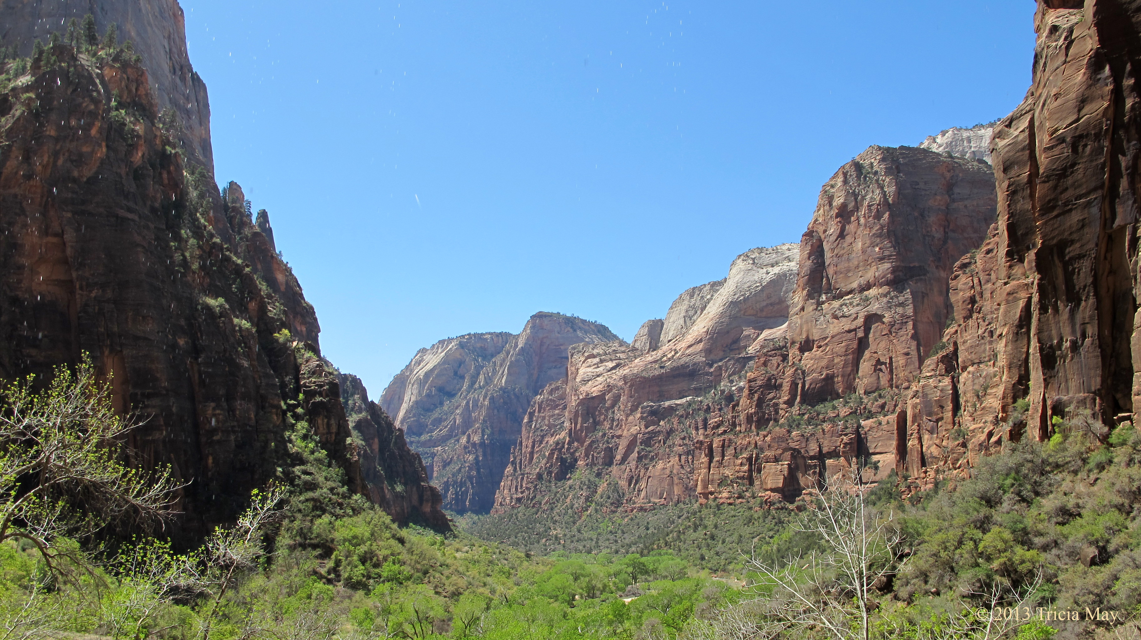
View from Weeping Rock
We walked back to the shuttle stop and waited for it to take us up to Zion Lodge where we had a picnic lunch and refilled our water bottles. Then it was on to the Emerald Pools and Kayenta trails – the trailhead is across the street. These are linked trails, and combined it is a 3 mile moderate hike with an elevation gain of 400 ft (4.9 km, 122 meters). I must say, the starting view was very pretty.
Approaching the Emerald Pools Trail
It was fairly dry while we were at the park, so the pools weren’t that spectacular. The first one was had a very small water fall which basically wet one rock, but the second had a very nice reflection of the surrounding hills.
Small falls dropping into the first pool of the Emerald Pools trail

Reflections in the second of the Emerald Pools
The third pool was in a beautiful location with towering sheer rock walls, but again, the water levels were so low that there was a lot more mud than there would be at other times of the year.
Instead of turning around and going back the same way, we took the Kayenta trail down. A nice, gentle decline and beautiful views that take you to the Grotto. We chose to walk back to the Zion Lodge on the Grotto trail instead of waiting for the shuttle and we treated ourselves to a well deserved ice cream cone once we got there. So refreshing! Our hikes for the day done, we took the shuttle back to the visitors centre and walked back to camp. It felt good to get the boots off and the sandals on.
DAY 4
Hikes for today: The Riverside Walk and as much of the Narrows we can do…without the proper gear. We really should have researched this part more. Everything we had read said that the Narrows shouldn’t be done in the spring due to the temperature of the water and the level from snow melt. Well, we were led astray. More on that later.
The Riverside walk. An easy hike that starts at the Temple of Sinawava, it is 2 miles (3.2 km) long and only has an elevation change of 100 ft (30.5 meters). The path is paved, and while some literature says that it is wheelchair accessible with assistance, it would take a lot of assistance. There are a lot of roots and some washed out areas that I think would be really difficult to get a wheelchair over. Strollers would be okay though.
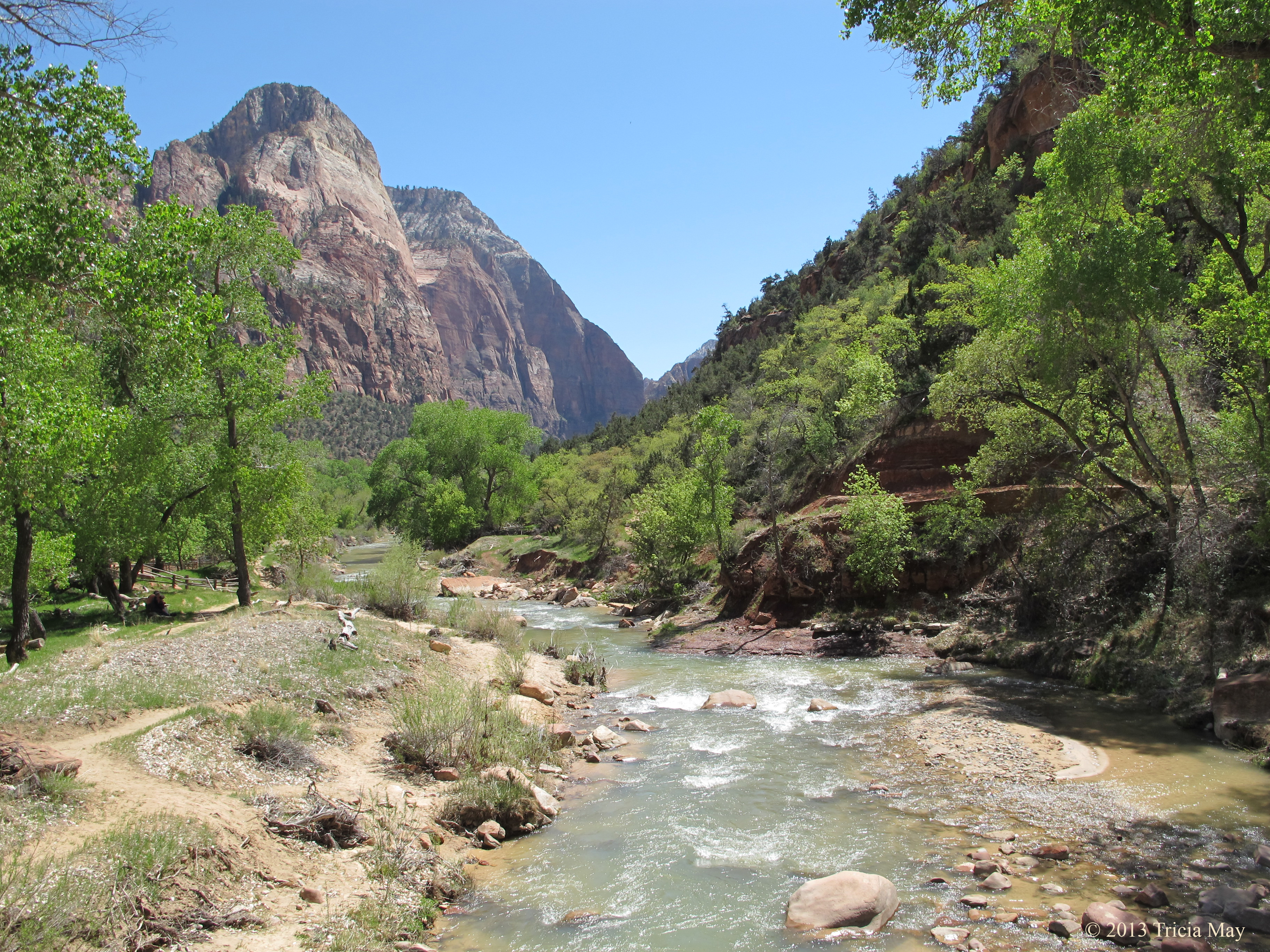
The path runs parallel to the Virgin River, giving you some awesome views of towering rock overhead.

Looking up along the Virgin River on the Riverside Walk
There were also a lot of mule deer to be seen along the trail.
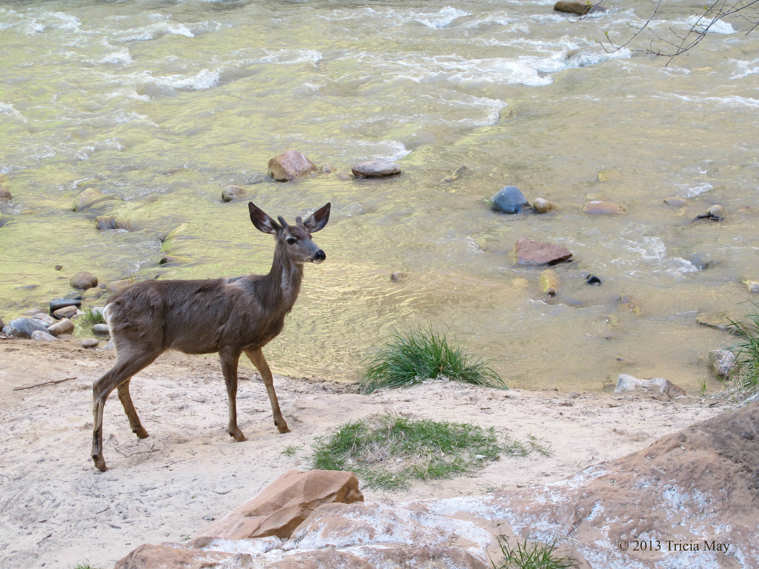
Mule deer along the Virgin River
The end of the Riverside walk is the entrance way to the Narrows – where the Virgin River is the trail. This is listed as moderate to difficult and anyone venturing in must be prepared to be chest deep in water. The return trip is about 10 miles (16 km), but you can turn around at any time.
It is here, at the mouth of the Narrows, that you’ll find all sorts of people sitting on the rocks, watching others head off into the slot canyons.

People heading into the Narrows
We wanted to be amongst those getting into the water, but we neglected to do the intelligent thing and consult with the Ranger about the water level and how fast it was running. If we had, we would have found out that it was safe to enter and go forth. We could have gone to one of the many outfitters in nearby Springdale and rented wet suits. But no…we didn’t do any of that. So when we reached the mouth of the narrows, we just decided to do what we could with what we had.

In the Narrows
Unfortunately, we didn’t get as far as we would have liked. It wasn’t that the water was too cold, but it was getting a bit deep, and without poles of some sort to help us along, we didn’t feel safe. The surface of the water may look pretty smooth, but it actually pulls at your legs pretty fierce. So, my advice if you want to do the Narrows, especially in the spring…is check with the ranger! Rent yourself a wet suit and a sturdy walking staff, and if you want to do the whole day trek, give yourself a full eight hours for the the return journey.
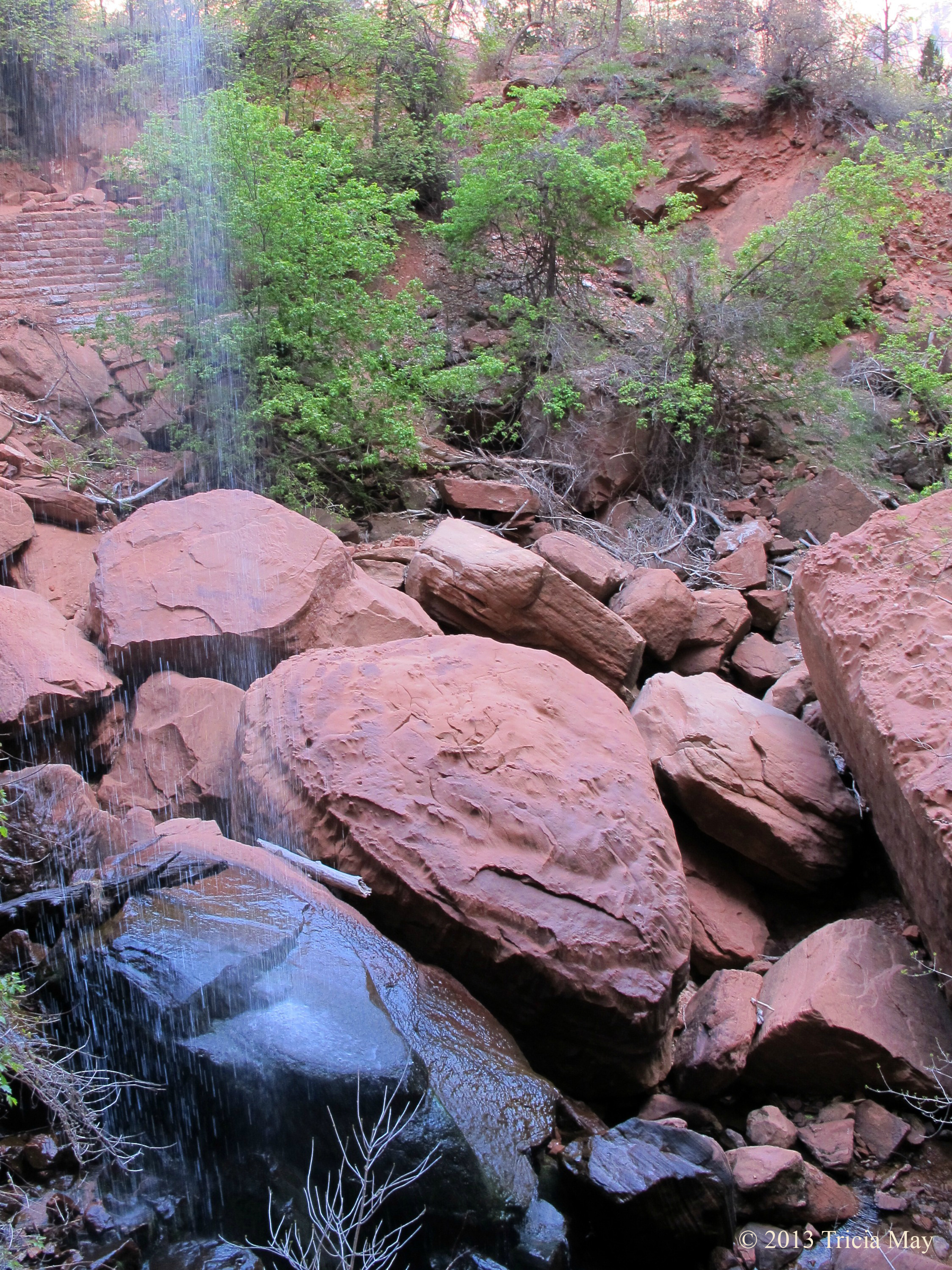
After getting out of the water and letting our boots drain for a bit, we got back on the Riverside trail and hopped on the shuttle, only to get off at the Big Bend stop. We wanted to check out Menu Falls – about a half mile (0.8 km) back. It was a nice little waterfall just off the road with a nice place to sit and just relax. On a hot day this would be a great place to chill out.

Menu Falls
After a few minutes here we got back on the shuttle and went back to camp for lunch. We needed to get some supplies so we walked into Springdale, picked up what we needed, and chilled at our site for the rest of the day.
DAY 5
Our last full day in Zion – which of course means we were heading for Angels Landing. Listed as a difficult 5.4 mile (8.7 km) trail with 1488 feet (453.5 m) elevation gain, this is the parks most well known canyon hike. Take the shuttle to the Grotto stop and you’ll see the trailhead across the road from the picnic area.
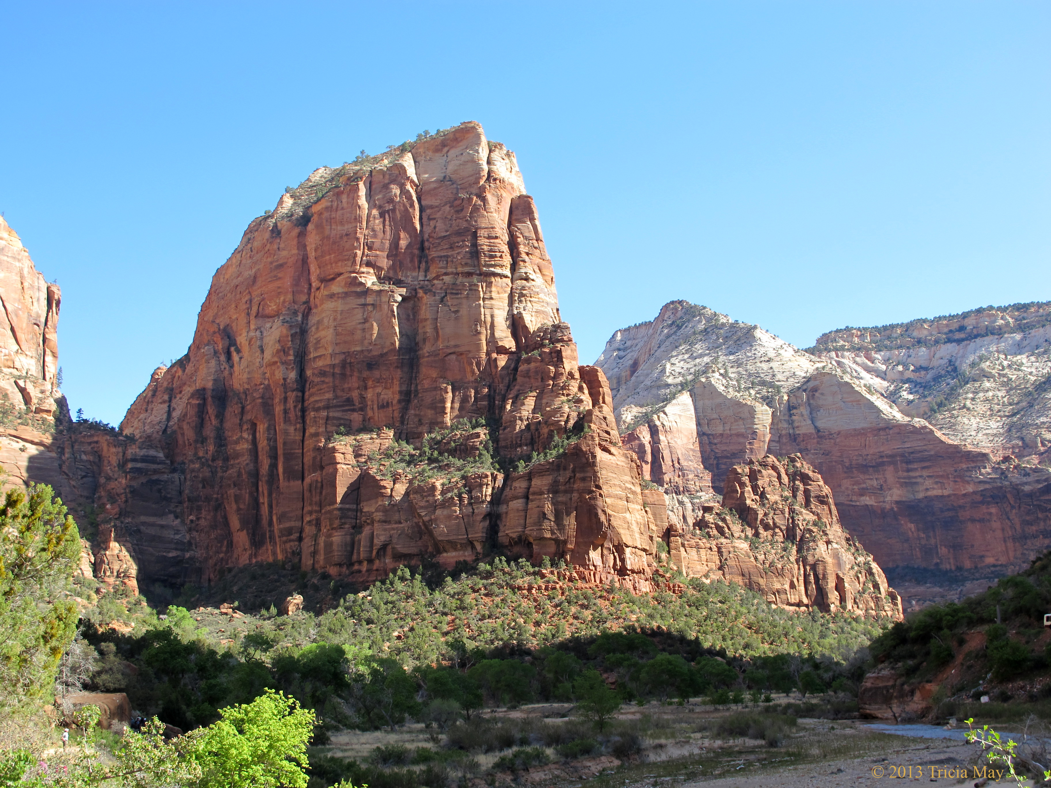
Angels Landing
Ah, it started out nice and gentle, but soon you get into some pretty serious switchbacks and any layers of clothes you were wearing start to come off. My knees and I were very happy to have my two hiking poles in hand, and I knew I would really appreciate them on the way back down.

Angels Landing switchbacks
This first batch of switchbacks end when you go under a rock over hang, and I for one was very happy for the short reprieve. Walters Wiggles, a set of 21 short, steep, stonework zigzags comes pretty quick, but once you get to the top of that, you are at Scout Lookout. Here you can visit the pit toilet and decide if you want to carry on all the way up to the top of Angels Landing.
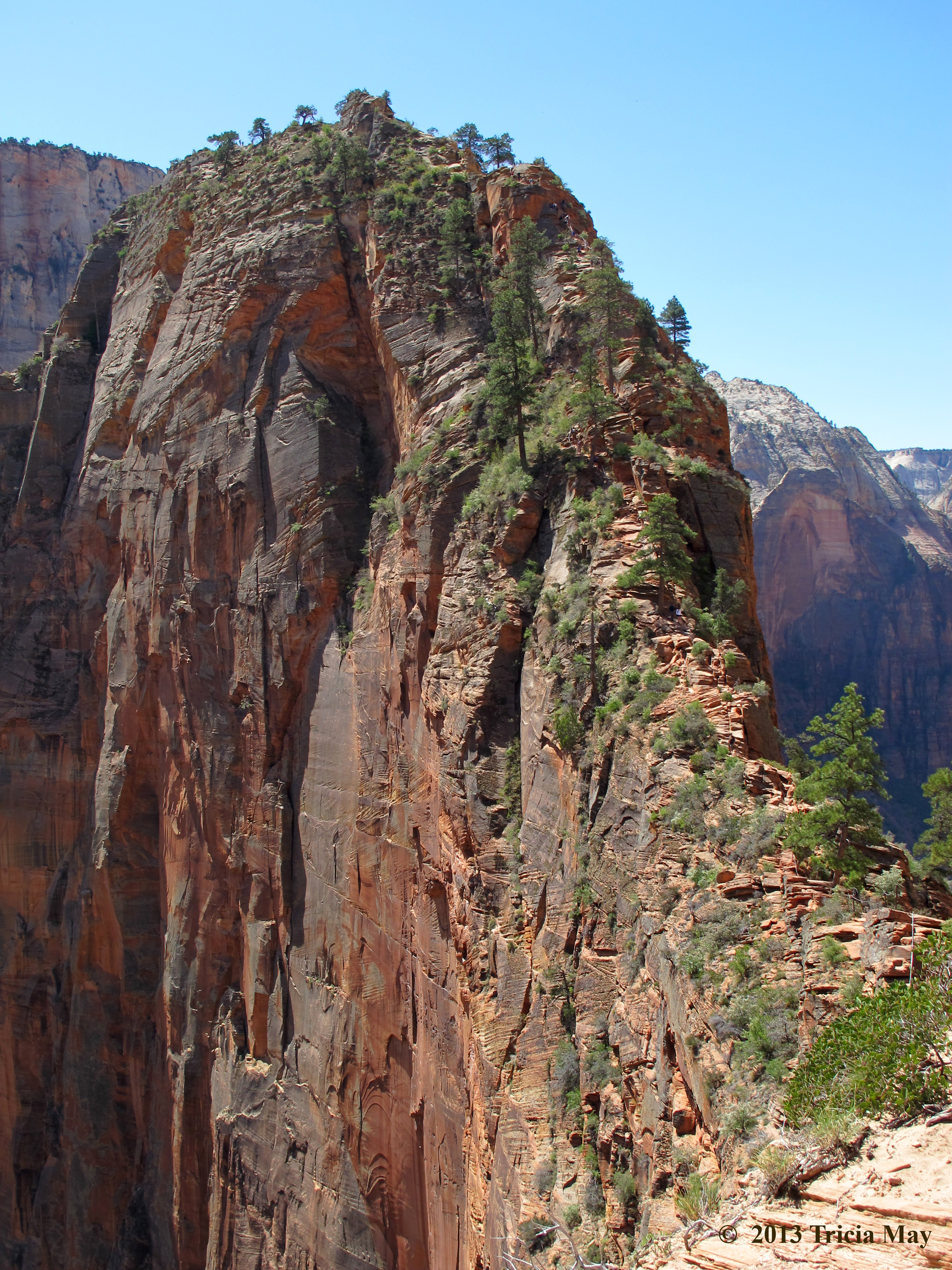
The thin saddle up to the top of Angels Landing
If you have issues with heights, narrow trails, or steep drop offs, you may just want to stop and enjoy the view from here. The trail is chain assisted, and you will need to use them. Put any hiking poles away because you will need both of your hands to scramble up rock. This is where the fun begins!!

Ascending Angels Landing
I personally love this kind of hiking, but with the popularity of this trail, you are bound to encounter over crowding. Unfortunately, impatience comes with over crowding and impatience can lead to dangerous circumstances. We came across some people who were trying to pass others on extremely narrow sections, almost knocking someone off the side. They were either oblivious to the danger they created, or they just didn’t care because they wanted to get to the summit faster. To avoid this, I would recommend hitting the trail really early – we got to the Grotto around 10:30 and there were already plenty of people ahead of us.
Getting to the top felt good…really good. The sun was bright, the sky was blue and the wind was blessedly calm. We got out our lunches and just sat and enjoyed the view.

View from Angels Landing
After lunch it was time to go back down – which many people say is harder, but I just found the whole thing fun. As I said, I love this kind of stuff.

Descending Angels Landing
Going down was much faster than going up, although it was harder on the knees. As I mentioned before, I was very glad to have my hiking poles with me for the return trip.
We figured since it was our last night in Zion, we should go out for dinner, so we drove to town and went to Oscars. Excellent food! I had a huge turkey burger with fries, and as much as I wanted to try their carrot cake, I just couldn’t. No room. The service was fast and friendly and I would highly recommend it to anyone in the area.
DAY 6
Goodbye Zion, hello Bryce Canyon! This day was a bit of a travel day so we were up earlier than usual. After packing up and making a nice breakfast of bannock over the fire, we were on our way and headed through the Mount Carmel Tunnel. It’s amazing how different the scenery is on the other side of that 1.1 mile (1.78 km) stretch. The colours, the shape of the land….Before long we stopped to look at the Checkerboard Mesa, a large sandstone hill with an unusual grid like crack pattern.

Checkerboard Mesa
I didn’t note how long it took us to get to Bryce Canyon, but I think it was about two hours – two hours of beautiful scenery. Once we got to Bryce, the hunt for a campsite in the North Campground was on. The really scenic spots were taken, but what we were looking for was a spot with a lot of sun exposure. The forecast was for cold…so we wanted as much help from the sun as we could get to keep us warm. I think we did pretty well…

Our Bryce Canyon campsite…Loop C #64
First things first though…time for a shower! Since there were none available at our Zion campsite, we were really looking forward to this. We drove to the general store and each bought our two tokens for two dollars – that would get us an eight minute shower. Absolute heaven!! After some lunch we went off to do a couple of small hikes to stretch our legs and take in our new surroundings. On the list: Mossy Cave and Bristlecone Loop.
Mossy Cave was an easy-moderate 0.8 mile (1.3 km) trail with only 150 feet (45.7) of elevation change. That may not sound like much, but the elevation at Bryce is much higher than Zion, and it was giving my lungs a bit of a workout. It was also my first time to get up close to the gorgeous red-orange hoodoos the park is famous for.

At the Mossy Cave Trailhead
Not that far onto the trail you can choose to go left or right. Turning right lets you follow along the river to a waterfall (cross at the second footbridge to get a better look at them) or left to the mossy cave. If you choose to check out the waterfall, you can then take a short, steep trail up to some arches to take in the view.

Off the Mossy Cave trail
If you choose to turn left, don’t be too disappointed…the mossy cave isn’t so much a cave as an overhang. While it isn’t deep it is sheltered enough for there to still have some snow and ice tucked into the back of it while I was there. I’ve read that it’s quite pretty in the winter when draped with icicles.
Since it was too early in the season for the shuttle buses to be running, we got back into our car and drove to the southern end of the park to Rainbow Point. From here we would access the Bristlecone Loop, an easy 1 mile (1.6 km) trail with only 100 feet (30.5 meters) elevation gain. Rainbow point stands at 9115 feet (2778 m), so for me, the less elevation gain, the better!
There was still snow on parts of the trail but not enough to cause issues. In fact, I was very tempted to make a snowman! Anyway, the trail is very well worn and brings you through many different types of pines, until you get to the tip of the trail, marked by a gazebo. A little further on you come to the namesake of the path – the bristlecone pine.

Young Bristlecone Pine
The bristlecone pine is the longest living tree, with some specimens being over 5,000 years old. I read that every diameter of trunk is approximately 100 years of growth, so the one in the picture above is pretty young compared to this guy…

Older bristlecone pine
There are also some great vistas to be had from this part of the trail:
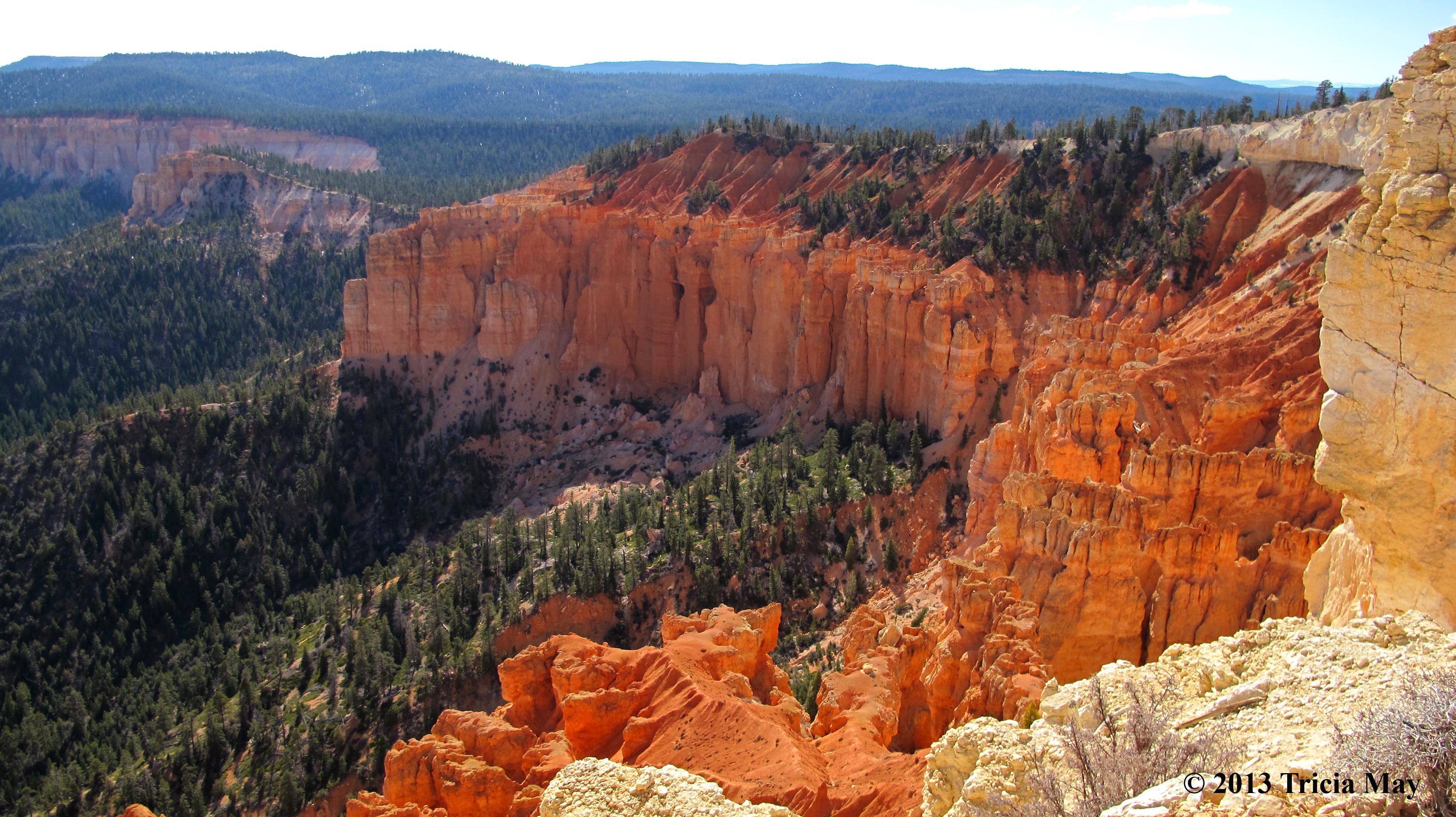
View from Bristlecone Loop trail
There were a bunch of great lookouts just screaming for photos to be taken on the way back, but we’d have a few days to discover them at a more leisurely pace, so we just went back to camp to prepare a hearty dinner and some hot drinks. The temperature dropped pretty quick once the sun went down.
DAY 7
Well, that was a cold night…-10C (14 F). I needed to add an additional layer of clothes part way through, but I still got up with aching bones and joints. I am not a fan of cold weather camping.
We got up really early this morning…we’re talking 06h00, so that we could go to the visitor centre and stand in line for full moon hike tickets. The tickets are free, but they go fast, and it’s first come first served the day of, with a maximum of 30 available. Well, there was going to be a full moon tonight, so there we were, sitting in the parking lot (in the car thankfully) by 06h15. The next people didn’t arrive until 07h00, and when the visitor centre opened at 08h00, there were 19 people with us.
Back at camp, hot beverages were at the top of our list…we were cold. After puttering around, making lunches and doing our dishes, we were off. Today’s hike to limber us up: the Navajo-Queens Garden Loop. This is listed as a moderate 2.9 mile (4.7 km) trail with an elevation gain of 521 feet (158.8 m). We walked along the Rim trail until reaching Sunrise Lookout – the trailhead for Queens Garden.

Queens Garden trailhead view
The variety of landscapes on this trail is surprising. We went from Martian like vistas….
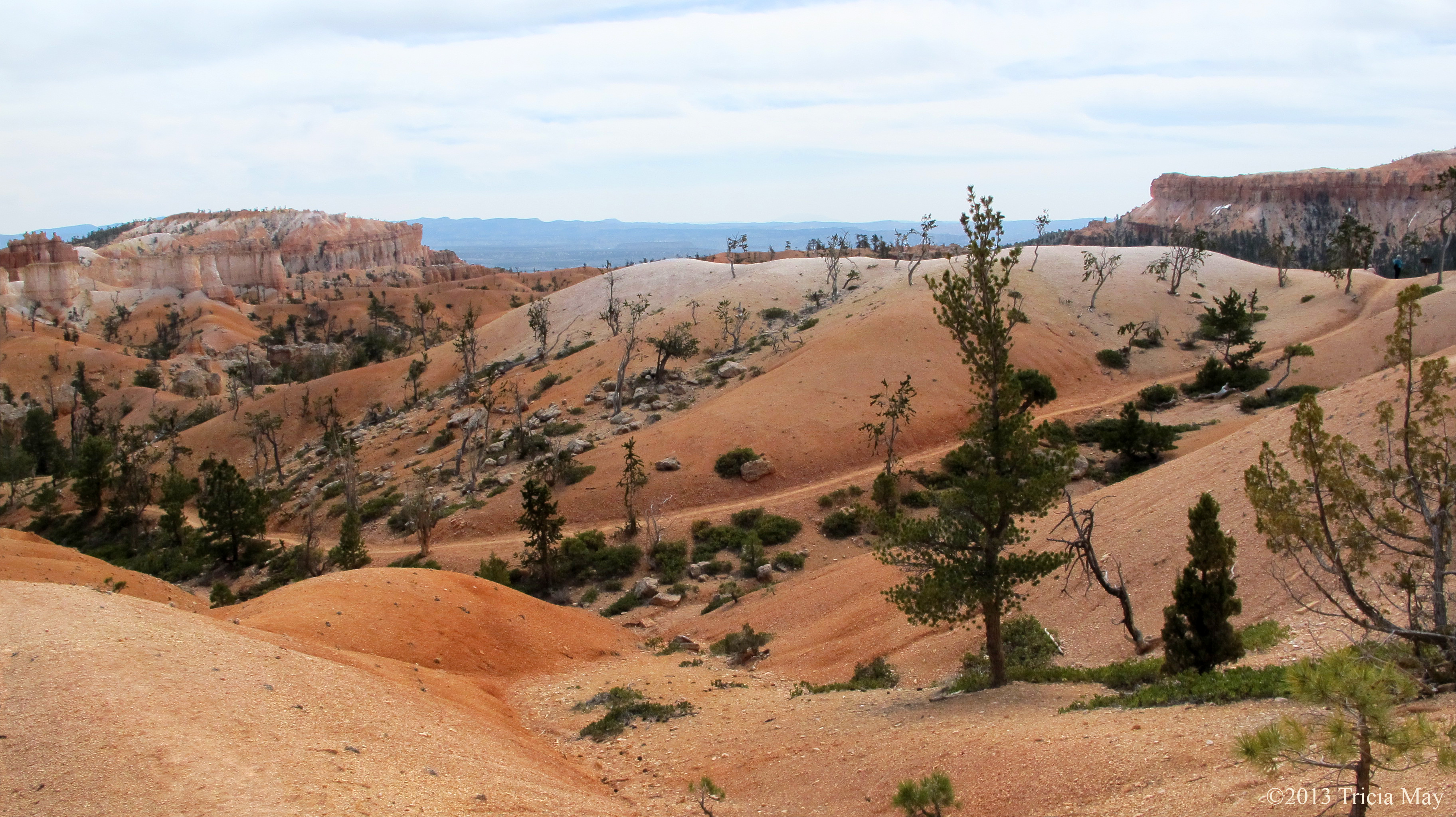
The Martian like landscape of the Queens Garden trail
to hoodoos that tower over hikers.
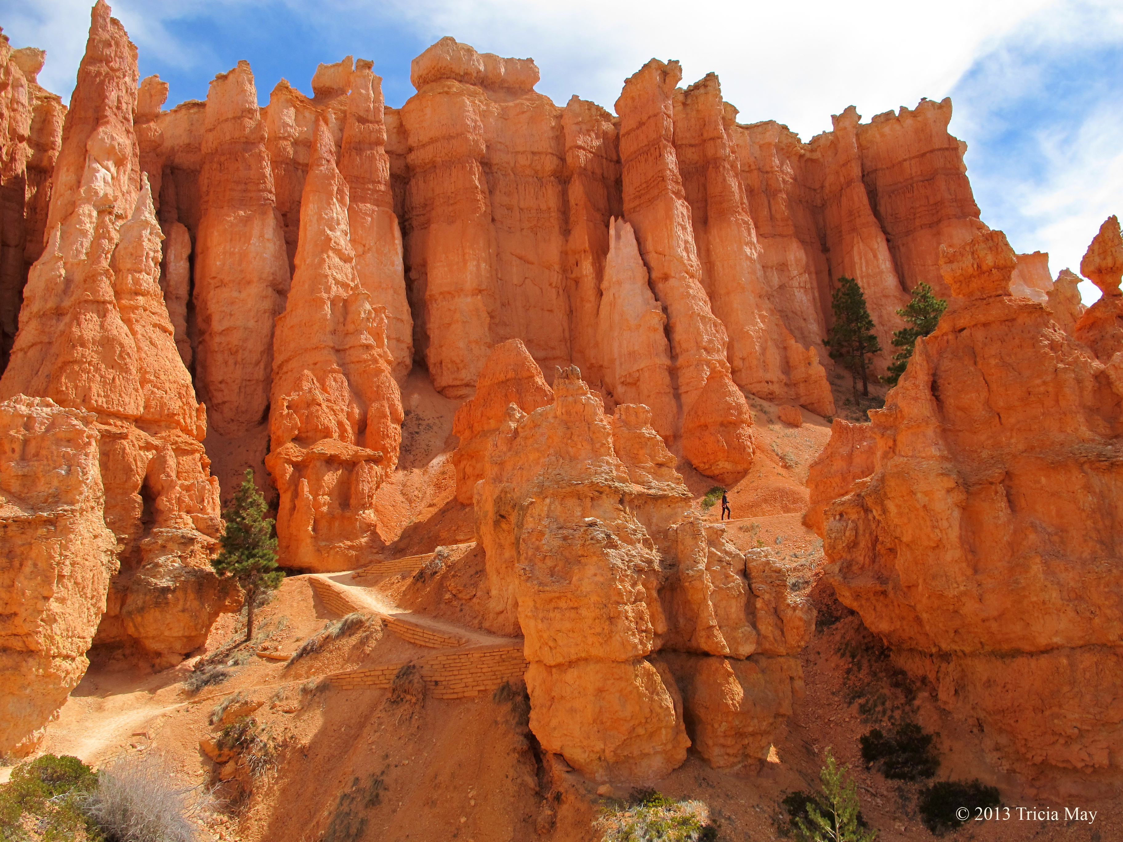
Spot the hiker amongst the towering hoodoos
There is a section of the loop called ‘Wall Street’ that is often closed due to rockfall, so you may be forced to close the loop by traversing the ‘Two Bridges’ branch instead. Such was the case while I was there. We wanted to see what we could of Wall Street, so we went as far as we were allowed.

Tall pine on Wall Street
Just past this pine was our turn around point – rockfalls had closed the rest. Going back the way we came, we got onto the trail and finished the Navajo loop by going up a steep section of switchbacks.

Switchbacks on the Navajo Loop trail
Your reward once you get back onto the Rim Trail at the end? Fantastic views of the parks most recognizable feature, Thor’s Hammer.

Thor’s Hammer at the end/start of the Navajo Loop
After taking in the views, we found a nice place to sit, ate our lunch, and then continued on along the Rim Trail until we reached our campsite. The plan was for a nice little nap in the sun, but the weather suddenly took a turn for the worse. We had to retreat to our tent when the wind picked up and brought with it some really, really dark clouds. The temperature dropped quickly and the wind picked up even more, so into our shelter we went. It calmed about an hour later, so we got up and took a walk around the camp grounds to warm up and get the blood flowing.
After dinner we got ready to head out on our full moon hike. We layered up and went to meet the group at Sunrise Point – the trailhead for the Queen’s Garden loop where we were that morning. Our guide led us out at 20h00, and while it wasn’t quite dark yet, we filled the time we hiked with stories about the moon – what it signifies in various origin stories in various belief systems. It was quite interesting.
At one point we stopped and watched the moonrise through a few layers of clouds. We had to keep our night vision so no flash photography was allowed.

Moon rise on full moon hike
We continued down the trail, it getting darker and yet staying bright at the same time. Once the moon broke through the final layer of cloud, our surroundings were brightly lit with no need for headlamps. The hoodoos surrounding us looked so different without their red hues…more imposing.

Hoodoo lit by moonlight
It was a great experience, so if you happen to go to the park during a full moon, I highly recommend getting up at an ungodly hour and reserving your ticket. We hiked back to camp, most of the way anyway, without our headlamps. Our night vision was ruined as we approached other campsites with people using lanterns, but it was nice while it lasted.
DAY 8
Another really cold night. Some water we accidentally left out overnight froze, so that’s saying something. Time to warm up, so that means getting back on the trail! But first, into the car…for the drive to today’s destination: Red Canyon in Dixie National Forest, about twenty minutes outside of Bryce.
We picked up a trail map at the visitor centre and they suggested, before heading out on a longer trail, to walk the short ones just behind the building, so we did . There was the Pink Ledges Trail which connected to the Hoodoo Trail which connected to the Birdseye Trail. Pink Ledges is only 0.4 miles (0.8 km) with an elevation gain of 200 ft (61 m) and it winds through hoodoos and ponderosa pine. The Hoodoo trail is itty bitty. At 0.3 miles (0.5 km) with an elevation gain of 30 feet (9 m) it’s over in a blink, but you do see hoodoos and some pinyon and juniper trees. The Birdseye Trail is a little longer at 0.8 miles (1.5 km) with an elevation change of 100 feet (21 m). There are some steeper sections, but its really quite tame.

Hoodoo on Pink Ledges Trail
On to our longer hike now. The visitor centre suggested we try the Buckhorn Trail which connects to the Golden Wall Trail. The Buckhorn is 0.9 miles (1.5 km) long and has an elevation gain of 500 feet (152 m). It starts down the road, in the Red Canyon Campground, between sites number 24 and 26. It has some switchbacks on the ascent and then sort of levels out to reveal some great views.

View from Buckhorn Trail
It is here that we connect to the Golden Wall, a 2.8 mile (4.5 km) long trail with 505 feet (154 m) elevation gain. There are lots of ponderosa pine and golden coloured rock walls, but sometimes it felt like we were walking on Mars. We didn’t know what scenery we would have from one minute to the next – around every turn it was something new.

The Golden Wall trail
These trails are much more rustic, maybe less maintained, than the trails in Bryce. Often only wide enough for single file hiking, one foot span at a time. They are also not nearly as busy. For all the time we were there, we only ran into four other people. There are options of connecting to other trails and continuing on, but we decided to head back to the car. The trail we were on ends at the highway, so we turned right and walked parallel to it on a paved walking/biking path. It didn’t take long to get back to the visitor centre.
It was a really nice hike – quiet, varied scenery…perfect if you want to get away from the crowds at Bryce for a day.
DAY 9
Still cold at night, about -6C (21F), but I managed to stay pretty cozy. The campers across from us did not, judging by the way they got up in the middle of the night, loudly complaining about how cold it was, and then drove off. Hotel in town maybe?
Anyway, we had a bit of a lazy morning, and didn’t leave camp for the trailhead until 10:05. Today’s hike: The Fairyland Loop. Rated as a difficult 8 mile (12.9 km) trail with 900 ft (274 m, but 2309 ft (704 m) cumulative) elevation gain and estimated duration of 4-5 hours. The official starting point is Fairyland Point, and if the shuttle is running while you’re there, note that it does NOT stop here. Our campsite was about a half mile away, so we walked along the Rim Trail until we got to Sunrise point – where the Loop meets the Rim.

The view at Fairyland Point
Again, spectacular views. There were vast expanses of hoodoos, strips of white, orange, burnt orange and red sand with pines scattered throughout. So beautiful. Anyway, the trail wasn’t busy at all but it was very well beaten with clean, even paths. You have the option at one point of taking a small off shoot trail to check out the Tower Bridge formation. It’s about 200 feet (61 m) in and there were some nicely placed logs among the trees to sit and rest if you like. It’s short, but worth it.

Tower Bridge on the Fairyland Loop trail
The thing about this trail…it meandered. A lot. Which was nice because it meant gentler climbs (part of the time) and more “wow” moments at every turn. I hadn’t really adjusted to the altitude yet, so I really didn’t mind its meandering nature. Don’t let the word fool you though…it was a hard hike. There were lots of saddles to climb up and over – lots of elevation gains and losses. But with it being a loop, you get to pick which direction you want to hike it in, which can make it a little easier on your knees. We chose counter clockwise for the simple fact that we were closer to Sunrise Point than the actual trailhead itself. And I am soooo glad. I wouldn’t want to climb up what we went down, which is about 900 ft (274 m). This graph from the National Park Service might give a better picture:

But there is some flat stuff too…

Gentle meandering trail on the Fairyland Loop
On the more open parts of the trail, prepare for wind…lots and lots of wind. At one point it was threatening to push me off the path and the temperature dropped quite a bit as well. But it was in the wide open areas that you got the best view of Boat Mesa, a huge formation of sandstone that has managed not to erode into hoodoos.

The Shipwreck Rock in Boat Mesa

You can’t have a good hair day in this wind
Make sure to bring lots of water and snacks (or lunch) with you…you’ll need the fuel. There were plenty of very nice, scenic places to stop and take in the view while eating, or just to catch your breath. More than once we were hiking up and up thinking we were almost at the top, only to turn a corner and be faced with another steep incline. Slow and steady people, slow and steady.

Hoodoos along the Fairyland Loop
Once we reached the official trailhead at Fairyland Point, we stopped for lunch and then continued along the Rim Trail back to our campsite – the loop completed. It was very nice to end on the flatter Rim, so I highly recommend doing this trail counter clockwise and starting it at Sunrise Point. If you want a great hike in this park without a lot of company, this might be for you. It took us just over four hours to complete.
After a snooze in the afternoon sun and then making a dinner of flat bread and spaghetti, we were off to the lodge for an astronomy talk. If you are at all interested in learning about the stars above your head, this talk would be well worth your time. Fascinating videos and a great history lesson on how discoveries came about and who actually made them, presented by a man passionate about the topic. It was a full house, so if you go, you may want to go early. After the presentation you could make your way to the visitor centre to look through the telescopes they had set up to get nice, close up views of the stars.
DAY 10
Sigh – our last day in the park. We had one last hike to complete: the Peekaboo Loop. It is described as a difficult 5.5 mile (8.9 km) hike with a cumulative elevation change of 1500 ft-1800 ft (457 m – 549 m). We started it from Bryce Point, but you can also access it from the Navajo Loop (Sunset Point) or the Queen’s Garden Loop (Sunrise Point). This is a horse trail as well, so if you come across anyone on horseback, step to the side and let them pass. They have right of way.
This trail goes up and down. A lot. Here’s the graph from the National Park Service for proof.

But doesn’t this view make it worth it?

View from Bryce Point, the start of the Peekaboo Loop
It’s a mile (2.6 km) straight down when the trail starts…which means you finish the trail by going a mile straight uphill. But don’t think about that. Just think of all of the beautiful scenery you’ll encounter. This loop offers some of the best views in the park, so it’s a must see.

On the Peekaboo Loop
Once we completed the initial mile down, we had the option of going left or right. We went right. Part way down Lynda spotted a hoodoo that we immediately dubbed “the Voyageur” since that is exactly what it looked like…a man hauling a backpack full of furs from the fur trade era in Canada.

The Voyageur hoodoo
There are a lot of well known hoodoo formations on this trail, like the cathedral with its strong buttress like features

The Cathedral on the Peekaboo Loop
Or the Fairy Castle, with its beautifully delicate red spires

Fairy Castle on the Peekaboo Loop
Lynda and I came to the conclusion that this trail is named the Peekaboo because you never know what you’re going to see around each corner. Each turn had us gasping at the beauty of it. Stunning.
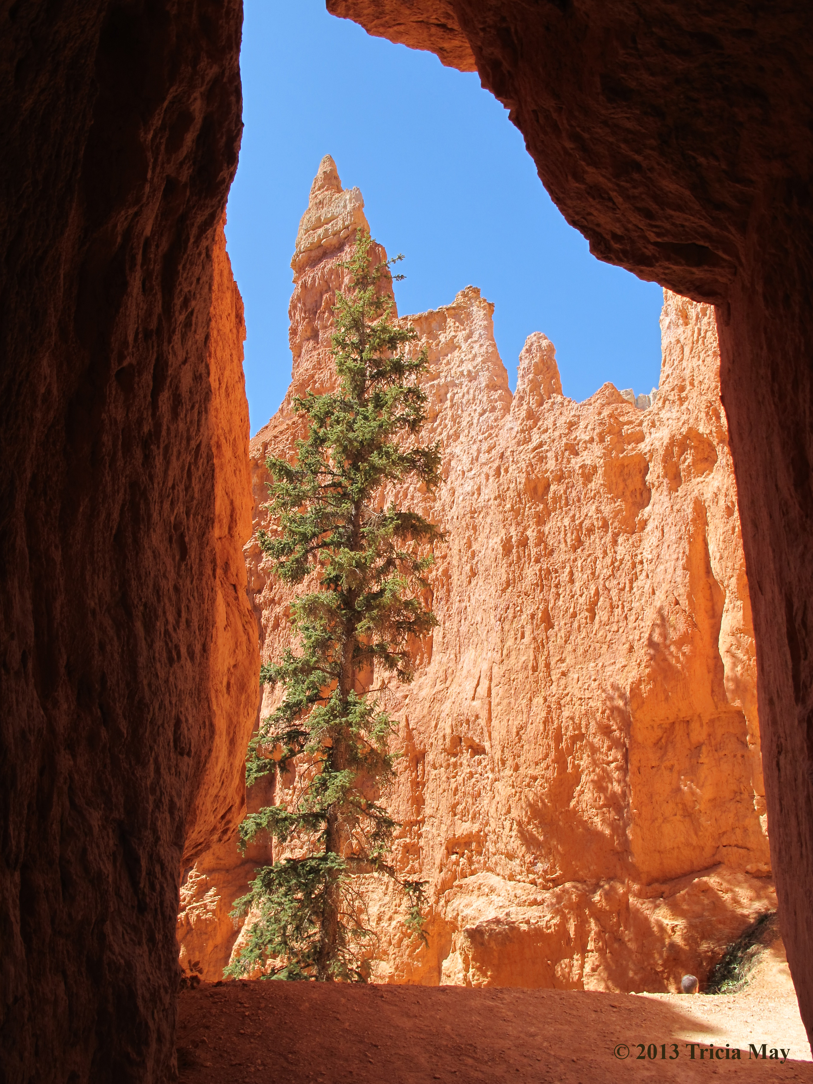
On the Peekaboo Trail
We knew the end of the loop was near when we came across the washrooms…yep, there were pit toilets and picnic tables on this trail. Not long past that was the junction point – time to walk that final mile back uphill. I huffed and puffed, but caught my breath on the flatter parts.

A flatter area on the final mile up
I was quickly running out of steam, but we pushed to the top before stopping for lunch. And how rewarding was this view after finishing a good hike? It was spectacular. If you want to watch the sunrise during your visit to the park, this is the best spot to see it – not Sunrise Point like the name would suggest. Don’t take it from me – this came straight from a Rangers mouth. This particular view was from Inspiration Point, but it’s just down the road, so this is basically what you’d see from Bryce Point.

The view from Inspiration Point
This was also a very nice parting view for us since we would leave the next morning. We spent the rest of the afternoon organizing our gear, then we showered up and went for a nice dinner at the lodge, finishing up the night with a lot of star gazing.
This trip was everything I had hoped for. If you like to hike but don’t want to carry a huge backpack into the backcountry, this is a great option. Well kept trails with gorgeous scenery and not swamped with people…at least not in the spring. I hope you enjoy it as much as I did.

